File:Delaware Locator Map.PNG
No higher resolution available.
Delaware_Locator_Map.PNG (377 × 339 pixels, file size: 12 KB, MIME type: image/png)
Captions
Captions
Add a one-line explanation of what this file represents
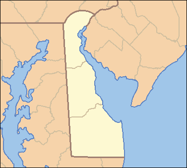
| Description | Locator Map of Delaware, United States |
| Date | |
| Source | taken from US Census website [1] and modified by User:VerruckteDan |
| Author | US Census, VerruckteDan |
| Permission (Reusing this file) |
US Census / US Government work is public domain, my modifications licensed under the GNU Free Documentation License |
| Other versions | one without black border, different water color |

|
Permission is granted to copy, distribute and/or modify this document under the terms of the GNU Free Documentation License, Version 1.2 or any later version published by the Free Software Foundation; with no Invariant Sections, no Front-Cover Texts, and no Back-Cover Texts. A copy of the license is included in the section entitled GNU Free Documentation License. |
| This file is licensed under the Creative Commons Attribution-Share Alike 3.0 Unported license. | ||
| ||
| This licensing tag was added to this file as part of the GFDL licensing update. |
File history
Click on a date/time to view the file as it appeared at that time.
| Date/Time | Thumbnail | Dimensions | User | Comment | |
|---|---|---|---|---|---|
| current | 03:54, 25 April 2007 | | 377 × 339 (12 KB) | Ruhrfisch (talk | contribs) | {{Information| |Description= Locator Map of Delaware, United States |Source= taken from US Census website [http://factfinder.census.gov/] and modified by User:VerruckteDan |Date= April 2007 |Author= US Census, VerruckteDan |Permission= US Census / US |
| 14:23, 24 April 2007 |  | 377 × 339 (12 KB) | Ruhrfisch (talk | contribs) | {{Information| |Description= Locator Map of Delaware, United States |Source= taken from US Census website [http://factfinder.census.gov/] and modified by User:VerruckteDan |Date= April 2007 |Author= US Census, VerruckteDan |Permission= US Census / US | |
| 01:33, 23 April 2007 |  | 377 × 339 (12 KB) | Ruhrfisch (talk | contribs) | {{Information| |Description= Locator Map of Delaware, United States |Source= taken from US Census website [http://factfinder.census.gov/] and modified by User:VerruckteDan |Date= April 2007 |Author= US Census, VerruckteDan |Permission= US Census / US | |
| 22:04, 22 April 2007 |  | 377 × 339 (12 KB) | VerruckteDan (talk | contribs) |
You cannot overwrite this file.
File usage on Commons
There are no pages that use this file.
File usage on other wikis
The following other wikis use this file:
- Usage on de.wikipedia.org
- Usage on en.wikipedia.org
- Usage on fa.wikipedia.org
- Usage on hu.wiktionary.org
- Usage on id.wikipedia.org
- Usage on ja.wikipedia.org
- Usage on new.wikipedia.org
- Usage on no.wikipedia.org
- Usage on pam.wikipedia.org
- Usage on si.wikipedia.org
- Usage on sr.wikipedia.org
- Довер (Делавер)
- Вилмингтон (Делавер)
- Белфонт (Делавер)
- Клејтон (Делавер)
- Делавер Сити
- Елсмир (Делавер)
- Харингтон (Делавер)
- Луис (Делавер)
- Мидлтаун (Делавер)
- Милфорд (Делавер)
- Њу Касл (Делавер)
- Рехобот Бич (Делавер)
- Сифорд (Делавер)
- Смирна (Делавер)
- Таунсенд (Делавер)
- Довер Бејс Хаусинг (Делавер)
- Пајк Крик Вали (Делавер)
- Шаблон:Location map Delaware
- Usage on uz.wikipedia.org
- Usage on vi.wikipedia.org
- Usage on zh.wikipedia.org