File:Depresiunea & Muntii Fagarasului - Harta topografica.jpg
Size of this preview: 275 × 599 pixels. Other resolutions: 110 × 240 pixels | 220 × 480 pixels | 352 × 768 pixels | 470 × 1,024 pixels | 1,657 × 3,610 pixels.
Original file (1,657 × 3,610 pixels, file size: 590 KB, MIME type: image/jpeg)
Captions
Captions
Add a one-line explanation of what this file represents
Summary edit
| Description |
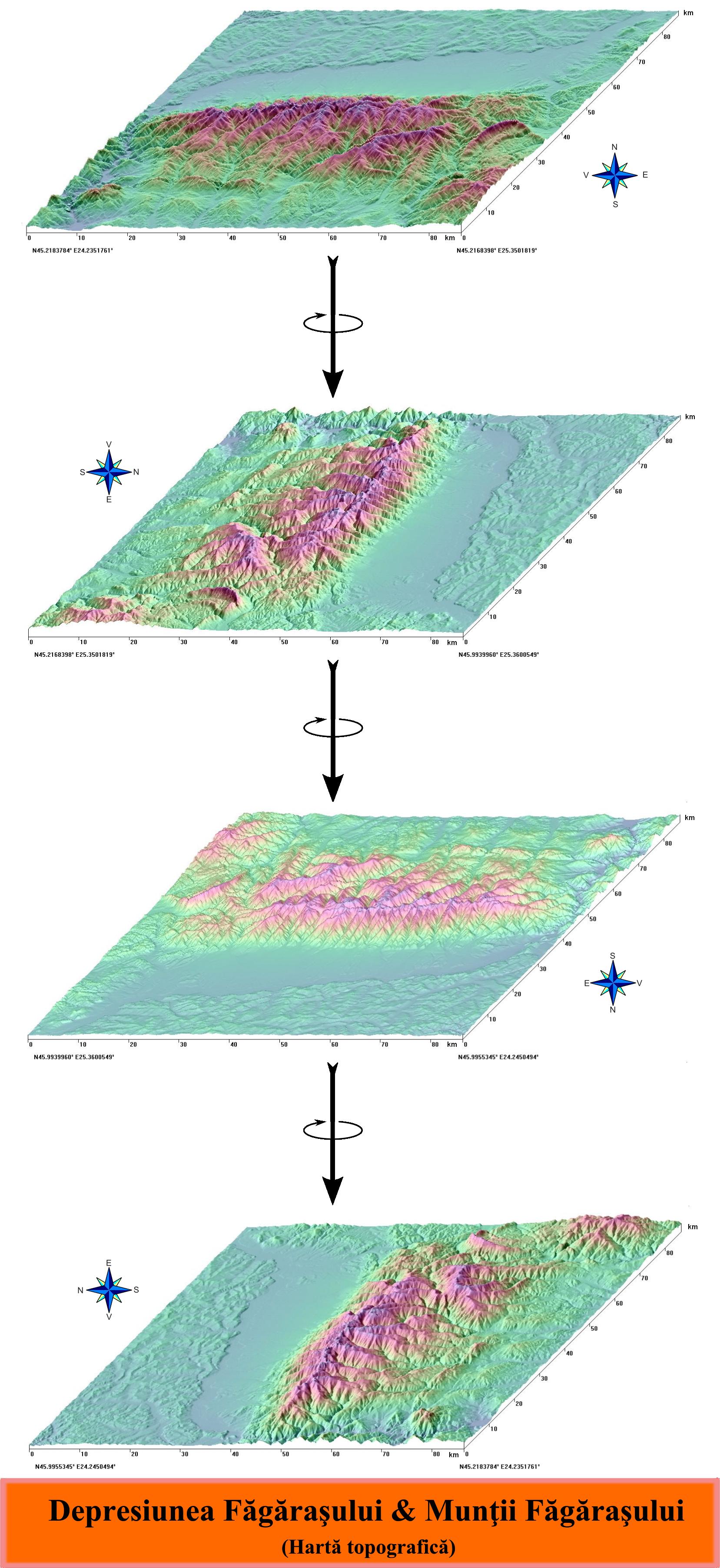
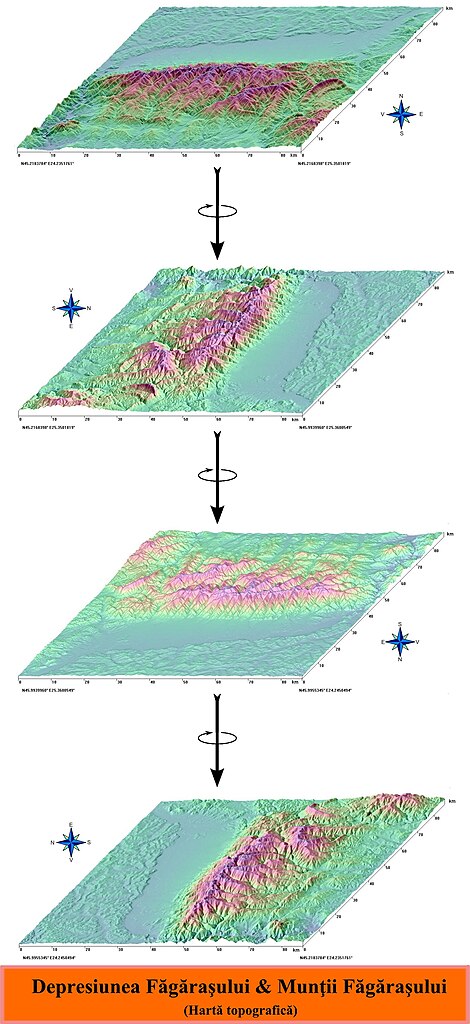
Română: Harta topografică a Depresiunii Făgăraşului şi a Munţilor Făgăraşului. Imagine obţinută după date SRTM furnizate de NASA. |
| Source | Topographic data SRTM from NASA and World Imagery |
| Author | Asybaris01 |
Licensing edit
| This file is in the public domain in the United States because it was solely created by NASA. NASA copyright policy states that "NASA material is not protected by copyright unless noted". (See Template:PD-USGov, NASA copyright policy page or JPL Image Use Policy.) | ||
 |
Warnings:
|
File history
Click on a date/time to view the file as it appeared at that time.
| Date/Time | Thumbnail | Dimensions | User | Comment | |
|---|---|---|---|---|---|
| current | 14:17, 25 June 2010 | | 1,657 × 3,610 (590 KB) | Asybaris01 (talk | contribs) | {{Information |Description={{ro|1=Harta topografică a Depresiunii Făgăraşului şi a Munţilor Făgăraşului. Imagine obţinută după date SRTM furnizate de NASA.}} |Source={{own}} |Author=Asybaris01 |Date= |Permission= |other_ver |
You cannot overwrite this file.
File usage on Commons
There are no pages that use this file.
File usage on other wikis
The following other wikis use this file:
- Usage on ca.wikipedia.org
- Usage on es.wikipedia.org
- Usage on fr.wikipedia.org
- Usage on ro.wikipedia.org