File:Der Bremmer Calmont im Landschaftsschutzgebiet Moselgebiet von Schweich bis Koblenz (4).jpg

Size of this preview: 800 × 600 pixels. Other resolutions: 320 × 240 pixels | 640 × 480 pixels | 1,024 × 768 pixels | 1,280 × 960 pixels | 2,560 × 1,920 pixels | 5,184 × 3,888 pixels.
Original file (5,184 × 3,888 pixels, file size: 5.7 MB, MIME type: image/jpeg)
Captions
Captions
Add a one-line explanation of what this file represents
Summary
edit.jpg&action=edit§ion=1)
| Description |
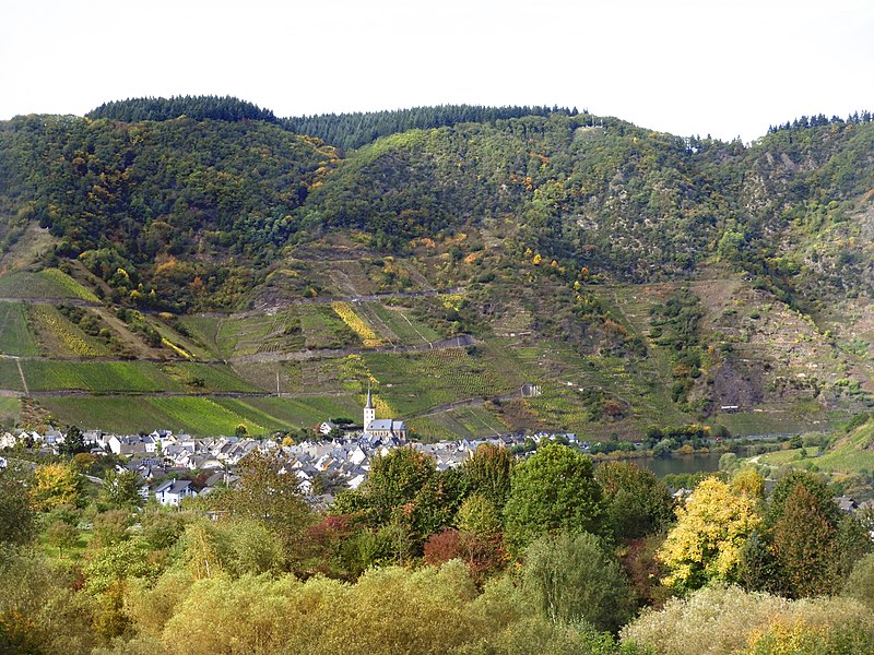
Deutsch: Bremm und der Calmont.
Der Bremmer Calmont, zwischen Bremm und Ediger-Eller im Landkreis Cochem-Zell, gilt wegen seiner Hangneigungen mit bis über 65 Grad als steilster Weinberg Europas. Der Calmont liegt im Landschaftsschutzgebiet "Moselgebiet von Schweich bis Koblenz" mit dem CDDA-Code 323051, im Vogelschutzgebiet 5908-401 "Wälder zwischen Wittlich und Cochem" und im FFH-Gebiet 5809-301 "Moselhänge und Nebentäler der unteren Mosel". Die Grenzen des FFH-Gebietes und des Vogelschutzgebietes reichen nicht ganz bis an die Mosel. |
| Date | Taken on 29 September 2017, 13:21:56 |
| Source | Own work |
| Author | Heinz K. S. |
Licensing
edit.jpg&action=edit§ion=2)
I, the copyright holder of this work, hereby publish it under the following license:
This file is licensed under the Creative Commons Attribution-Share Alike 4.0 International license.
- You are free:
- to share – to copy, distribute and transmit the work
- to remix – to adapt the work
- Under the following conditions:
- attribution – You must give appropriate credit, provide a link to the license, and indicate if changes were made. You may do so in any reasonable manner, but not in any way that suggests the licensor endorses you or your use.
- share alike – If you remix, transform, or build upon the material, you must distribute your contributions under the same or compatible license as the original.
This image was uploaded as part of Wiki Loves Earth 2018.
|
 |
File history
Click on a date/time to view the file as it appeared at that time.
| Date/Time | Thumbnail | Dimensions | User | Comment | |
|---|---|---|---|---|---|
| current | 19:17, 9 May 2018 | | 5,184 × 3,888 (5.7 MB) | Heinz K. S. (talk | contribs) | User created page with UploadWizard |
You cannot overwrite this file.
File usage on Commons
The following page uses this file:
File usage on other wikis
The following other wikis use this file:
- Usage on de.wikipedia.org
- Usage on ro.wikipedia.org
- Usage on www.wikidata.org
.jpg&oldid=747940116)