File:Der Mackenbach im NSG Rodenbacher Bruch.jpg

Size of this preview: 800 × 600 pixels. Other resolutions: 320 × 240 pixels | 640 × 480 pixels | 1,024 × 768 pixels | 1,280 × 960 pixels | 2,560 × 1,920 pixels | 4,320 × 3,240 pixels.
Original file (4,320 × 3,240 pixels, file size: 2.01 MB, MIME type: image/jpeg)
Captions
Captions
Add a one-line explanation of what this file represents
Summary
edit
| Description |
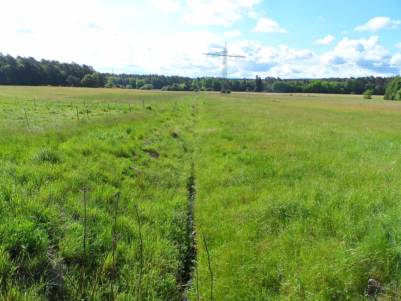
Deutsch: Im Naturschutzgebiet "Rodenbacher Bruch" (NSG: 335054; WDPA: 82428) fließt der kleine Bach "Mackenbach" der Mooslauter zu. Der Mackenbach entspringt im Bereich des Mackenbacher Golfplatzes, hat eine Länge von 3,6 km, ein Einzugsbegiet von 5,247 qkm (km²) und mündet auf etwa 226 m üNN von links in die Mooslauter (oder den Bruchbach). Seine Gewässerkennzahl lautet 254668-112. In sehr heißen Sommern ist das kleine Bachbett im Unterlauf völlig trocken.
Blick nach Südosten, von einer kleinen Brücke aus. Koordinaten: 49°28'05.6"N 7°37'31.3"E |
| Date | |
| Source | Own work |
| Author | Pueblodelapablo |
Licensing
edit
I, the copyright holder of this work, hereby publish it under the following license:
This file is licensed under the Creative Commons Attribution-Share Alike 4.0 International license.
- You are free:
- to share – to copy, distribute and transmit the work
- to remix – to adapt the work
- Under the following conditions:
- attribution – You must give appropriate credit, provide a link to the license, and indicate if changes were made. You may do so in any reasonable manner, but not in any way that suggests the licensor endorses you or your use.
- share alike – If you remix, transform, or build upon the material, you must distribute your contributions under the same or compatible license as the original.
This image was uploaded as part of Wiki Loves Earth 2020.
|
 |
File history
Click on a date/time to view the file as it appeared at that time.
| Date/Time | Thumbnail | Dimensions | User | Comment | |
|---|---|---|---|---|---|
| current | 11:37, 12 May 2020 | | 4,320 × 3,240 (2.01 MB) | Pueblodelapablo (talk | contribs) | Uploaded own work with UploadWizard |
You cannot overwrite this file.
File usage on Commons
There are no pages that use this file.