File:Descending into Hezekiah's Tunnel-A (3782602481).jpg
Original file (3,000 × 4,000 pixels, file size: 4.92 MB, MIME type: image/jpeg)
Captions
Captions
Summary
edit.jpg&action=edit§ion=1)
| Description |
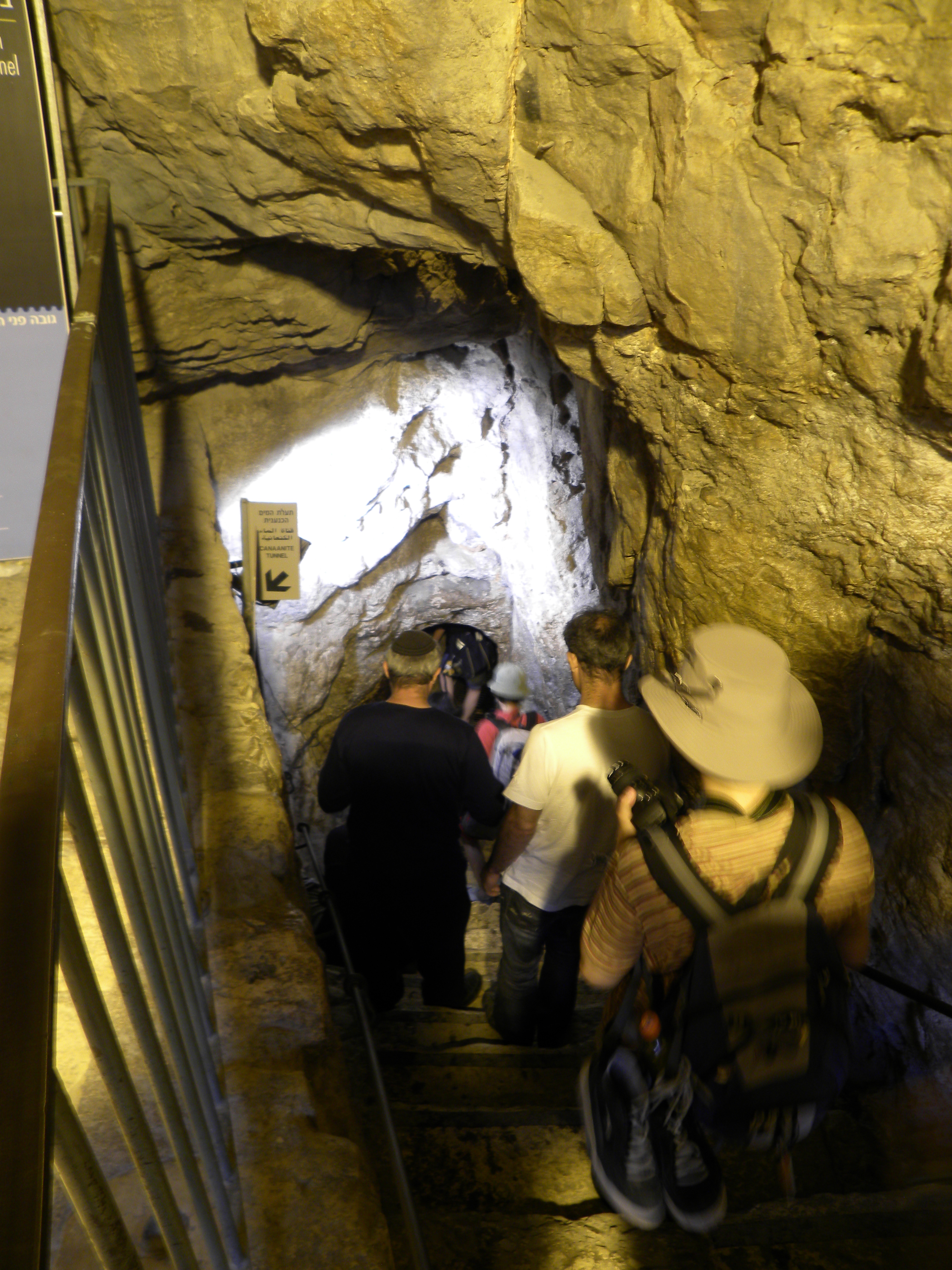
Descending into "Hezekiah's tunnel," the 8th century water channel cut through bedrock right under the City of David. The channel brought water from the Gihon spring (on the north-eastern slope of the hill) to the Siloam pool at the southern tip of the city. King Hezekiah ordered construction of this water system to secure a water source inside the city walls in the face of the approaching Assyrian army. When the channel was finished, the entrance to the spring was covered over with rubble to prevent the Assyrians from using (or tampering with) the water. |
| Date | |
| Source | Descending into Hezekiah's Tunnel-A |
| Author | Ian Scott |
Licensing
edit.jpg&action=edit§ion=2)
- You are free:
- to share – to copy, distribute and transmit the work
- to remix – to adapt the work
- Under the following conditions:
- attribution – You must give appropriate credit, provide a link to the license, and indicate if changes were made. You may do so in any reasonable manner, but not in any way that suggests the licensor endorses you or your use.
- share alike – If you remix, transform, or build upon the material, you must distribute your contributions under the same or compatible license as the original.
| This image was originally posted to Flickr by Ian W Scott at https://flickr.com/photos/38000818@N06/3782602481. It was reviewed on 14 November 2015 by FlickreviewR and was confirmed to be licensed under the terms of the cc-by-sa-2.0. |
File history
Click on a date/time to view the file as it appeared at that time.
| Date/Time | Thumbnail | Dimensions | User | Comment | |
|---|---|---|---|---|---|
| current | 07:12, 14 November 2015 | | 3,000 × 4,000 (4.92 MB) | Geagea (talk | contribs) | Transferred from Flickr via Flickr2Commons |
You cannot overwrite this file.
File usage on Commons
The following page uses this file:
.jpg&oldid=887831060)