File:Desert pale gilia, Aliciella hutchinsifolia (44806057204).jpg
Original file (3,648 × 2,736 pixels, file size: 5.95 MB, MIME type: image/jpeg)
Captions
Captions
Summary
edit.jpg&action=edit§ion=1)
| Description |
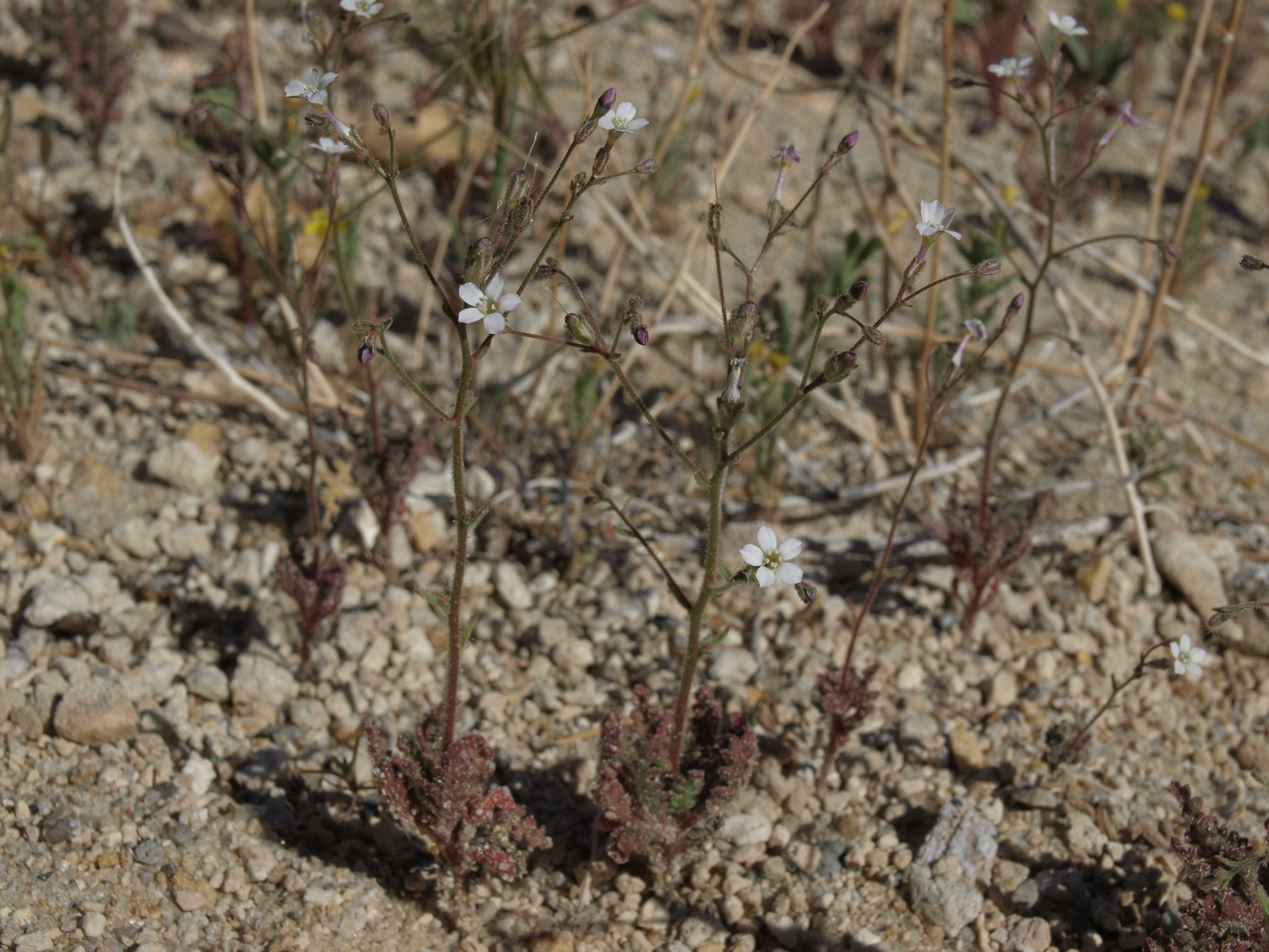
desert pale gilia, Aliciella hutchinsifolia, California, White Mountains, McAfee Creek, Fishlake Valley drainage, elevation 1638 m (5375 ft). This is an example of a self-armoring desert annual species. The sticky (and aromatic) exudate of dense glands on the leaves and lower stems captures wind-blown sand grains, which then help to protect the plant from further sand-blasting, and to moderate the effects of intense solar radiation, evaporative loss, and potential herbivores. Many other desert annuals employ this same strategy, which uniquely adapts them to survival in sandy habitats. This species is widespread in such habitats of the Mojave Desert, southern Great Basin, and adjacent Colorado Plateau of southeastern California, south and central Nevada, south and west Utah, and northwest and central Arizona. Also visible in this image is whitestem stickleaf (Mentzelia albicaulis). |
| Date | |
| Source | desert pale gilia, Aliciella hutchinsifolia |
| Author | Jim Morefield from Nevada, USA |
| Camera location | | View this and other nearby images on: OpenStreetMap |
|---|
.jpg¶ms=037.635338_N_-118.092320_E_globe:Earth_type:camera_source:Flickr_&language=en)
Licensing
edit.jpg&action=edit§ion=2)
- You are free:
- to share – to copy, distribute and transmit the work
- to remix – to adapt the work
- Under the following conditions:
- attribution – You must give appropriate credit, provide a link to the license, and indicate if changes were made. You may do so in any reasonable manner, but not in any way that suggests the licensor endorses you or your use.
- share alike – If you remix, transform, or build upon the material, you must distribute your contributions under the same or compatible license as the original.
| This image was originally posted to Flickr by Jim Morefield at https://flickr.com/photos/127605180@N04/44806057204 (archive). It was reviewed on 29 December 2019 by FlickreviewR 2 and was confirmed to be licensed under the terms of the cc-by-sa-2.0. |
File history
Click on a date/time to view the file as it appeared at that time.
| Date/Time | Thumbnail | Dimensions | User | Comment | |
|---|---|---|---|---|---|
| current | 03:07, 29 December 2019 | | 3,648 × 2,736 (5.95 MB) | Ser Amantio di Nicolao (talk | contribs) | Transferred from Flickr via #flickr2commons |
You cannot overwrite this file.
File usage on Commons
There are no pages that use this file.
File usage on other wikis
The following other wikis use this file:
- Usage on ceb.wikipedia.org
.jpg&oldid=700801721)