File:Detail view of bridges underside. - Humpback Covered Bridge, Humpback Bridge Wayside Park, spanning Dunlap Creek, Covington, Covington, VA HAER VA,3-COV.V,1-10.tif

Size of this JPG preview of this TIF file: 430 × 599 pixels. Other resolutions: 172 × 240 pixels | 344 × 480 pixels | 551 × 768 pixels | 735 × 1,024 pixels | 1,470 × 2,048 pixels | 3,588 × 5,000 pixels.
Original file (3,588 × 5,000 pixels, file size: 17.11 MB, MIME type: image/tiff)
Captions
Captions
Add a one-line explanation of what this file represents
Summary edit
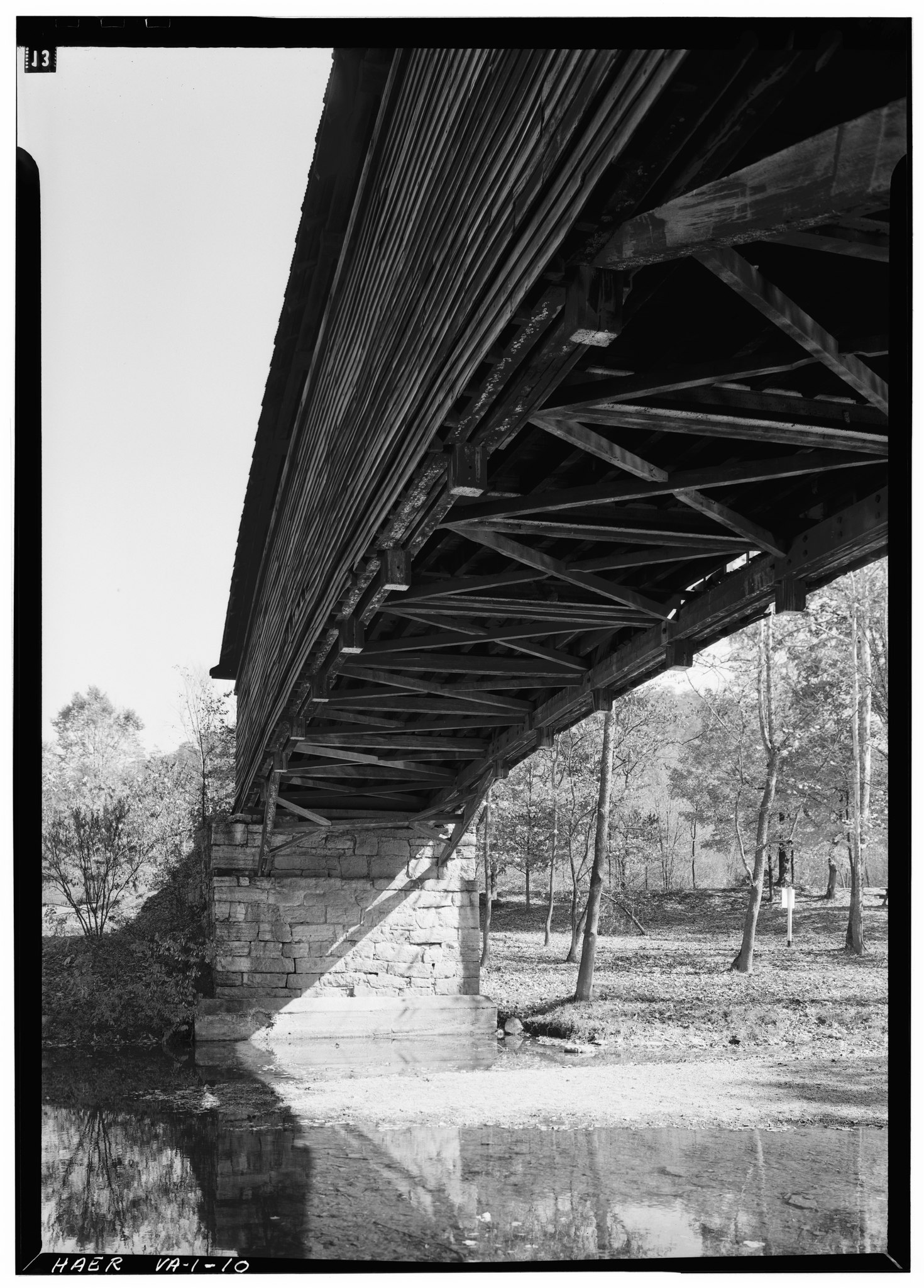
| Detail view of bridges underside. - Humpback Covered Bridge, Humpback Bridge Wayside Park, spanning Dunlap Creek, Covington, Covington, VA | ||||
|---|---|---|---|---|
| Photographer |
Boucher, Jack E. |
|||
| Title |
Detail view of bridges underside. - Humpback Covered Bridge, Humpback Bridge Wayside Park, spanning Dunlap Creek, Covington, Covington, VA |
|||
| Description |
James River and Kanawha Turnpike Company; Virginia Department of Transportation; Covington Business and Professional Women's Club; Pollak, Richard J, project manager; Federal Highway Administration, sponsor; Marston, Christopher, project manager; Christianson, Justine, transmitter |
|||
| Depicted place | Virginia; Covington; Covington | |||
| Date | 1971 | |||
| Dimensions | 5 x 7 in. | |||
| Current location |
Library of Congress Prints and Photographs Division Washington, D.C. 20540 USA http://hdl.loc.gov/loc.pnp/pp.print |
|||
| Accession number |
HAER VA,3-COV.V,1-10 |
|||
| Credit line |
|
|||
| Notes |
|
|||
| References |
|
|||
| Source | https://www.loc.gov/pictures/item/va0239.photos.161268p | |||
| Permission (Reusing this file) |
|
|||

| Object location | | View this and other nearby images on: OpenStreetMap |
|---|
File history
Click on a date/time to view the file as it appeared at that time.
| Date/Time | Thumbnail | Dimensions | User | Comment | |
|---|---|---|---|---|---|
| current | 04:49, 4 August 2014 |  | 3,588 × 5,000 (17.11 MB) | Fæ (talk | contribs) | GWToolset: Creating mediafile for Fæ. HABS 2014-08-02 (3401:3600) |
You cannot overwrite this file.
File usage on Commons
The following page uses this file: