File:Detailed map of Jackson, Ohio.png
No higher resolution available.
Detailed_map_of_Jackson,_Ohio.png (575 × 425 pixels, file size: 45 KB, MIME type: image/png)
Captions
Captions
Add a one-line explanation of what this file represents
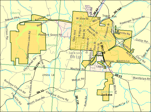
| Description | Map of Jackson, a city in Jackson County, Ohio, United States, with its boundaries at the time of the 2000 census. | |||
| Date | Unknown date; downloaded by me on 14 December 2008 | |||
| Source | http://factfinder.census.gov/leg2/59/120905459.gif, from http://factfinder.census.gov | |||
| Author | United States Census Bureau | |||
| Permission (Reusing this file) |
|

File history
Click on a date/time to view the file as it appeared at that time.
| Date/Time | Thumbnail | Dimensions | User | Comment | |
|---|---|---|---|---|---|
| current | 15:00, 14 December 2008 | | 575 × 425 (45 KB) | Nyttend (talk | contribs) | {{Information |Description=Map of {{w|Jackson, Ohio|Jackson}}, a city in {{w|Jackson County, Ohio|Jackson County}}, {{w|Ohio}}, {{w|United States}}, with its boundaries at the time of the {{w|2000 United States Census|2000 census}}. |Source=http://factfin |
You cannot overwrite this file.
File usage on Commons
There are no pages that use this file.
File usage on other wikis
The following other wikis use this file:
- Usage on de.wikipedia.org
- Usage on en.wikipedia.org
- Usage on fa.wikipedia.org
- Usage on ro.wikipedia.org
- Usage on sh.wikipedia.org
- Usage on ur.wikipedia.org