File:Dhaka oli 202279 lrg.jpg

Size of this preview: 624 × 600 pixels. Other resolutions: 250 × 240 pixels | 499 × 480 pixels | 799 × 768 pixels | 1,065 × 1,024 pixels | 1,817 × 1,747 pixels.
Original file (1,817 × 1,747 pixels, file size: 3.98 MB, MIME type: image/jpeg)
Captions
Captions
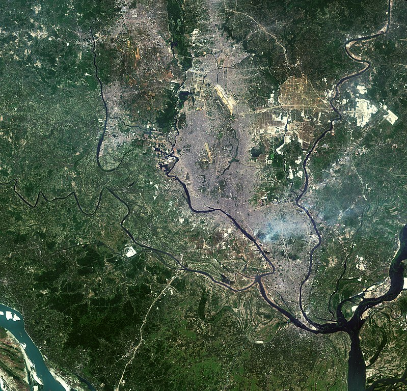
Satellite image of Greater Dhaka Urban agglomeration
Summary edit
| Description |
English: Satellite image of Greater Dhaka Urban agglomeration |
| Date | |
| Source | https://landsat.visibleearth.nasa.gov/view.php?id=150274 |
| Author | Landsat |
Licensing edit
| This file is in the public domain in the United States because it was solely created by NASA. NASA copyright policy states that "NASA material is not protected by copyright unless noted". (See Template:PD-USGov, NASA copyright policy page or JPL Image Use Policy.) | ||
 |
Warnings:
|
File history
Click on a date/time to view the file as it appeared at that time.
| Date/Time | Thumbnail | Dimensions | User | Comment | |
|---|---|---|---|---|---|
| current | 13:26, 31 January 2023 | | 1,817 × 1,747 (3.98 MB) | Nasif05 (talk | contribs) | Uploaded a work by Landsat from https://landsat.visibleearth.nasa.gov/view.php?id=150274 with UploadWizard |
You cannot overwrite this file.
File usage on Commons
There are no pages that use this file.
File usage on other wikis
The following other wikis use this file:
- Usage on bn.wikipedia.org
- Usage on en.wikipedia.org