File:Diagrama Cerdanya.svg

Size of this PNG preview of this SVG file: 225 × 181 pixels. Other resolutions: 298 × 240 pixels | 597 × 480 pixels | 955 × 768 pixels | 1,273 × 1,024 pixels | 2,546 × 2,048 pixels.
Original file (SVG file, nominally 225 × 181 pixels, file size: 110 KB)
Captions
Captions
Add a one-line explanation of what this file represents
Summary edit
| Description |
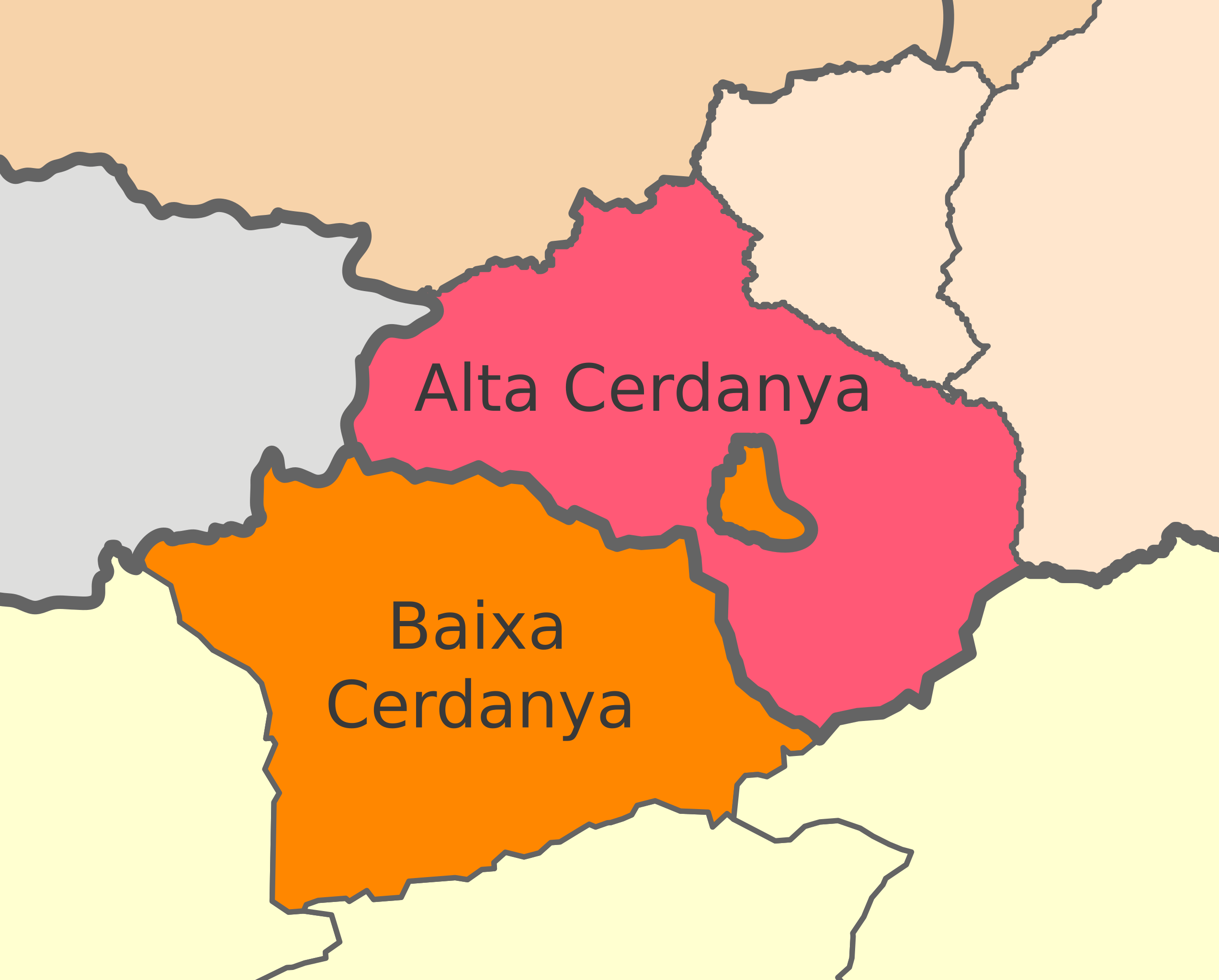
Català: Divisió de la Cerdanya entre la República Francesa i el Regne d'Espanya |
| Date | |
| Source | File:Mapa de localització a les comarques catalanes.svg, which in turn comes from many other free licensed images |
| Author | Includes work from user:Martorell, user:Wagner51, Eric Gaba (Sting - fr:Sting), Emilio Gómez Fernández, Darz Mol, Joan M. Borràs (ebrenc) and myself User:SMP |
Licensing edit
This file is licensed under the Creative Commons Attribution-Share Alike 3.0 Unported license.
- You are free:
- to share – to copy, distribute and transmit the work
- to remix – to adapt the work
- Under the following conditions:
- attribution – You must give appropriate credit, provide a link to the license, and indicate if changes were made. You may do so in any reasonable manner, but not in any way that suggests the licensor endorses you or your use.
- share alike – If you remix, transform, or build upon the material, you must distribute your contributions under the same or compatible license as the original.
File history
Click on a date/time to view the file as it appeared at that time.
| Date/Time | Thumbnail | Dimensions | User | Comment | |
|---|---|---|---|---|---|
| current | 19:52, 11 June 2011 | | 225 × 181 (110 KB) | SMP (talk | contribs) |
You cannot overwrite this file.
File usage on Commons
There are no pages that use this file.
File usage on other wikis
The following other wikis use this file:
- Usage on ca.wikipedia.org
- Usage on en.wikipedia.org
- Usage on eu.wikipedia.org
- Lles de Cerdanya
- Prats i Sansor
- Prullans
- Riu de Cerdanya
- Bellver de Cerdanya
- Alp
- Bolvir
- Das
- Fontanals de Cerdanya
- Ger
- Guils de Cerdanya
- Isòvol
- Llívia
- Meranges
- Urús
- Puigcerdà
- Montellà i Martinet
- Alta Cerdanya
- Cerdanya
- Angostrina i Vilanova de les Escaldes
- Bolquera
- La Guingueta d'Ix
- La Cabanassa
- Dorres
- Èguet
- Enveig
- Er
- Estavar
- Eina
- La Tor de Querol
- Llo
- Matamala
- Montlluís
- Naüja
- Font-romeu, Odelló i Vià
- Oceja
- Palau de Cerdanya
- Planès
- Porta
- Portè
- Sallagosa
- Santa Llocaia
- Sant Pere dels Forcats
- Targasona
- Ur (Cerdanya)
- Vallcebollera
- Txantiloi:Cerdanyako udalerri aurkibidea
- Olià
View more global usage of this file.