File:Die Weißeritz bei Dresden-Plauen 02.jpg
Size of this preview: 734 × 600 pixels. Other resolutions: 294 × 240 pixels | 588 × 480 pixels | 940 × 768 pixels | 1,254 × 1,024 pixels | 2,507 × 2,048 pixels | 3,401 × 2,778 pixels.
Original file (3,401 × 2,778 pixels, file size: 3.04 MB, MIME type: image/jpeg)
Captions
Captions
Add a one-line explanation of what this file represents
Summary edit
| Description |
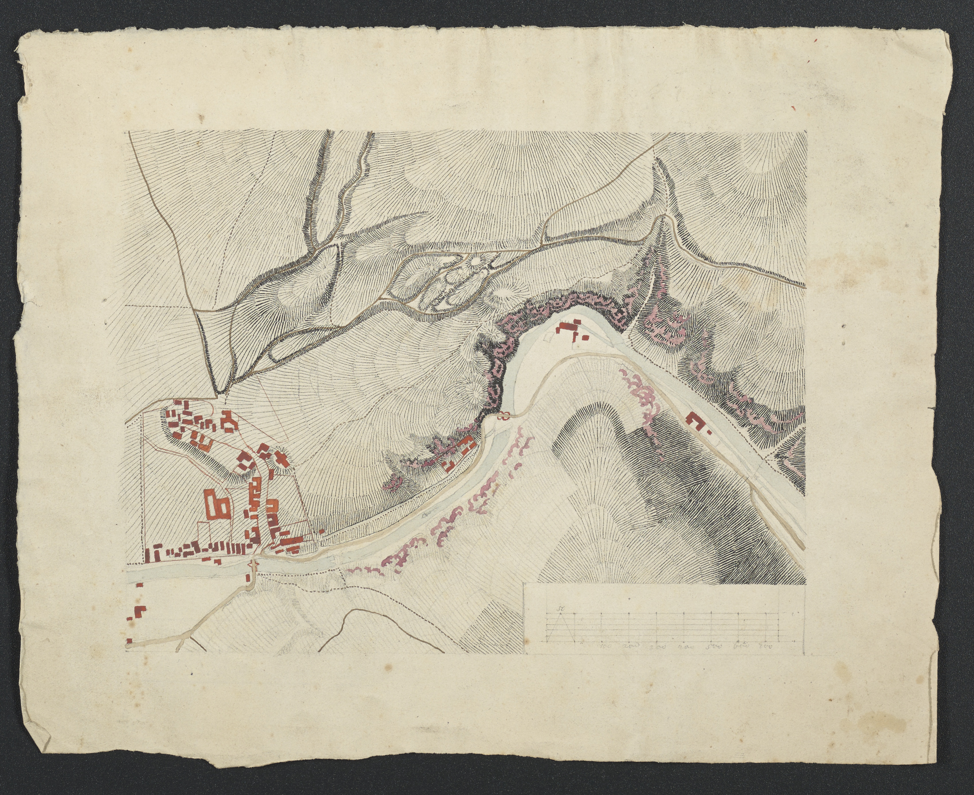
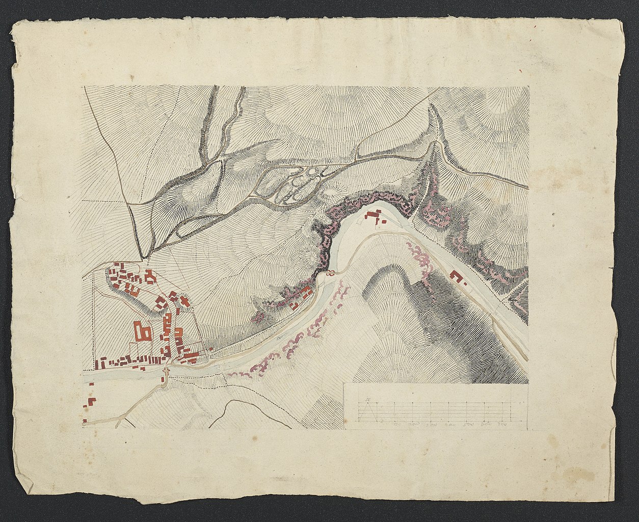
Deutsch: 1 Kt. : teilw. kolor. (20 x 16 cm); Koordinaten E 13°40'51"-E 13°41'29"/N 51°01'27"-N 51°01'10"; Maßstab in graph. Form (Dresdner Ellen). - Maßstab unten rechts. - Ohne Titel. - Flussverlauf: Weißeritz. - Höhendarstellung in Schraffen |
| Date | circa 1830 |
| Source | Leibniz-Institut für Länderkunde, Leipzig |
| Author | o. A. |
Ausschnitt aus dem Flussverlauf der Weißeritz
Licensing edit
| This file is made available under the Creative Commons CC0 1.0 Universal Public Domain Dedication. | |
| The person who associated a work with this deed has dedicated the work to the public domain by waiving all of their rights to the work worldwide under copyright law, including all related and neighboring rights, to the extent allowed by law. You can copy, modify, distribute and perform the work, even for commercial purposes, all without asking permission.
|
File history
Click on a date/time to view the file as it appeared at that time.
| Date/Time | Thumbnail | Dimensions | User | Comment | |
|---|---|---|---|---|---|
| current | 12:33, 18 September 2018 | | 3,401 × 2,778 (3.04 MB) | Higgenhorscht (talk | contribs) | User created page with UploadWizard |
You cannot overwrite this file.
File usage on Commons
The following 2 pages use this file: