File:Dietlinger Wasserfaelle unterer Fall 2022-09-09.jpg

Size of this preview: 460 × 600 pixels. Other resolutions: 184 × 240 pixels | 368 × 480 pixels | 589 × 768 pixels | 785 × 1,024 pixels | 2,291 × 2,988 pixels.
Original file (2,291 × 2,988 pixels, file size: 2.48 MB, MIME type: image/jpeg)
Captions
Captions
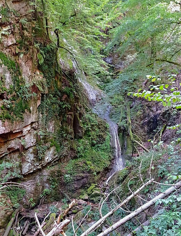
Lower part of Dietlingen waterfalls in southern Black Forest (not accessible by trails)
Summary edit
| Description |
Deutsch: Die Dietlinger Wasserfälle des Großbachs, eines rechten Nebenbachs der unteren Schlücht, liegen versteckt in einer teils klammartigen Schlucht. Nur der obere Fall ist über einen Stichpfad erschlossen. Der dreistufige untere Fall hat eine Höhe von gut 20 Metern. |
| Date | |
| Source | Own work |
| Author | WWasser |
| Camera location | | View this and other nearby images on: OpenStreetMap |
|---|
Licensing edit
I, the copyright holder of this work, hereby publish it under the following license:
This file is licensed under the Creative Commons Attribution-Share Alike 4.0 International license.
- You are free:
- to share – to copy, distribute and transmit the work
- to remix – to adapt the work
- Under the following conditions:
- attribution – You must give appropriate credit, provide a link to the license, and indicate if changes were made. You may do so in any reasonable manner, but not in any way that suggests the licensor endorses you or your use.
- share alike – If you remix, transform, or build upon the material, you must distribute your contributions under the same or compatible license as the original.
File history
Click on a date/time to view the file as it appeared at that time.
| Date/Time | Thumbnail | Dimensions | User | Comment | |
|---|---|---|---|---|---|
| current | 13:29, 18 September 2022 | | 2,291 × 2,988 (2.48 MB) | WWasser (talk | contribs) | Uploaded own work with UploadWizard |
You cannot overwrite this file.
File usage on Commons
The following page uses this file:
File usage on other wikis
The following other wikis use this file:
- Usage on de.wikipedia.org