File:DinastíaHotkí1722-1729.svg

Size of this PNG preview of this SVG file: 787 × 600 pixels. Other resolutions: 315 × 240 pixels | 630 × 480 pixels | 1,008 × 768 pixels | 1,280 × 976 pixels | 2,560 × 1,952 pixels | 1,801 × 1,373 pixels.
Original file (SVG file, nominally 1,801 × 1,373 pixels, file size: 2.06 MB)
Captions
Captions
Add a one-line explanation of what this file represents
Summary edit
| Description |
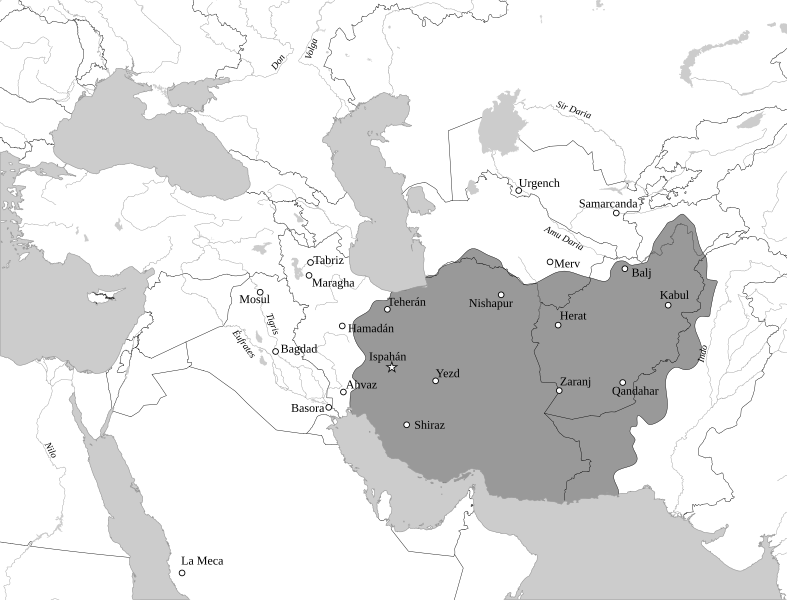
English: Map of The Hotakids from 1722 to 1729 Español: Irán durante la dinastía hotakí, 1722-1729. |
| Date | |
| Source |
This file was derived from: Map of Asia (it).svg : Arab League |
| Author |
|
.svg)
Licensing edit
I, the copyright holder of this work, hereby publish it under the following license:
This file is licensed under the Creative Commons Attribution-Share Alike 4.0 International license.
- You are free:
- to share – to copy, distribute and transmit the work
- to remix – to adapt the work
- Under the following conditions:
- attribution – You must give appropriate credit, provide a link to the license, and indicate if changes were made. You may do so in any reasonable manner, but not in any way that suggests the licensor endorses you or your use.
- share alike – If you remix, transform, or build upon the material, you must distribute your contributions under the same or compatible license as the original.
File history
Click on a date/time to view the file as it appeared at that time.
| Date/Time | Thumbnail | Dimensions | User | Comment | |
|---|---|---|---|---|---|
| current | 08:06, 23 August 2019 | | 1,801 × 1,373 (2.06 MB) | Rowanwindwhistler (talk | contribs) | New version. *Projection:EPSG 32639 *Rivers, coast, sea, lakes: Natural Earth *cities: OSM (mostly) |
| 06:54, 22 May 2019 |  | 982 × 685 (347 KB) | Rowanwindwhistler (talk | contribs) | Better contrast | |
| 07:18, 12 September 2014 |  | 982 × 685 (152 KB) | Rowanwindwhistler (talk | contribs) | User created page with UploadWizard |
You cannot overwrite this file.
File usage on Commons
There are no pages that use this file.
File usage on other wikis
The following other wikis use this file:
- Usage on en.wikipedia.org
- Usage on es.wikipedia.org