File:Doksy CL CZ.png
Size of this preview: 429 × 599 pixels. Other resolutions: 172 × 240 pixels | 344 × 480 pixels | 818 × 1,142 pixels.
Original file (818 × 1,142 pixels, file size: 59 KB, MIME type: image/png)
Captions
Captions
Add a one-line explanation of what this file represents
Summary
edit| Description |
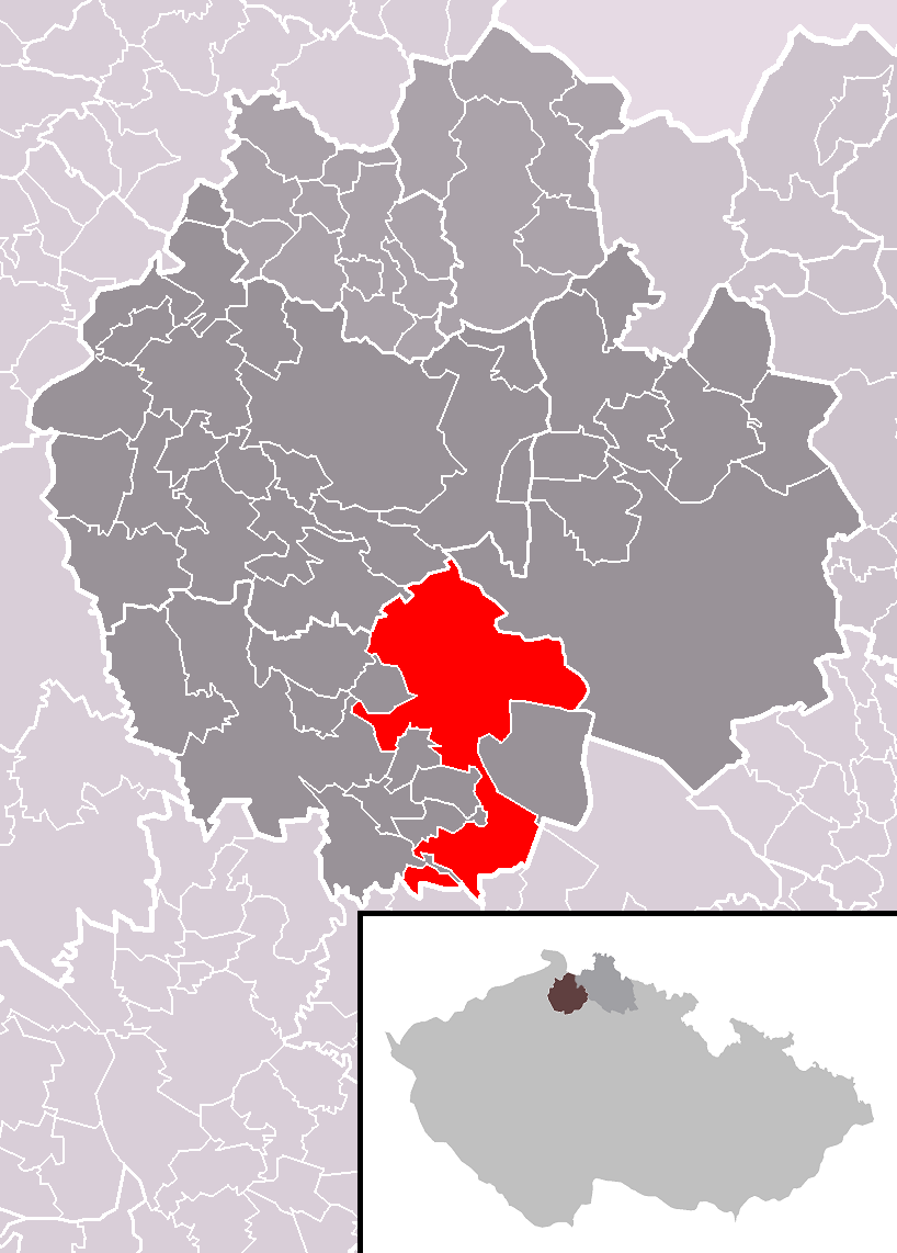
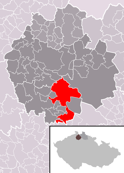
Čeština: Poloha města Doksy v rámci okresu Česká Lípa a správního obvodu obce s rozšířenou působností Česká Lípa. Katastrální území Žďár v Podbezdězí a Kruh v Podbezdězí na jihu souvisejí s ostatkem města jen úzkým koridorem. Katastrální území Vojetín dokonce nesouvisí vůbec, neboť je odděleno výběžkem katastrálního území Houska, spadajícího pod obec Blatce.
English: Location of Doksy town within Česká Lípa District and administrative area of Česká Lípa as a Municipality with Extended Competence. |
| Date | |
| Source | Own work based on File:Ceska_Lipa_District_2007_CL_CZ.png and File:Map CZ - district Ceska Lipa.PNG |
| Author | User:Miaow Miaow |
| Permission (Reusing this file) |
PD-self |
| Other versions |
|

Licensing
edit
| I, the copyright holder of this work, release this work into the public domain. This applies worldwide. In some countries this may not be legally possible; if so: I grant anyone the right to use this work for any purpose, without any conditions, unless such conditions are required by law. |
File history
Click on a date/time to view the file as it appeared at that time.
| Date/Time | Thumbnail | Dimensions | User | Comment | |
|---|---|---|---|---|---|
| current | 21:46, 20 March 2011 | | 818 × 1,142 (59 KB) | Miaow Miaow (talk | contribs) | {{Information |Description={{cs|Poloha města '''Doksy''' v rámci okresu Česká Lípa a správního obvodu obce s rozšířenou působností Česká Lípa.}} {{en|Location of '''Doksy''' town within Česká Lípa District and |
You cannot overwrite this file.
File usage on Commons
The following 10 pages use this file:
File usage on other wikis
The following other wikis use this file:
- Usage on ceb.wikipedia.org
- Usage on cs.wikipedia.org
- Usage on de.wikipedia.org
- Usage on eo.wikipedia.org
- Usage on es.wikipedia.org
- Usage on eu.wikipedia.org
- Usage on fr.wikipedia.org
- Usage on it.wikipedia.org
- Usage on lmo.wikipedia.org
- Usage on pt.wikipedia.org
- Usage on sv.wikipedia.org
- Usage on vi.wikipedia.org
- Usage on www.wikidata.org
- Usage on zh-min-nan.wikipedia.org