File:Dom Chernova 1868.jpg
Size of this preview: 698 × 600 pixels. Other resolutions: 279 × 240 pixels | 559 × 480 pixels | 861 × 740 pixels.
Original file (861 × 740 pixels, file size: 144 KB, MIME type: image/jpeg)
Captions
Captions
Add a one-line explanation of what this file represents
Summary edit
| Description |
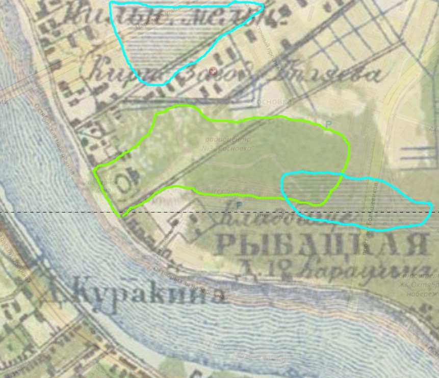
Русский: Топографическая карта частей Санкт-Петербургской и Выборгской губерний. Масштаб - 1 верста в дюйме. Состояние местности на 1860-е годы.
Вырезка в окрестностях Дачи Чернова. Зеленым обозначены современные границы. Синим зоны заболачивания в 1860е |
| Date | |
| Source | http://retromap.ru/_1418685_z15_59.874002,30.484356&rightmain_ov=49&rightback_ov=46 |
| Author | Russian Empire Military Department |
Licensing edit
|
This work is in the public domain in its country of origin and other countries and areas where the copyright term is the author's life plus 70 years or fewer. This work is in the public domain in the United States because it was published (or registered with the U.S. Copyright Office) before January 1, 1929. | |
| This file has been identified as being free of known restrictions under copyright law, including all related and neighboring rights. | |
File history
Click on a date/time to view the file as it appeared at that time.
| Date/Time | Thumbnail | Dimensions | User | Comment | |
|---|---|---|---|---|---|
| current | 05:30, 26 January 2023 | | 861 × 740 (144 KB) | Hisexpert69 (talk | contribs) | Uploaded a work by Russian Empire Military Department from http://retromap.ru/_1418685_z15_59.874002,30.484356&rightmain_ov=49&rightback_ov=46 with UploadWizard |
You cannot overwrite this file.
File usage on Commons
There are no pages that use this file.
File usage on other wikis
The following other wikis use this file:
- Usage on ru.wikipedia.org