File:Dominio Marítimo del Perú.svg

Size of this PNG preview of this SVG file: 463 × 600 pixels. Other resolutions: 185 × 240 pixels | 370 × 480 pixels | 593 × 768 pixels | 790 × 1,024 pixels | 1,581 × 2,048 pixels | 1,168 × 1,513 pixels.
Original file (SVG file, nominally 1,168 × 1,513 pixels, file size: 187 KB)
Captions
Captions
Add a one-line explanation of what this file represents
Summary
edit
| Description |
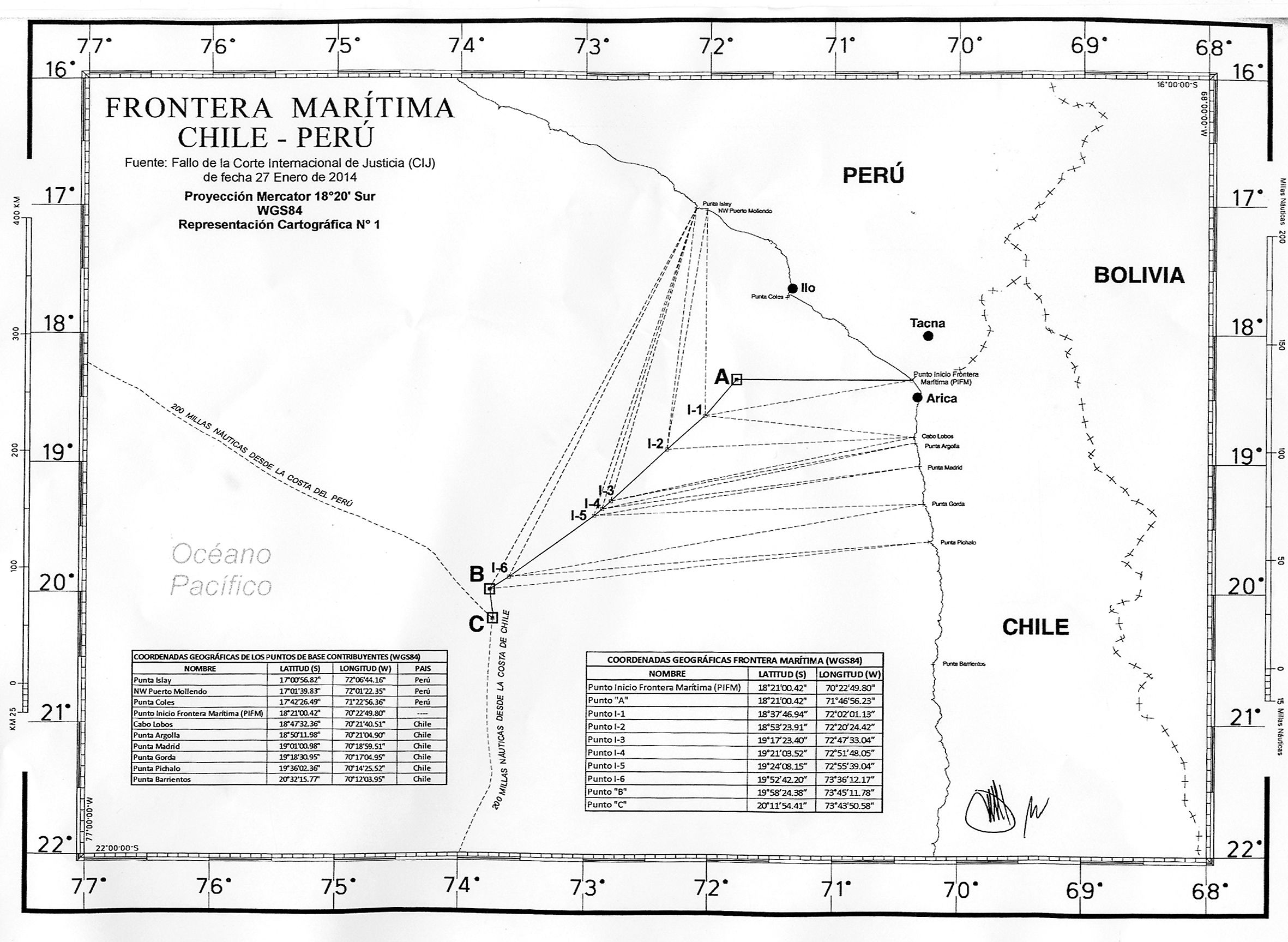
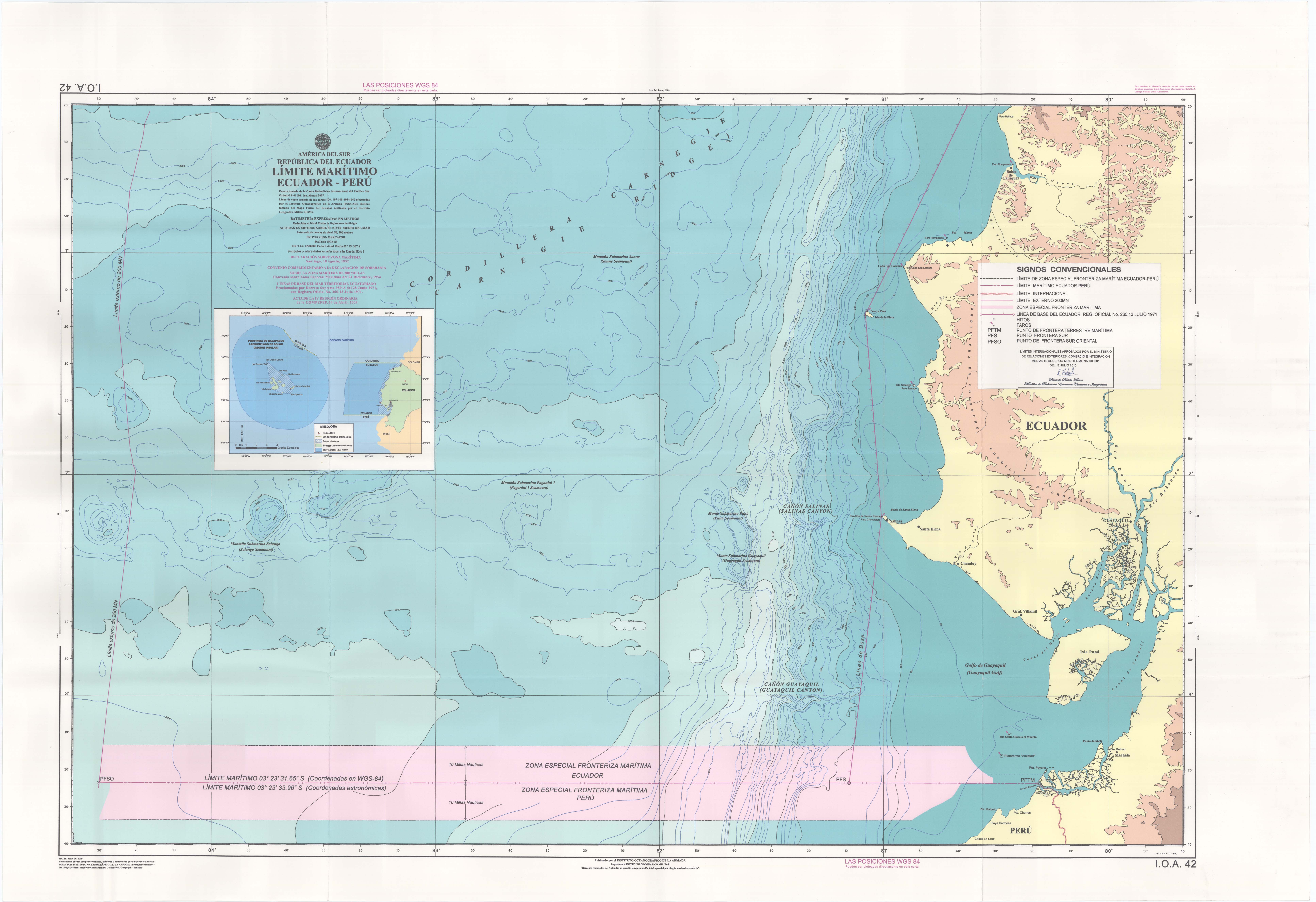
Español: Mapa del dominio marítimo del Perú (Mar de Grau), incluyendo aguas interiores/archipelágicas, aguas territoriales, zona económica exclusiva y areas disputadas. |
| Date | |
| Source |
This file was derived from: Maritime Claims of Peru and Ecuador.svg
|
| Author |
|
Licensing
edit
I, the copyright holder of this work, hereby publish it under the following license:
This file is licensed under the Creative Commons Attribution-Share Alike 3.0 Unported license.
- You are free:
- to share – to copy, distribute and transmit the work
- to remix – to adapt the work
- Under the following conditions:
- attribution – You must give appropriate credit, provide a link to the license, and indicate if changes were made. You may do so in any reasonable manner, but not in any way that suggests the licensor endorses you or your use.
- share alike – If you remix, transform, or build upon the material, you must distribute your contributions under the same or compatible license as the original.
Original upload log
edit
This image is a derivative work of the following images:
- File:Maritime_Claims_of_Peru_and_Ecuador.svg licensed with Cc-by-sa-3.0
Uploaded with derivativeFX
File history
Click on a date/time to view the file as it appeared at that time.
| Date/Time | Thumbnail | Dimensions | User | Comment | |
|---|---|---|---|---|---|
| current | 14:09, 27 July 2020 | | 1,168 × 1,513 (187 KB) | MiguelAlanCS (talk | contribs) | Retiro leyenda que no se utiliza. Retiro línea accesoria |
| 19:00, 9 April 2014 |  | 1,168 × 1,513 (249 KB) | Milenioscuro (talk | contribs) | User created page with UploadWizard |
You cannot overwrite this file.
File usage on Commons
There are no pages that use this file.
File usage on other wikis
The following other wikis use this file:
- Usage on es.wikipedia.org