File:Dona juana volcano location map.jpg
Size of this preview: 451 × 599 pixels. Other resolutions: 180 × 240 pixels | 559 × 743 pixels.
Original file (559 × 743 pixels, file size: 157 KB, MIME type: image/jpeg)
Captions
Captions
Add a one-line explanation of what this file represents
| Description |
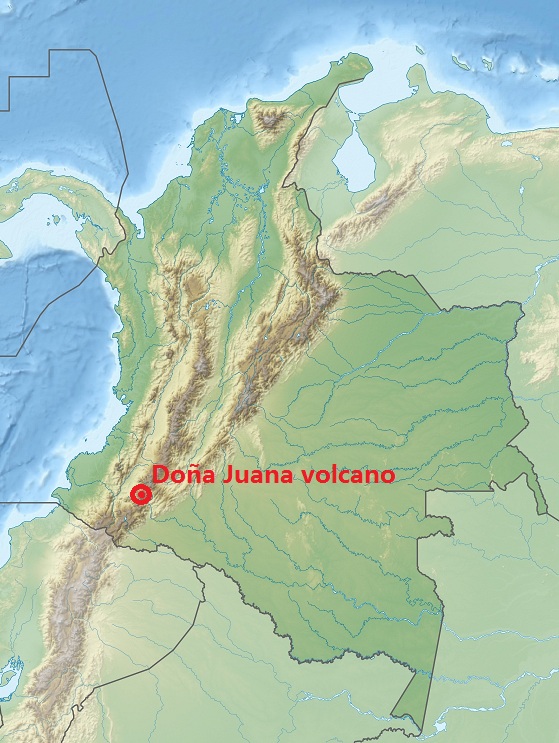
Deutsch: Physische Positionskarte von Kolumbien Quadratische Plattkarte. Geographische Begrenzung der Karte: English: Physical Location map of Colombia Equirectangular projection. Geographic limits of the map: * N: 16.78333 N * S: 4.45 S * W: 85.2 W * E: 66.53333 W |
| Date | (UTC) |
| Source | |
| Author |
|
| This is a retouched picture, which means that it has been digitally altered from its original version. Modifications: Caption showing location of Dona Juana volcano. The original can be viewed here: Colombia relief location map.jpg:
|
I, the copyright holder of this work, hereby publish it under the following license:
This file is licensed under the Creative Commons Attribution-Share Alike 3.0 Unported license.
- You are free:
- to share – to copy, distribute and transmit the work
- to remix – to adapt the work
- Under the following conditions:
- attribution – You must give appropriate credit, provide a link to the license, and indicate if changes were made. You may do so in any reasonable manner, but not in any way that suggests the licensor endorses you or your use.
- share alike – If you remix, transform, or build upon the material, you must distribute your contributions under the same or compatible license as the original.
Original upload log
edit
This image is a derivative work of the following images:
- File:Colombia_relief_location_map.jpg licensed with Cc-by-sa-3.0
- 2010-02-06T12:38:55Z Alexrk2 1516x1736 (922328 Bytes) {{Information |Description= {{de|Physische Positionskarte von [[:de:Kolumbien|Kolumbien]] Quadratische Plattkarte. Geographische Begrenzung der Karte:}} {{en|Physical Location map of [[:en:Colombia|Colombia]] Equirectangular
Uploaded with derivativeFX
File history
Click on a date/time to view the file as it appeared at that time.
| Date/Time | Thumbnail | Dimensions | User | Comment | |
|---|---|---|---|---|---|
| current | 15:07, 11 January 2011 | | 559 × 743 (157 KB) | Christinebenson58 (talk | contribs) | {{Information |Description={{de|Physische Positionskarte von Kolumbien Quadratische Plattkarte. Geographische Begrenzung der Karte:}} {{en|Physical Location map of Colombia Equirectangular projection. Geographic limits o |
You cannot overwrite this file.
File usage on Commons
There are no pages that use this file.