File:Donnerloch Kienberg No 112.jpeg

Size of this preview: 800 × 600 pixels. Other resolutions: 320 × 240 pixels | 640 × 480 pixels | 1,024 × 768 pixels | 1,280 × 960 pixels | 2,272 × 1,704 pixels.
Original file (2,272 × 1,704 pixels, file size: 1.41 MB, MIME type: image/jpeg)
Captions
Captions
Add a one-line explanation of what this file represents
Summary
edit
| Description |
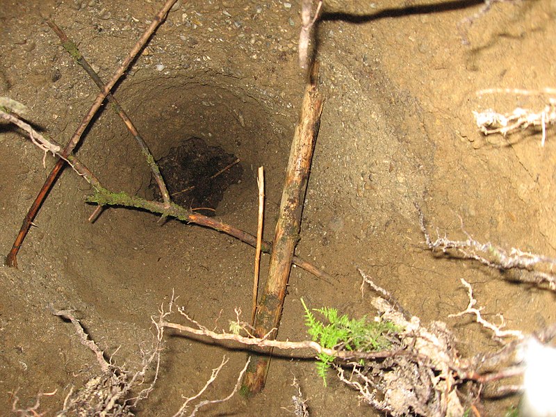
English: Sinkhole No. 112, discovered at 25. Oct 2013, location: Kienberg (Upper Bavaria)
Deutsch: Donnerloch No. 112 bei Kienberg, Nähe TS31 zwischen Sonnau und Viehhausen Erdfall/ Doline, entdeckt am 25.10.2013, Tiefe ca. 8m, Breite oben ca. 1,5m |
| Date | |
| Source | Own work |
| Author | Hans Lauterbach Furchenstein |
| Other versions |
 |
| Camera location | | View this and other nearby images on: OpenStreetMap |
|---|
Anmerkung: Eine Erklärung für die Donnerlöcher gibt das LFU in der Gefahrenhinweiskarte Alpen mit Alpenvorland - Landkreis Traunstein archive copy at the Wayback Machine, Seiten 49-50
Licensing
edit
I, the copyright holder of this work, hereby publish it under the following license:
| This file is made available under the Creative Commons CC0 1.0 Universal Public Domain Dedication. | |
| The person who associated a work with this deed has dedicated the work to the public domain by waiving all of their rights to the work worldwide under copyright law, including all related and neighboring rights, to the extent allowed by law. You can copy, modify, distribute and perform the work, even for commercial purposes, all without asking permission.
|
File history
Click on a date/time to view the file as it appeared at that time.
| Date/Time | Thumbnail | Dimensions | User | Comment | |
|---|---|---|---|---|---|
| current | 13:29, 18 November 2013 | | 2,272 × 1,704 (1.41 MB) | Furchenstein (talk | contribs) | {{Information |Description ={{en|1=Sinkhole No. 112, discovered at 25. Oct 2013, location: Kienberg (Upper Bavaria)}} {{de|1=Donnerloch No. 112 bei Kienberg, Nähe TS31 zwischen Sonnau und Viehhausen Erdfall/ Doline, entdeckt am 25.10.2013, Tiefe c... |
You cannot overwrite this file.
File usage on Commons
The following page uses this file:
File usage on other wikis
The following other wikis use this file:
- Usage on de.wikipedia.org
- Usage on uk.wikipedia.org