File:Donuzlav, Navigation tower, Crimea.jpg

Size of this preview: 800 × 533 pixels. Other resolutions: 320 × 213 pixels | 640 × 427 pixels | 1,024 × 683 pixels | 1,280 × 853 pixels | 2,560 × 1,707 pixels | 3,072 × 2,048 pixels.
Original file (3,072 × 2,048 pixels, file size: 5 MB, MIME type: image/jpeg)
Captions
Captions
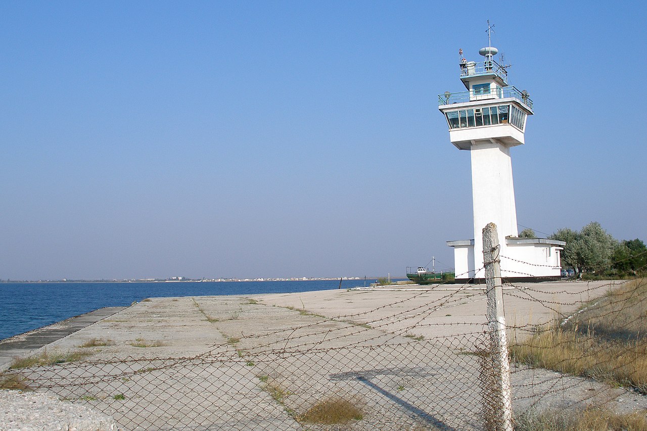
Navigation tower. Donuzlav Naval Base (Soviet Navy). Donuzlav, Crimea.
Summary
edit
| Description |
English: Navigation tower of the 112th Reconnaissance Ship Brigade (Lake Donuzlav). Donuzlav is known for a top secret Soviet naval base that was established here in the 1960s. In XX century, the Black Sea Fleet provided ships for the 5th Operational Squadron in the Mediterranean, which confronted the United States Navy during the Arab-Israeli wars. Donuzlav, Crimea.
Русский: Центр управления движением судов, навигационная башня 112 бригады разведывательных кораблей ЧФ ВМФ СССР. При Советском Союзе район озера Донузлав был сверхсекретным, сюда невозможно было попасть без пропуска. Озеро Донузлав представляет собой лучшую гавань на Черном море, по удобству использования и защищенности превосходит бухты Севастополя и Балаклавы. Донузлав был местом базирования полка гидросамолетов противолодочной авиации, десантных кораблей на воздушной подушке, сторожевых катеров, морской пехоты и боевых пловцов-диверсантов. Донузлав, Крым. |
| Date | |
| Source | Own work |
| Author | Vyacheslav Argenberg |
| Camera location | | View this and other nearby images on: OpenStreetMap |
|---|

|
This image was taken by Vyacheslav Argenberg
If you have any questions, comments or queries, please contact me. |

|
Licensing
edit
Vyacheslav Argenberg, the copyright holder of this work, hereby publishes it under the following license:
This file is licensed under the Creative Commons Attribution 4.0 International license.
Attribution: © Vyacheslav Argenberg / http://www.vascoplanet.com/
- You are free:
- to share – to copy, distribute and transmit the work
- to remix – to adapt the work
- Under the following conditions:
- attribution – You must give appropriate credit, provide a link to the license, and indicate if changes were made. You may do so in any reasonable manner, but not in any way that suggests the licensor endorses you or your use.
File history
Click on a date/time to view the file as it appeared at that time.
| Date/Time | Thumbnail | Dimensions | User | Comment | |
|---|---|---|---|---|---|
| current | 20:11, 17 April 2023 | | 3,072 × 2,048 (5 MB) | Argenberg (talk | contribs) | Uploaded own work with UploadWizard |
You cannot overwrite this file.
File usage on Commons
There are no pages that use this file.
File usage on other wikis
The following other wikis use this file:
- Usage on ru.wikipedia.org