File:Downderry Church - geograph.org.uk - 205722.jpg
No higher resolution available.
Downderry_Church_-_geograph.org.uk_-_205722.jpg (640 × 427 pixels, file size: 102 KB, MIME type: image/jpeg)
Captions
Captions
Add a one-line explanation of what this file represents
Summary edit
| Description |
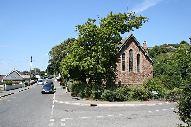
English: Downderry Church. The Church of St Nicolas Downderry began as a mission church to service the growing population of the village. The building dates from 1905. The bent-over shape of the tree in front of the church is interesting as it may indicate a response by the tree to being battered by strong southwesterly gales in the winter in this exposed coastal location. |
| Date | |
| Source | From geograph.org.uk |
| Author | Tony Atkin |
| Attribution (required by the license) | Tony Atkin / Downderry Church / |
| Object location | | View this and other nearby images on: OpenStreetMap |
|---|
_heading:270.00&language=en)
Licensing edit

|
This image was taken from the Geograph project collection. See this photograph's page on the Geograph website for the photographer's contact details. The copyright on this image is owned by Tony Atkin and is licensed for reuse under the Creative Commons Attribution-ShareAlike 2.0 license.
|
This file is licensed under the Creative Commons Attribution-Share Alike 2.0 Generic license.
Attribution: Tony Atkin
- You are free:
- to share – to copy, distribute and transmit the work
- to remix – to adapt the work
- Under the following conditions:
- attribution – You must give appropriate credit, provide a link to the license, and indicate if changes were made. You may do so in any reasonable manner, but not in any way that suggests the licensor endorses you or your use.
- share alike – If you remix, transform, or build upon the material, you must distribute your contributions under the same or compatible license as the original.
File history
Click on a date/time to view the file as it appeared at that time.
| Date/Time | Thumbnail | Dimensions | User | Comment | |
|---|---|---|---|---|---|
| current | 18:32, 31 January 2010 | | 640 × 427 (102 KB) | GeographBot (talk | contribs) | == {{int:filedesc}} == {{Information |description={{en|1=Downderry Church. The Church of St Nicolas Downderry began as a mission church to service the growing population of the village. The building dates from 1905. The bent-over shape of the tree in fr |
You cannot overwrite this file.
File usage on Commons
The following page uses this file:
File usage on other wikis
The following other wikis use this file: