File:Dreiecksnetz sachsen.jpg

Size of this preview: 800 × 504 pixels. Other resolutions: 320 × 201 pixels | 640 × 403 pixels | 1,024 × 645 pixels | 1,280 × 806 pixels | 2,560 × 1,612 pixels | 3,259 × 2,052 pixels.
Original file (3,259 × 2,052 pixels, file size: 1.22 MB, MIME type: image/jpeg)
Captions
Captions
Add a one-line explanation of what this file represents
Summary edit
| Description |
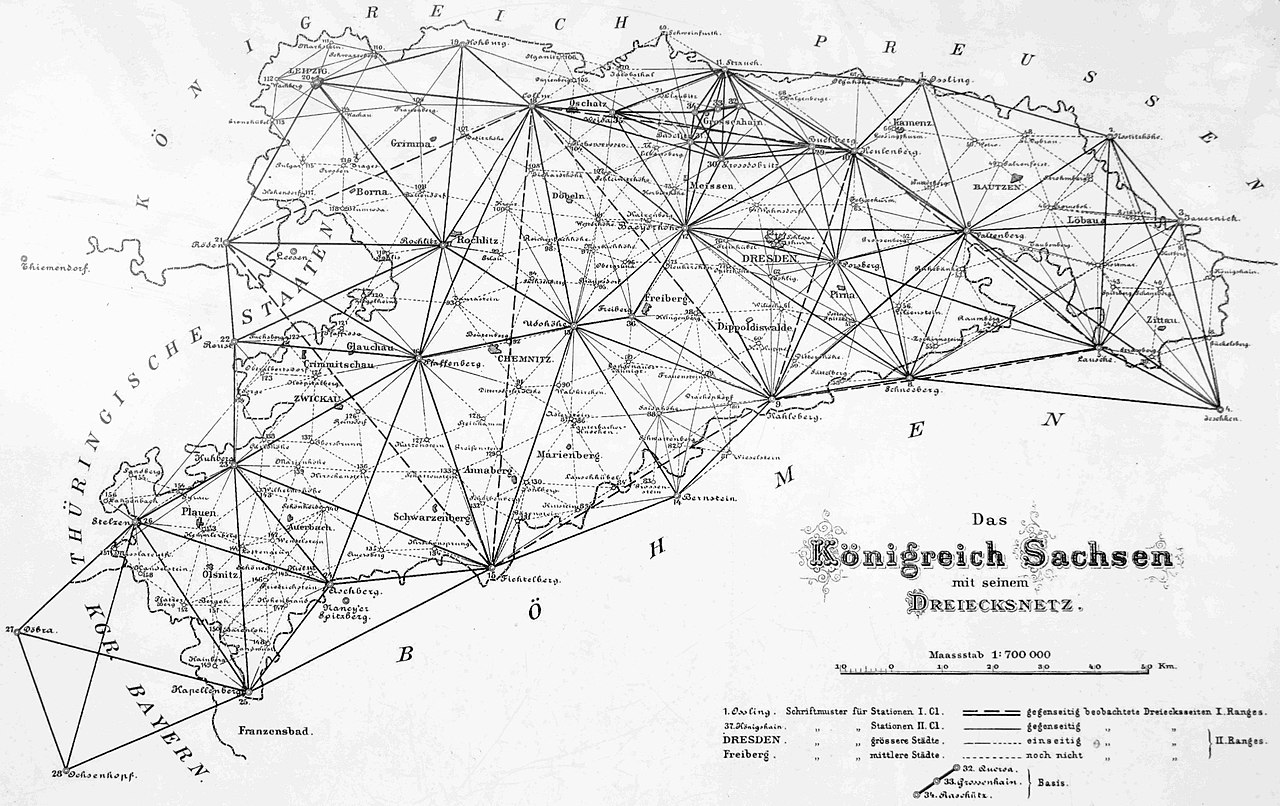
English: Geodetic control points in Saxony
Deutsch: Triangulationspunkte in Sachsen im Rahmen der Königlich-Sächsischen Triangulierung |
| Date | circa 1890 |
| Source | Scan of old map |
| Author | Unknown author |
| Permission (Reusing this file) |
This image is in the public domain due to its age. |
Licensing edit
|
This is a faithful photographic reproduction of a two-dimensional, public domain work of art. The work of art itself is in the public domain for the following reason:
The official position taken by the Wikimedia Foundation is that "faithful reproductions of two-dimensional public domain works of art are public domain".
This photographic reproduction is therefore also considered to be in the public domain in the United States. In other jurisdictions, re-use of this content may be restricted; see Reuse of PD-Art photographs for details. | ||||
|
This work is in the public domain in its country of origin and other countries and areas where the copyright term is the author's life plus 100 years or fewer. This work is in the public domain in the United States because it was published (or registered with the U.S. Copyright Office) before January 1, 1929. | |
| This file has been identified as being free of known restrictions under copyright law, including all related and neighboring rights. | |
File history
Click on a date/time to view the file as it appeared at that time.
| Date/Time | Thumbnail | Dimensions | User | Comment | |
|---|---|---|---|---|---|
| current | 12:28, 15 August 2018 | | 3,259 × 2,052 (1.22 MB) | Markscheider (talk | contribs) | ausgerichtet, aufgehellt und beschnitten |
| 18:54, 29 January 2012 |  | 3,293 × 2,108 (1.46 MB) | Foto 12 (talk | contribs) | {{Information |Description ={{en|1=Geodetic control points in Saxony}} {{de|1=Triangulationspunkte in Sachsen}} |Source =Scan of old map |Author =Unknown |Date =Ca. 1890 |Permission = |other_versions = }} [[Category:Köni |
You cannot overwrite this file.
File usage on Commons
The following page uses this file:
File usage on other wikis
The following other wikis use this file:
- Usage on da.wikipedia.org
- Usage on de.wikipedia.org
- Usage on www.wikidata.org