File:Drove Road.jpg
No higher resolution available.
Drove_Road.jpg (640 × 410 pixels, file size: 69 KB, MIME type: image/jpeg)
Captions
Captions
Add a one-line explanation of what this file represents
| Description |
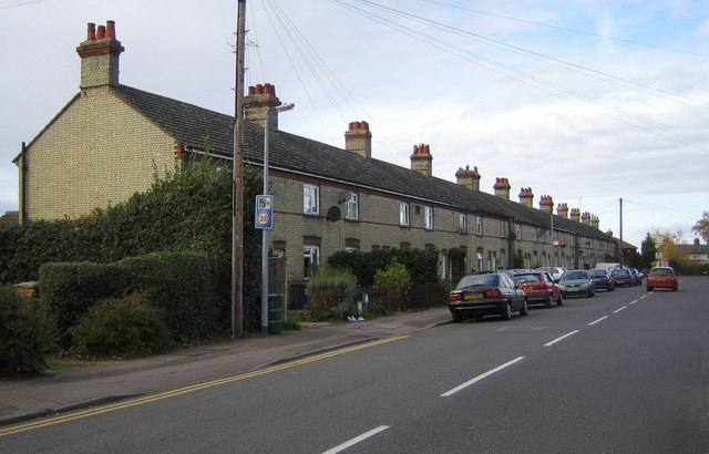
English: Biggleswade: Drove Road
The tablets in the walls of these terraced houses read B.U.D.C. 1913 B.U.D.C. stands for Biggleswade Urban District Council who were the main authority in the town prior to the reorganization of local government in 1973. Drove Road is also the B1040 to Potton and, eventually, St Ives. |
| Date | |
| Source | https://www.geograph.org.uk/photo/612634 |
| Author | Nigel Cox |
| Camera location | | View this and other nearby images on: OpenStreetMap |
|---|

|
This image was taken from the Geograph project collection. See this photograph's page on the Geograph website for the photographer's contact details. The copyright on this image is owned by Nigel Cox and is licensed for reuse under the Creative Commons Attribution-ShareAlike 2.0 license.
|
This file is licensed under the Creative Commons Attribution-Share Alike 2.0 Generic license.
Attribution: Nigel Cox
- You are free:
- to share – to copy, distribute and transmit the work
- to remix – to adapt the work
- Under the following conditions:
- attribution – You must give appropriate credit, provide a link to the license, and indicate if changes were made. You may do so in any reasonable manner, but not in any way that suggests the licensor endorses you or your use.
- share alike – If you remix, transform, or build upon the material, you must distribute your contributions under the same or compatible license as the original.
File history
Click on a date/time to view the file as it appeared at that time.
| Date/Time | Thumbnail | Dimensions | User | Comment | |
|---|---|---|---|---|---|
| current | 17:57, 25 October 2010 | | 640 × 410 (69 KB) | Acather96 (talk | contribs) | {{Information |Description={{en|1=Biggleswade: Drove Road The tablets in the walls of these terraced houses read B.U.D.C. 1913 B.U.D.C. stands for Biggleswade Urban District Council who were the main authority in the town prior to the reorganization of |
You cannot overwrite this file.
File usage on Commons
There are no pages that use this file.