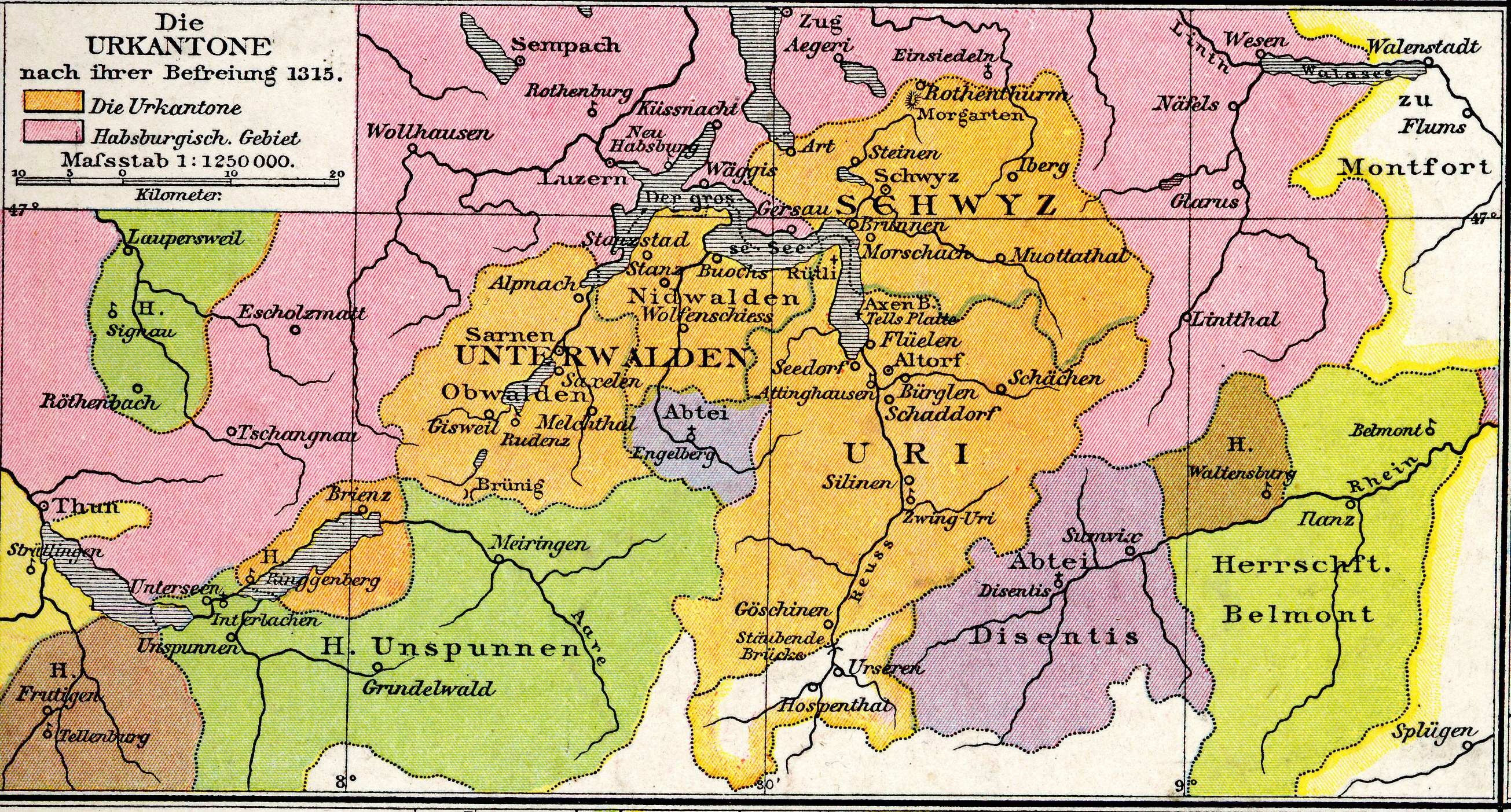
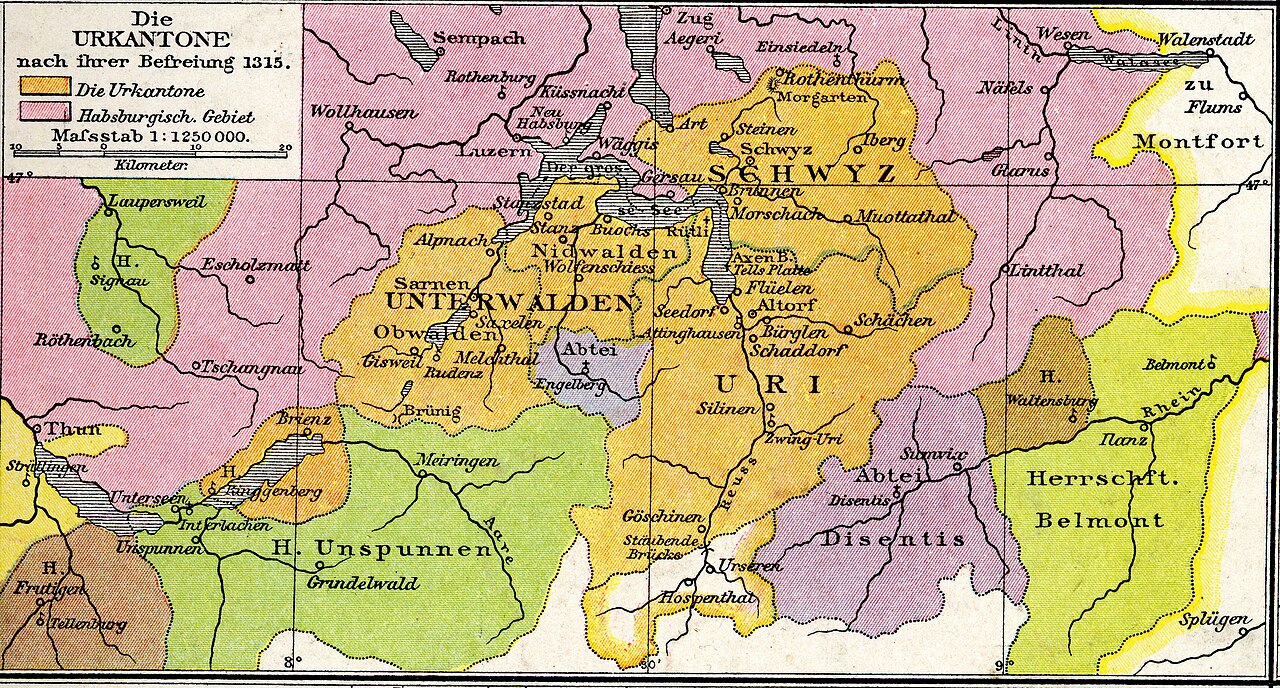
File:Droysens-25c.jpg
Size of this preview: 800 × 430 pixels. Other resolutions: 320 × 172 pixels | 640 × 344 pixels | 1,024 × 550 pixels | 1,280 × 688 pixels | 2,610 × 1,403 pixels.
Original file (2,610 × 1,403 pixels, file size: 4.4 MB, MIME type: image/jpeg)
Captions
Captions
Add a one-line explanation of what this file represents
Summary
edit
| Description |
Deutsch: Die Urkantone nach ihrer Befreiung 1315 English: The original cantons after their liberation in 1315. |
| Date | |
| Source | Third map from plate 25 of Professor G. Droysens Allgemeiner Historischer Handatlas, published by R. Andrée, 1886. |
| Author | Droysen, Andrée; C.Dändliker rev. |
Licensing
edit
I, the copyright holder of this work, hereby publish it under the following licenses:
This file is licensed under the Creative Commons Attribution-Share Alike 3.0 Unported license.
- You are free:
- to share – to copy, distribute and transmit the work
- to remix – to adapt the work
- Under the following conditions:
- attribution – You must give appropriate credit, provide a link to the license, and indicate if changes were made. You may do so in any reasonable manner, but not in any way that suggests the licensor endorses you or your use.
- share alike – If you remix, transform, or build upon the material, you must distribute your contributions under the same or compatible license as the original.

|
Permission is granted to copy, distribute and/or modify this document under the terms of the GNU Free Documentation License, Version 1.2 or any later version published by the Free Software Foundation; with no Invariant Sections, no Front-Cover Texts, and no Back-Cover Texts. A copy of the license is included in the section entitled GNU Free Documentation License. |
You may select the license of your choice.
File history
Click on a date/time to view the file as it appeared at that time.
| Date/Time | Thumbnail | Dimensions | User | Comment | |
|---|---|---|---|---|---|
| current | 12:58, 11 October 2011 | | 2,610 × 1,403 (4.4 MB) | Maproom (talk | contribs) | {{Information |Description ={{de|1=Die Urkantone}} |Source =Third map from plate 25 of Professor G. Droysens Allgemeiner Historischer Handatlas, published by R. Andrée, 1886. |Author =Droysen, Andrée; C.Dändliker rev. |Date |
You cannot overwrite this file.
File usage on Commons
The following page uses this file: