File:Drygalski-Fjord-Map-Larsen-Harbour.png
Size of this preview: 800 × 458 pixels. Other resolutions: 320 × 183 pixels | 640 × 366 pixels | 1,139 × 652 pixels.
Original file (1,139 × 652 pixels, file size: 152 KB, MIME type: image/png)
Captions
Captions
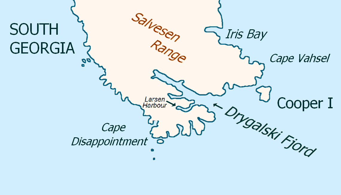
Map of Drygalski Fjord, South Georgia Island, with Larsen Harbour labelled.
Summary
edit
| Description |
English: Map of Drygalski Fjord, South Georgia Island, with Larsen Harbour labelled. |
| Date | |
| Source | Based on File:Drygalski-Fjord-Map.png, with the label for Larsen Harbour added. |
| Author |
|
Licensing
edit
| I, the copyright holder of this work, release this work into the public domain. This applies worldwide. In some countries this may not be legally possible; if so: I grant anyone the right to use this work for any purpose, without any conditions, unless such conditions are required by law. |
File history
Click on a date/time to view the file as it appeared at that time.
| Date/Time | Thumbnail | Dimensions | User | Comment | |
|---|---|---|---|---|---|
| current | 03:33, 5 March 2020 | | 1,139 × 652 (152 KB) | Premeditated Chaos (talk | contribs) | Uploaded a work by * Original file created & uploaded by User:Apcbg * Addition made by User:Premeditated Chaos from Based on File:Drygalski-Fjord-Map.png, with the label for Larsen Harbour added. with UploadWizard |
You cannot overwrite this file.
File usage on Commons
There are no pages that use this file.
File usage on other wikis
The following other wikis use this file:
- Usage on en.wikipedia.org