File:Dudley upper 1919 map.png
Size of this preview: 683 × 600 pixels. Other resolutions: 273 × 240 pixels | 546 × 480 pixels | 874 × 768 pixels | 1,166 × 1,024 pixels | 2,331 × 2,048 pixels | 6,384 × 5,608 pixels.
Original file (6,384 × 5,608 pixels, file size: 4.77 MB, MIME type: image/png)
Captions
Captions
Add a one-line explanation of what this file represents
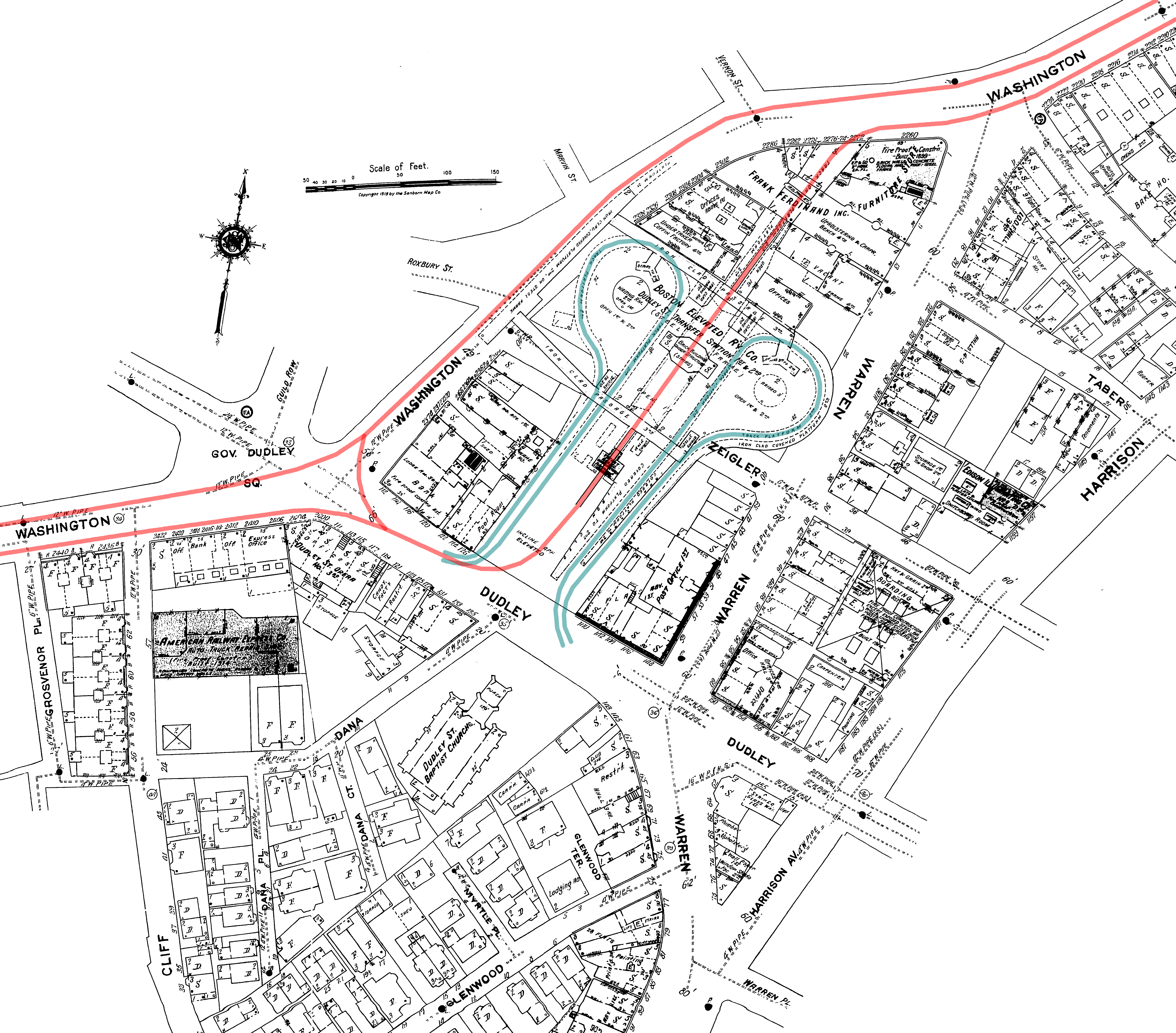
| Description | Diagram of the old Dudley elevated station in Boston, accurate to the 1919 date of the base map. The Main Line Elevated (future Orange Line) tracks are in red, with the streetcar loops (later busways) in blue. Both are on the same level, with elevated walkways connecting the three platforms - two on the northbound Orange Line track and one southbound. | ||
| Date | |||
| Source | Own work | ||
| Author | User:SPUI (overlay of Sanborn base map) | ||
| Permission (Reusing this file) |
|
File history
Click on a date/time to view the file as it appeared at that time.
| Date/Time | Thumbnail | Dimensions | User | Comment | |
|---|---|---|---|---|---|
| current | 08:34, 15 May 2005 | | 6,384 × 5,608 (4.77 MB) | SPUI~commonswiki (talk | contribs) | {{spuimap}} Diagram of the old Dudley elevated station in Boston - elevated (Orange Line) tracks in red, streetcar tracks (later busways) in blue. Both on the same level, with elevated walkways connecting the three platforms - two on the northbound Orange |
You cannot overwrite this file.
File usage on Commons
The following 3 pages use this file: