File:Dumblehole Brook - geograph.org.uk - 1202707.jpg
No higher resolution available.
Dumblehole_Brook_-_geograph.org.uk_-_1202707.jpg (640 × 480 pixels, file size: 164 KB, MIME type: image/jpeg)
Captions
Captions
Add a one-line explanation of what this file represents
Summary
edit
| Description |
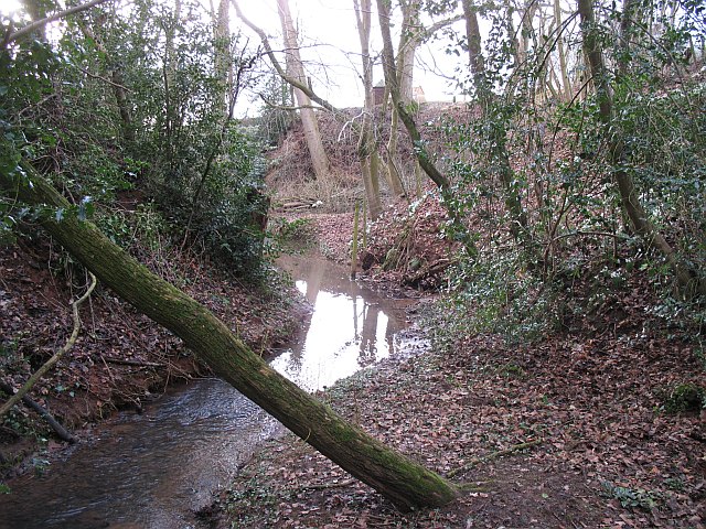
English: Dumblehole Brook The brook is running deep beneath the surrounding land. It has cut down to the new level of the river, which has been much larger since the Teme was diverted this way in glacial times. The dingle was formed by a retreating waterfall - the falls are behind The Dumblehole ("Dumbleholes Farm" according to the Ordnance Survey) at SO52697020.
The photograph was taken from the remains of a footbridge which carried a footpath around a ford at Dumblehole. The ford was filled in 1973, one plank of the now obsolete bridge remains. |
| Date | |
| Source | From geograph.org.uk |
| Author | Richard Webb |
| Attribution (required by the license) | Richard Webb / Dumblehole Brook / |
| Camera location | | View this and other nearby images on: OpenStreetMap |
|---|
_heading:247.00&language=en)
| Object location | | View this and other nearby images on: OpenStreetMap |
|---|
_heading:247.00&language=en)
Licensing
edit

|
This image was taken from the Geograph project collection. See this photograph's page on the Geograph website for the photographer's contact details. The copyright on this image is owned by Richard Webb and is licensed for reuse under the Creative Commons Attribution-ShareAlike 2.0 license.
|
This file is licensed under the Creative Commons Attribution-Share Alike 2.0 Generic license.
Attribution: Richard Webb
- You are free:
- to share – to copy, distribute and transmit the work
- to remix – to adapt the work
- Under the following conditions:
- attribution – You must give appropriate credit, provide a link to the license, and indicate if changes were made. You may do so in any reasonable manner, but not in any way that suggests the licensor endorses you or your use.
- share alike – If you remix, transform, or build upon the material, you must distribute your contributions under the same or compatible license as the original.
File history
Click on a date/time to view the file as it appeared at that time.
| Date/Time | Thumbnail | Dimensions | User | Comment | |
|---|---|---|---|---|---|
| current | 03:13, 26 February 2011 | | 640 × 480 (164 KB) | GeographBot (talk | contribs) | == {{int:filedesc}} == {{Information |description={{en|1=Dumblehole Brook The brook is running deep beneath the surrounding land. It has cut down to the new level of the river, which has been much larger since the Teme was diverted this way in glacial tim |
You cannot overwrite this file.
File usage on Commons
There are no pages that use this file.