File:Dunkle Erdhummel in Pollen - Flickr - gbohne.jpg
Original file (2,039 × 2,719 pixels, file size: 3.44 MB, MIME type: image/jpeg)
Captions
Captions
Summary edit
| Description |
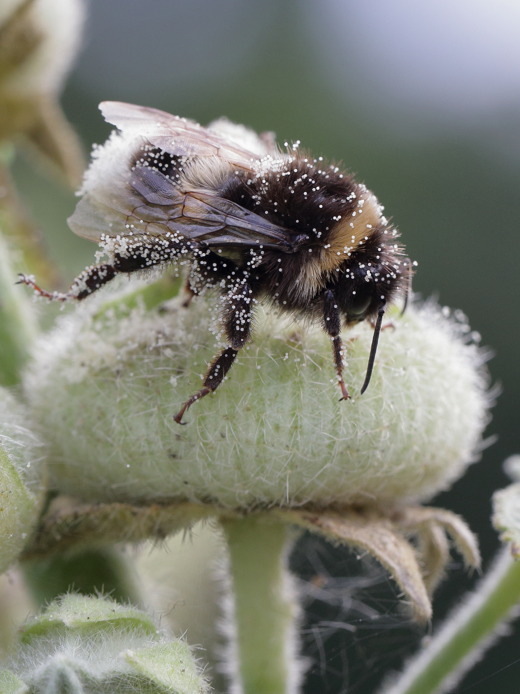
plant: Alcea rosea L. (Gewöhnliche Stockrose) Family: Malvaceae (Malvengewächse) de.wikipedia.org/wiki/Gew%C3%B6hnliche_Stockrose Phylum: Arthropoda LATREILLE, 1829 (arthropods, Gliederfüßer) Subphylum: Hexapoda BLAINVILLE, 1816 Class: Insecta LINNAEUS, 1758 (insects, Insekten) Subclass: Pterygota LANG, 1888 (Fluginsekten) Infraclass: Neoptera MARTYNOV, 1923 (Neuflügler) Order: Hymenoptera LINNAEUS, 1758 (bees, ants & wasps, Hautflügler) Suborder: Apocrita (Taillenwespen) Superfamily: Apoidea LATREILLE, 1802 Family: Apidae LATREILLE, 1802 (bees, Bienen) Subfamily: Apinae LATREILLE, 1802 Tribus: Bombini LATREILLE, 1802 Genus: Bombus LATREILLE, 1802 (bumblebee, Hummeln) probably: Bombus terrestris LINNAEUS, 1758 ? (Buff-tailed Bumblebee, Dunkle Erdhummel) some info: de.wikipedia.org/wiki/Dunkle_Erdhummel Central-Germany, Hesse, Kassel: Heisebachtal NP, ca. 180m asl., 30.07.2016 IMG_8664 |
| Date | Taken on 30 July 2016, 18:55 |
| Source | Dunkle Erdhummel in Pollen |
| Author | gbohne |
| Flickr tags | canon, geo:region=europe, geo:country=germany, arthropoda, arthropods, taxonomy:phylum=arthropoda, taxonomy:subphylum=hexapoda, insects, insekten, insect, insekt, insecta, taxonomy:class=insecta, gliederfüßer, pterygota, taxonomy:subclass=pterygota, neoptera, taxonomy:infraclass=neoptera, hymenoptera, taxonomy:order=hymenoptera, apocrita, taxonomy:suborder=apocrita, apoidea, taxonomy:superfamily=apoidea, hautflügler, hummeln, erdhummel, taxonomy:family=apidae, taxonomy:subfamily=apinae, taxonomy:tribus=bombini, taxonomy:genus=bombus, taxonomy:binomial=bombus terrestris, hummel, in explore, explored, pollen, bumble bee, gewöhnliche stockrose, stockmalve, bauernrose, bestäubung, identified |
| Camera location | | View this and other nearby images on: OpenStreetMap |
|---|
Licensing edit
- You are free:
- to share – to copy, distribute and transmit the work
- to remix – to adapt the work
- Under the following conditions:
- attribution – You must give appropriate credit, provide a link to the license, and indicate if changes were made. You may do so in any reasonable manner, but not in any way that suggests the licensor endorses you or your use.
- share alike – If you remix, transform, or build upon the material, you must distribute your contributions under the same or compatible license as the original.
| This image was originally posted to Flickr by gbohne at https://flickr.com/photos/51216897@N07/32426034013. It was reviewed on 7 August 2020 by FlickreviewR 2 and was confirmed to be licensed under the terms of the cc-by-sa-2.0. |
File history
Click on a date/time to view the file as it appeared at that time.
| Date/Time | Thumbnail | Dimensions | User | Comment | |
|---|---|---|---|---|---|
| current | 07:19, 7 August 2020 | | 2,039 × 2,719 (3.44 MB) | Red panda bot (talk | contribs) | In Flickr Explore: 2017-03-04 |
You cannot overwrite this file.
File usage on Commons
There are no pages that use this file.