File:Dura Europos, röm. hell. 280 v.Chr. (38651055926).jpg
Size of this preview: 800 × 600 pixels. Other resolutions: 320 × 240 pixels | 640 × 480 pixels | 1,024 × 768 pixels | 1,280 × 960 pixels | 1,632 × 1,224 pixels.
Original file (1,632 × 1,224 pixels, file size: 947 KB, MIME type: image/jpeg)
Captions
Captions
Add a one-line explanation of what this file represents
Summary edit
.jpg&action=edit§ion=1)
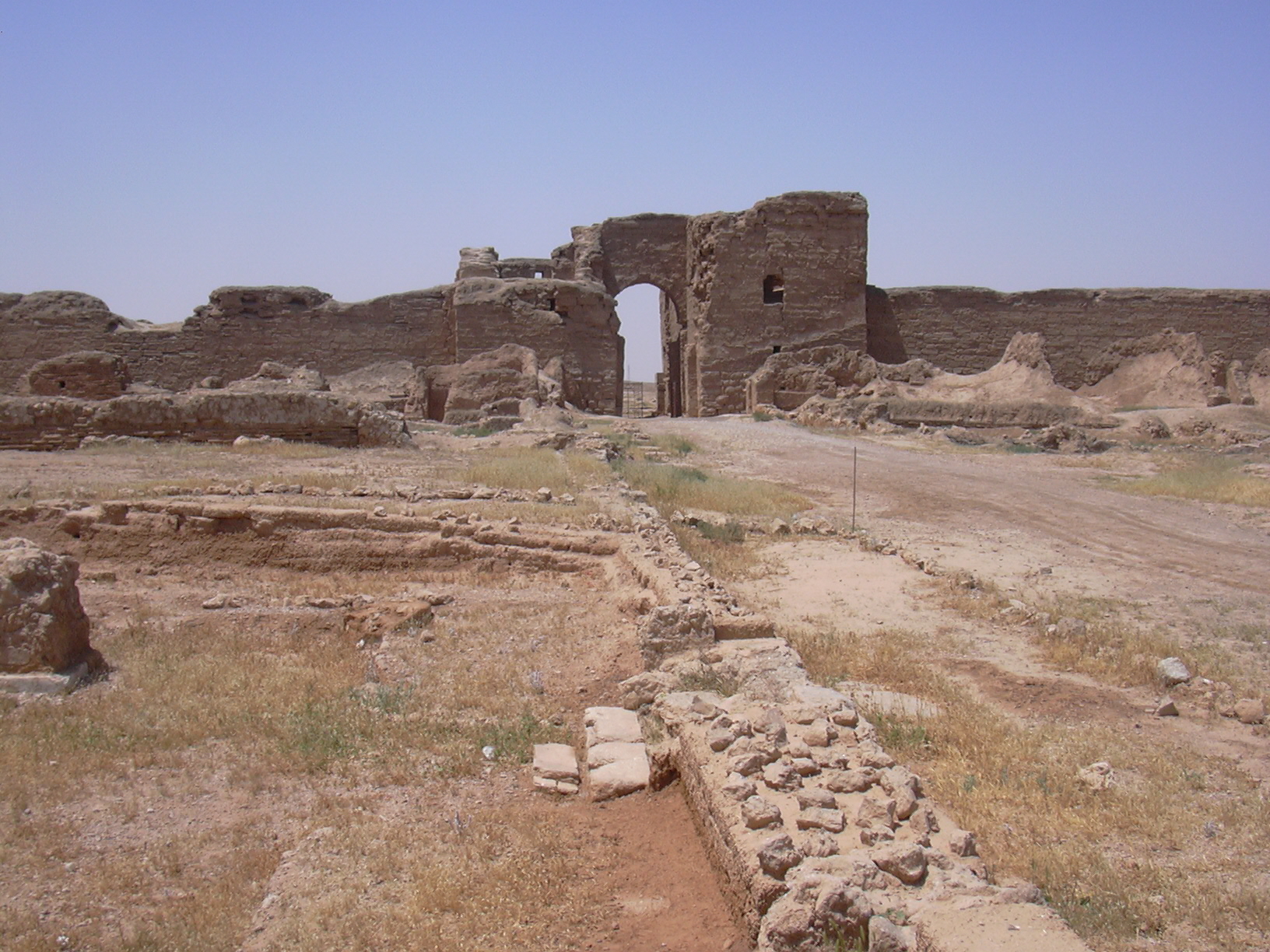
| Description | Die Seleukiden gründeten um 280 v.Chr. diese befestigte Garnisonsstadt 90 m über den Klippen des Euphrat. Dura bedeutet in assyrischer Sprache Mauer, die Araber nennen den Ort Tell Salhiye. 128 v. Chr wurde die Stadt von den Parthern erobert, die unter großem Einfluss von Palmyra standen. Von 165 n.Chr. bis 256 n.Chr. war hier ein wichtiger Stützpunkt des römischen Reiches zur Sicherung seiner Aussengrenze gegen die Perser. |
| Date | |
| Source | Dura Europos, röm./hell. 280 v.Chr. |
| Author | Herbert Frank from Wien (Vienna), AT |
| Camera location | | View this and other nearby images on: OpenStreetMap |
|---|
.jpg¶ms=034.746491_N_0040.727558_E_globe:Earth_type:camera_source:Flickr_&language=en)
Licensing edit
.jpg&action=edit§ion=2)
This file is licensed under the Creative Commons Attribution 2.0 Generic license.
- You are free:
- to share – to copy, distribute and transmit the work
- to remix – to adapt the work
- Under the following conditions:
- attribution – You must give appropriate credit, provide a link to the license, and indicate if changes were made. You may do so in any reasonable manner, but not in any way that suggests the licensor endorses you or your use.
| This image was originally posted to Flickr by liakada-web at https://flickr.com/photos/154650255@N03/38651055926 (archive). It was reviewed on 12 June 2018 by FlickreviewR 2 and was confirmed to be licensed under the terms of the cc-by-2.0. |
File history
Click on a date/time to view the file as it appeared at that time.
| Date/Time | Thumbnail | Dimensions | User | Comment | |
|---|---|---|---|---|---|
| current | 19:25, 12 June 2018 | | 1,632 × 1,224 (947 KB) | Meisam (talk | contribs) | Transferred from Flickr via #flickr2commons |
You cannot overwrite this file.
File usage on Commons
There are no pages that use this file.
.jpg&oldid=476940415)