File:Durham Council UK ward map 2010 (blank).svg

Size of this PNG preview of this SVG file: 800 × 524 pixels. Other resolutions: 320 × 210 pixels | 640 × 419 pixels | 1,024 × 671 pixels | 1,280 × 839 pixels | 2,560 × 1,678 pixels | 1,425 × 934 pixels.
Original file (SVG file, nominally 1,425 × 934 pixels, file size: 1.26 MB)
Captions
Captions
Add a one-line explanation of what this file represents
| Description |
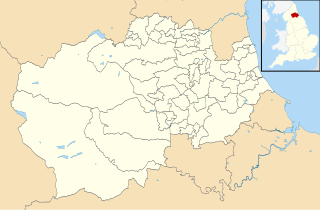
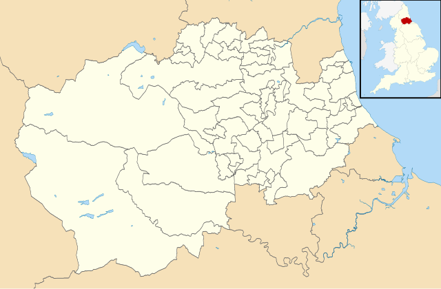
Blank map of Durham County Council area (excluding Darlington, Hartlepool and Stockton-on-Tees), UK with electoral divisions and wards shown. Equirectangular map projection on WGS 84 datum, with N/S stretched 170% Geographic limits:
|
| Date | |
| Source |
|
| Author | Nilfanion, created using Ordnance Survey data |
| Permission (Reusing this file) |
This file is licensed under the Creative Commons Attribution-Share Alike 3.0 Unported license. Attribution: Contains Ordnance Survey data © Crown copyright and database right
|
File history
Click on a date/time to view the file as it appeared at that time.
| Date/Time | Thumbnail | Dimensions | User | Comment | |
|---|---|---|---|---|---|
| current | 01:09, 25 April 2011 | | 1,425 × 934 (1.26 MB) | Nilfanion (talk | contribs) | {{Information |Description=Blank map of Durham County Council area, UK with electoral divisions and wards shown. Equirectangular map projection on WGS 84 datum, with N/S stretched 170% Geographic limits: *West: 2.40W *East: 1.05W *No |
You cannot overwrite this file.
File usage on Commons
The following 2 pages use this file:
File usage on other wikis
The following other wikis use this file:
- Usage on en.wikipedia.org
.svg&oldid=476604450)