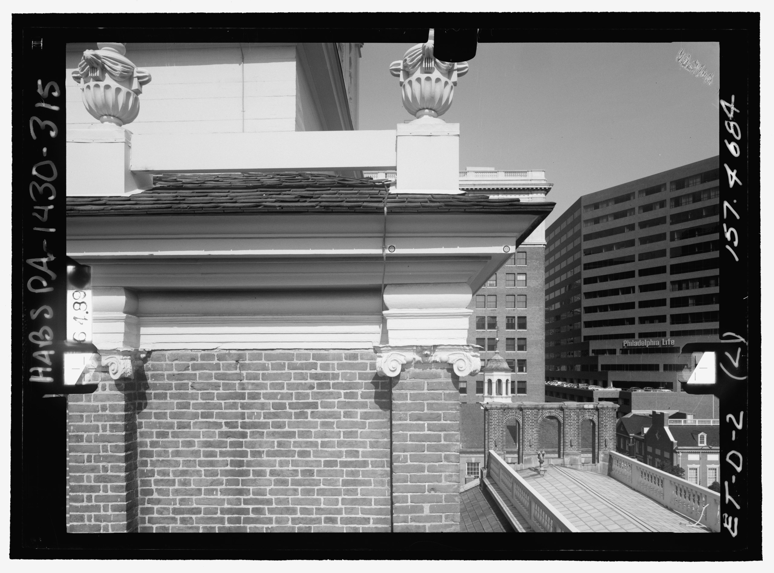
File:EAST TOWER, DETAIL VIEW OF CARVED IONIC PILASTER CAPITAL. Glass plate stereopair number PA-1430-139 LC-HABS-GS05-ET-D-2 157.4684. Left (printed) - Independence Hall Complex, HABS PA,51-PHILA,6-315.tif

Size of this JPG preview of this TIF file: 800 × 592 pixels. Other resolutions: 320 × 237 pixels | 640 × 474 pixels | 1,024 × 758 pixels | 1,280 × 948 pixels | 2,560 × 1,896 pixels | 5,187 × 3,841 pixels.
Original file (5,187 × 3,841 pixels, file size: 19 MB, MIME type: image/tiff)
Captions
Captions
Add a one-line explanation of what this file represents
Summary edit
| Photographer |
Dennett, Muessig and Associates, Limited |
|||
| Title |
EAST TOWER, DETAIL VIEW OF CARVED IONIC PILASTER CAPITAL. Glass plate stereopair number PA-1430-139 LC-HABS-GS05-ET-D-2 157.4684. Left (printed) - Independence Hall Complex, Independence Hall, 500 Chestnut Street, Philadelphia, Philadelphia County, PA |
|||
| Depicted place | Pennsylvania; Philadelphia County; Philadelphia | |||
| Date | 1985 | |||
| Dimensions | 2.5 x 3.5 in. | |||
| Current location |
Library of Congress Prints and Photographs Division Washington, D.C. 20540 USA http://hdl.loc.gov/loc.pnp/pp.print |
|||
| Accession number |
HABS PA,51-PHILA,6-315 |
|||
| Credit line |
|
|||
| Notes |
|
|||
| References |
|
|||
| Source | https://www.loc.gov/pictures/item/pa0939.photos.368502p | |||
| Permission (Reusing this file) |
|

| Object location | | View this and other nearby images on: OpenStreetMap |
|---|
File history
Click on a date/time to view the file as it appeared at that time.
| Date/Time | Thumbnail | Dimensions | User | Comment | |
|---|---|---|---|---|---|
| current | 05:53, 3 August 2014 |  | 5,187 × 3,841 (19 MB) | Fæ (talk | contribs) | GWToolset: Creating mediafile for Fæ. HABS 2014-08-01 2601-2900 missing |
You cannot overwrite this file.
File usage on Commons
The following page uses this file: