File:EB 1911 Map Fig 9.png
Size of this preview: 744 × 600 pixels. Other resolutions: 298 × 240 pixels | 596 × 480 pixels | 953 × 768 pixels | 1,270 × 1,024 pixels | 1,950 × 1,572 pixels.
Original file (1,950 × 1,572 pixels, file size: 648 KB, MIME type: image/png)
Captions
Captions
Add a one-line explanation of what this file represents
Summary
edit| Description |
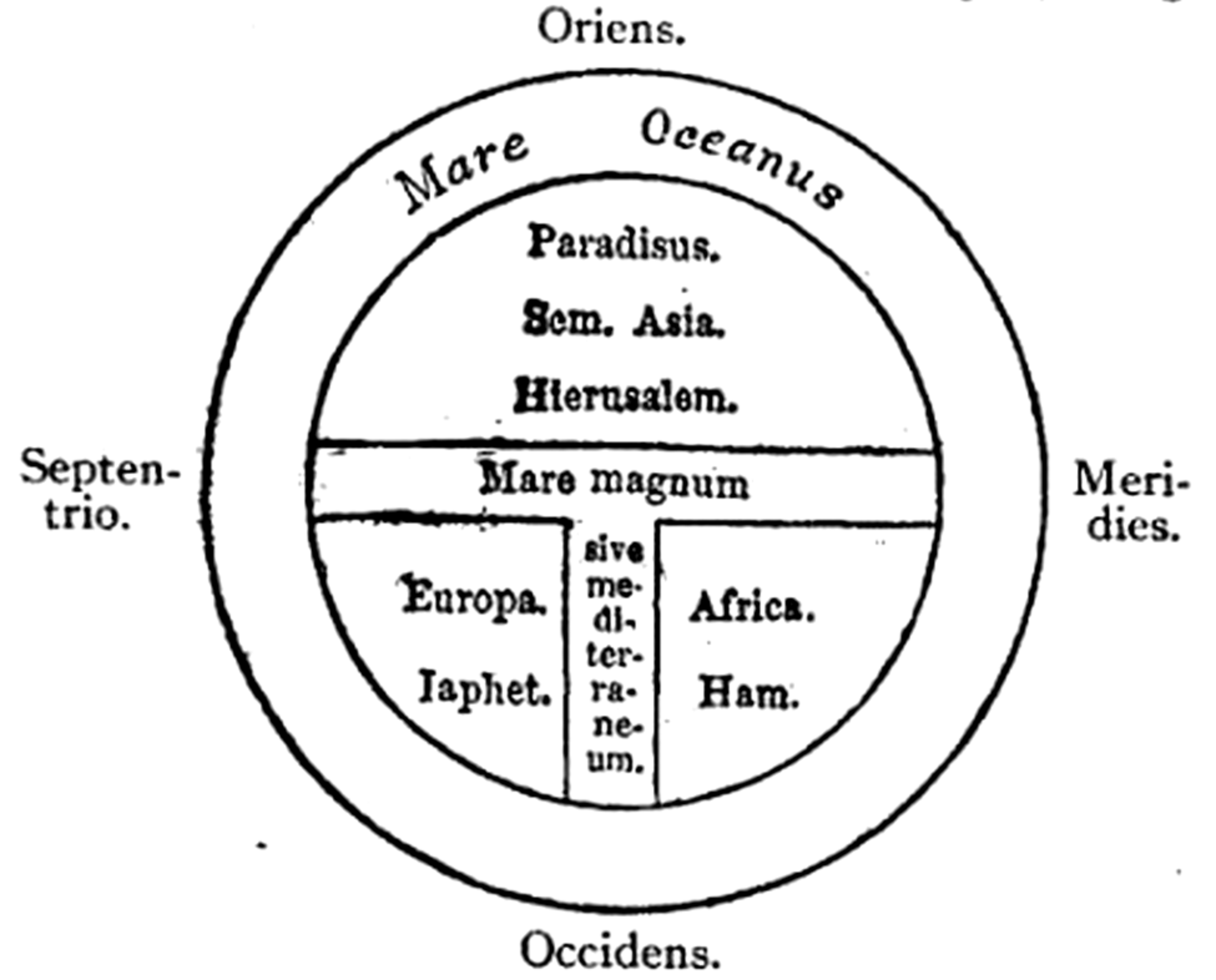
English: Caption: "Fig. 9.—T map from Isidor of Seville's Origines." A schematic Latin T&O map with East (Oriens) at the top, South (Meridies) at the right, West (Occidens) at the bottom, and North (Septentrio) at the left. The central sea is labeled "The Great Sea or Mediterranean" (Mare magnum sive mediterraneum). The continents are labeled along with the son of Noah credited with its settlement: Europe and Japhet (Europa. Iaphet.), Africa and Ham (Africa. Ham.), and Asia and Shem (Sem. Asia.). Jerusalem (Hierusalem) is placed near the center of the world in western Asia; the Garden of Eden (Paradisus) is placed in the Far East. |
| Date | circa 1911 (archetype circa 630) |
| Source | "Map" in the Encyclopaedia Britannica, 11th ed., Vol. XVII, p. 638. |
| Author | Anonymous. Presumably Emery Walker |
| Permission (Reusing this file) |
PD-US; PD-Britannica |
| Other versions |
|

Licensing
edit
This media file is in the public domain in the United States. This applies to U.S. works where the copyright has expired, often because its first publication occurred prior to January 1, 1929, and if not then due to lack of notice or renewal. See this page for further explanation.
|
 | |
 |
This image might not be in the public domain outside of the United States; this especially applies in the countries and areas that do not apply the rule of the shorter term for US works, such as Canada, Mainland China (not Hong Kong or Macao), Germany, Mexico, and Switzerland. The creator and year of publication are essential information and must be provided. See Wikipedia:Public domain and Wikipedia:Copyrights for more details.
|
| This image comes from the 13th edition of the Encyclopædia Britannica or earlier. The copyrights for that book have expired in the United States because the book was first published in the US with the publication occurring before January 1, 1929. As such, this image is in the public domain in the United States. |  |
| Annotations | This image is annotated: View the annotations at Commons |
File history
Click on a date/time to view the file as it appeared at that time.
| Date/Time | Thumbnail | Dimensions | User | Comment | |
|---|---|---|---|---|---|
| current | 13:33, 30 March 2015 | | 1,950 × 1,572 (648 KB) | LlywelynII (talk | contribs) | User created page with UploadWizard |
You cannot overwrite this file.
File usage on Commons
The following page uses this file:
File usage on other wikis
The following other wikis use this file:
- Usage on en.wikisource.org