File:ECDM 20230517 FL Uganda (cropped).jpg

Size of this preview: 800 × 525 pixels. Other resolutions: 320 × 210 pixels | 640 × 420 pixels | 1,024 × 672 pixels | 1,280 × 840 pixels | 2,560 × 1,680 pixels | 4,962 × 3,256 pixels.
Original file (4,962 × 3,256 pixels, file size: 2.3 MB, MIME type: image/jpeg)
Captions
Captions
Add a one-line explanation of what this file represents
Summary edit
| Description |
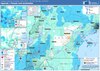
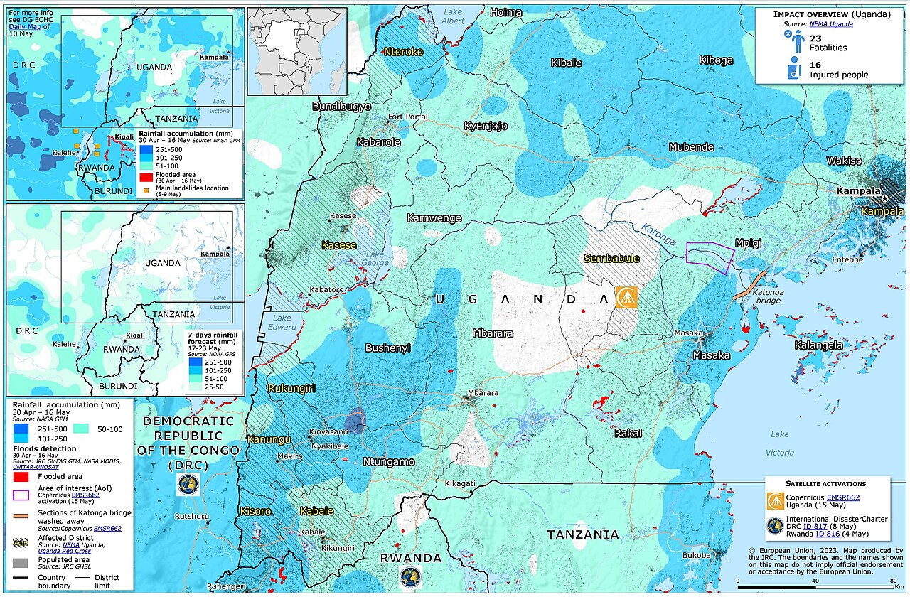
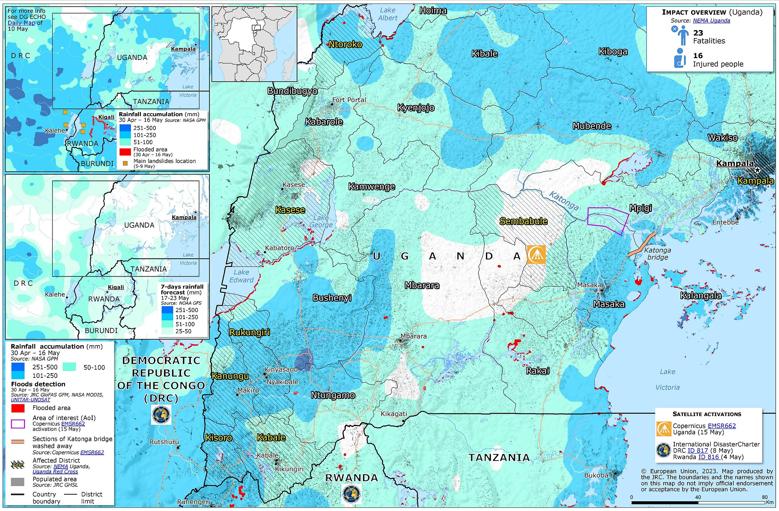
Deutsch: Überschwemmungen und Erdrutsche in Uganda
English: Floods and landslides in Uganda. ECHO Daily Map of 17 May 2023 |
| Date | |
| Source | https://erccportal.jrc.ec.europa.eu/ECHO-Products/Maps#/maps/4495 |
| Author |
ERCC - Emergency Response Coordination Centre Sources: JRC-GLOFAS, UNITAR-UNOSAT, NASA GPM, NOAA GFS, JRC GHSL, NEMA Uganda, Uganda Red Cross, Copernicus EMSR662, International DisasterCharter. |
| Other versions |
.jpg&action=edit§ion=1)
Licensing edit
.jpg&action=edit§ion=2)
Public documents (any content whatever its medium) produced by the Commission or by entities on its behalf published by the Commission or the Publications Office or which have not been published for economic or other practical reasons, such as studies, reports and other data shall be made available for reuse unless otherwise specified[1] without restrictions according to 2011/833/EU: Commission Decision of 12 December 2011 on the reuse of Commission documents
Note: Content on ec.europa.eu or its data portal is published with the specified restrictions of the CC BY 4.0 license.
| |
File history
Click on a date/time to view the file as it appeared at that time.
| Date/Time | Thumbnail | Dimensions | User | Comment | |
|---|---|---|---|---|---|
| current | 13:49, 18 May 2023 | | 4,962 × 3,256 (2.3 MB) | Lupe (talk | contribs) | File:ECDM 20230517 FL Uganda.pdf cropped 7 % vertically using CropTool with lossless mode. |
You cannot overwrite this file.
File usage on Commons
The following page uses this file:
.jpg&oldid=873725443)