File:EE-map.jpg
Size of this preview: 581 × 599 pixels. Other resolutions: 233 × 240 pixels | 465 × 480 pixels | 694 × 716 pixels.
Original file (694 × 716 pixels, file size: 106 KB, MIME type: image/jpeg)
Captions
Captions
Add a one-line explanation of what this file represents
Summary edit
| Description |
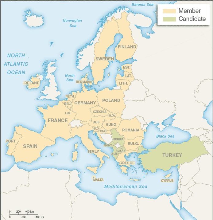
English: CIA map of the European Union showing 27 member states and 5 candidate states. |
| Date | |
| Source | CIA World Factbook |
| Author | CIA |
Licensing edit
This image is in the public domain because it contains materials that originally came from the United States Central Intelligence Agency's World Factbook.
|
 |
File history
Click on a date/time to view the file as it appeared at that time.
| Date/Time | Thumbnail | Dimensions | User | Comment | |
|---|---|---|---|---|---|
| current | 06:20, 27 May 2021 | | 694 × 716 (106 KB) | Sbb1413 (talk | contribs) | Uploaded a work by CIA from [https://www.cia.gov/the-world-factbook/countries/european-union/ CIA World Factbook] with UploadWizard |
You cannot overwrite this file.
File usage on Commons
The following page uses this file:
File usage on other wikis
The following other wikis use this file:
- Usage on simple.wikipedia.org