File:EF3 damage Mullica Hills, New Jersey 2021.jpg
Size of this preview: 800 × 600 pixels. Other resolutions: 320 × 240 pixels | 640 × 480 pixels | 1,024 × 768 pixels | 1,280 × 960 pixels | 2,560 × 1,920 pixels | 4,032 × 3,024 pixels.
Original file (4,032 × 3,024 pixels, file size: 2.3 MB, MIME type: image/jpeg)
Captions
Captions
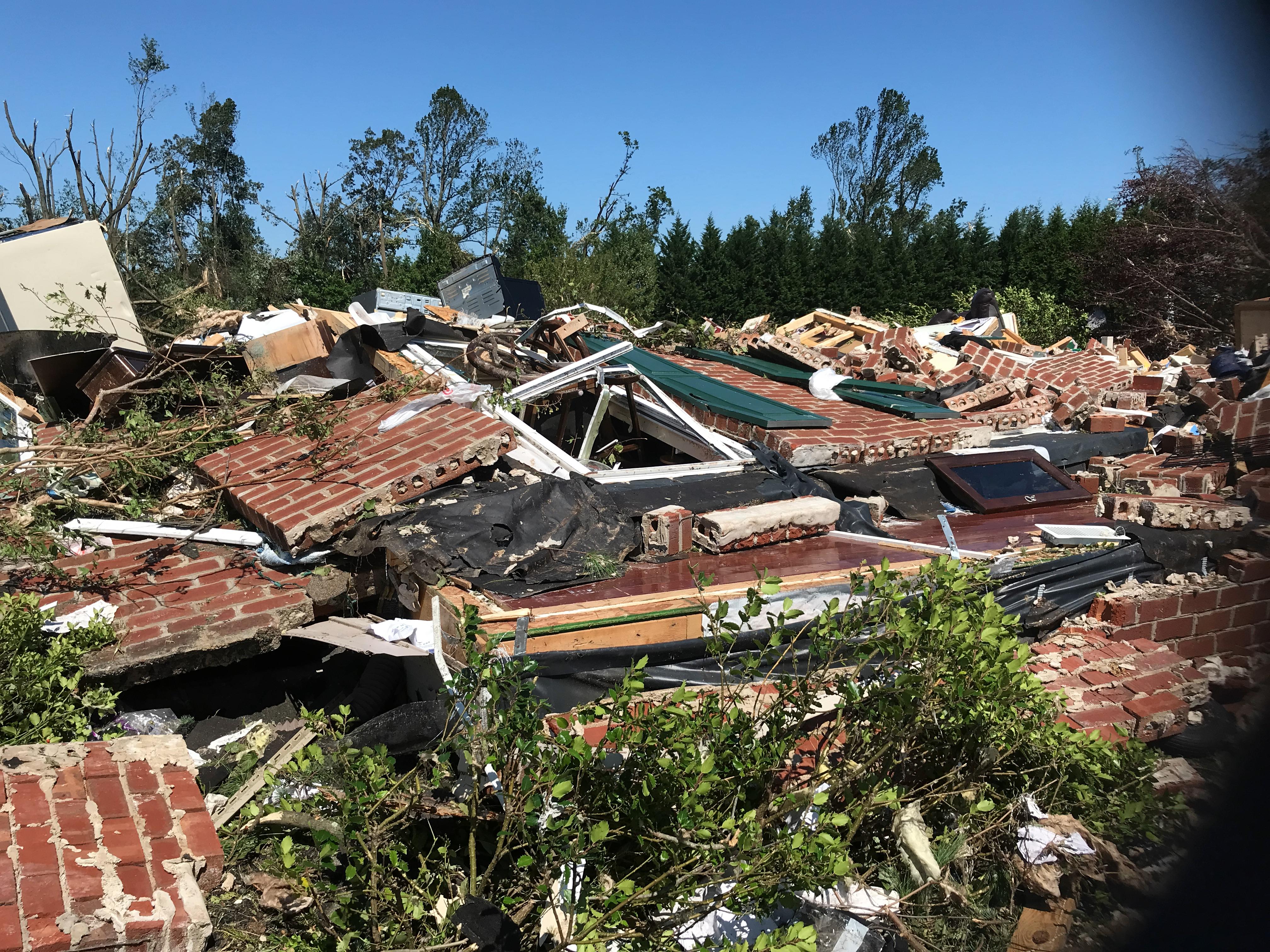
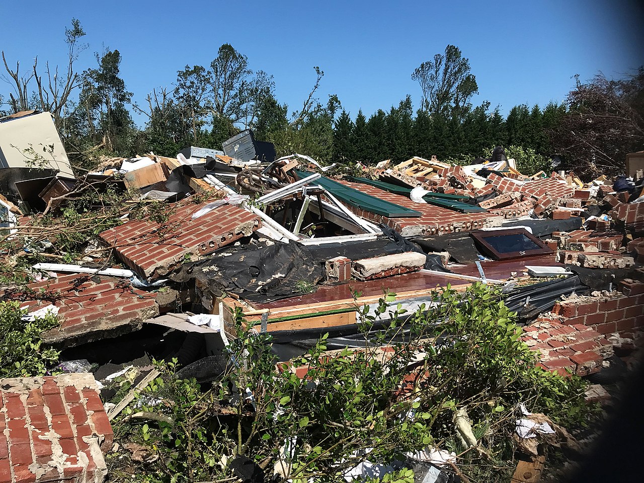
A home that was completely leveled at EF3 intensity on the east side of Mullica Hill, New Jersey..
Summary edit
| Description |
English: A home that was leveled by the EF3 Mullica Hills, New Jersey tornado produced by the remnants of Hurricane Ida. |
| Date | |
| Source | https://services.dat.noaa.gov/arcgis/rest/services/nws_damageassessmenttoolkit/DamageViewer/FeatureServer/0/2470225/attachments/1519212 |
| Author | NWS Mount Holly |
| Camera location | | View this and other nearby images on: OpenStreetMap |
|---|
Licensing edit
This image is in the public domain because it contains materials that originally came from the U.S. National Oceanic and Atmospheric Administration, taken or made as part of an employee's official duties.
|
File history
Click on a date/time to view the file as it appeared at that time.
| Date/Time | Thumbnail | Dimensions | User | Comment | |
|---|---|---|---|---|---|
| current | 11:36, 3 January 2022 | | 4,032 × 3,024 (2.3 MB) | ChessEric (talk | contribs) | Uploaded a work by NWS Mount Holly from https://services.dat.noaa.gov/arcgis/rest/services/nws_damageassessmenttoolkit/DamageViewer/FeatureServer/0/2470225/attachments/1519212 with UploadWizard |
You cannot overwrite this file.
File usage on Commons
There are no pages that use this file.
File usage on other wikis
The following other wikis use this file:
- Usage on en.wikipedia.org