File:EIT smashed by tree.jpg

Size of this preview: 800 × 600 pixels. Other resolutions: 320 × 240 pixels | 640 × 480 pixels | 1,024 × 768 pixels | 1,280 × 960 pixels | 1,600 × 1,200 pixels.
Original file (1,600 × 1,200 pixels, file size: 211 KB, MIME type: image/jpeg)
Captions
Captions
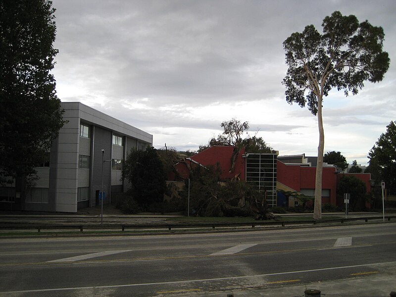
EIT building in Taradale with fallen tree embedded in it after Cyclone Gabrielle
Summary
edit
| Description |
English: Eastern Institute of Technology (EIT) building on Gloucester Street, Taradale, with fallen tree embedded in it after Cyclone Gabrielle. View from the Tutaekuri River stopbank. The buildings were also flooded by water from the river, which overtopped this stretch of the stopbank. Silt lies in the EIT grounds, with traces on the road also. |
| Date | |
| Source | Own work |
| Author | Nurg |
| Camera location | | View this and other nearby images on: OpenStreetMap |
|---|
Licensing
edit
I, the copyright holder of this work, hereby publish it under the following license:
This file is licensed under the Creative Commons Attribution-Share Alike 4.0 International license.
- You are free:
- to share – to copy, distribute and transmit the work
- to remix – to adapt the work
- Under the following conditions:
- attribution – You must give appropriate credit, provide a link to the license, and indicate if changes were made. You may do so in any reasonable manner, but not in any way that suggests the licensor endorses you or your use.
- share alike – If you remix, transform, or build upon the material, you must distribute your contributions under the same or compatible license as the original.
File history
Click on a date/time to view the file as it appeared at that time.
| Date/Time | Thumbnail | Dimensions | User | Comment | |
|---|---|---|---|---|---|
| current | 02:46, 5 March 2023 | | 1,600 × 1,200 (211 KB) | Nurg (talk | contribs) | Uploaded own work with UploadWizard |
You cannot overwrite this file.
File usage on Commons
There are no pages that use this file.