File:ES DensidadePopulacional.svg

Size of this PNG preview of this SVG file: 411 × 599 pixels. Other resolutions: 165 × 240 pixels | 329 × 480 pixels | 527 × 768 pixels | 703 × 1,024 pixels | 1,406 × 2,048 pixels | 677 × 986 pixels.
Original file (SVG file, nominally 677 × 986 pixels, file size: 157 KB)
Captions
Captions
Add a one-line explanation of what this file represents
Summary edit
| Description |
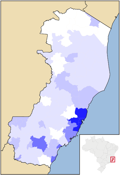
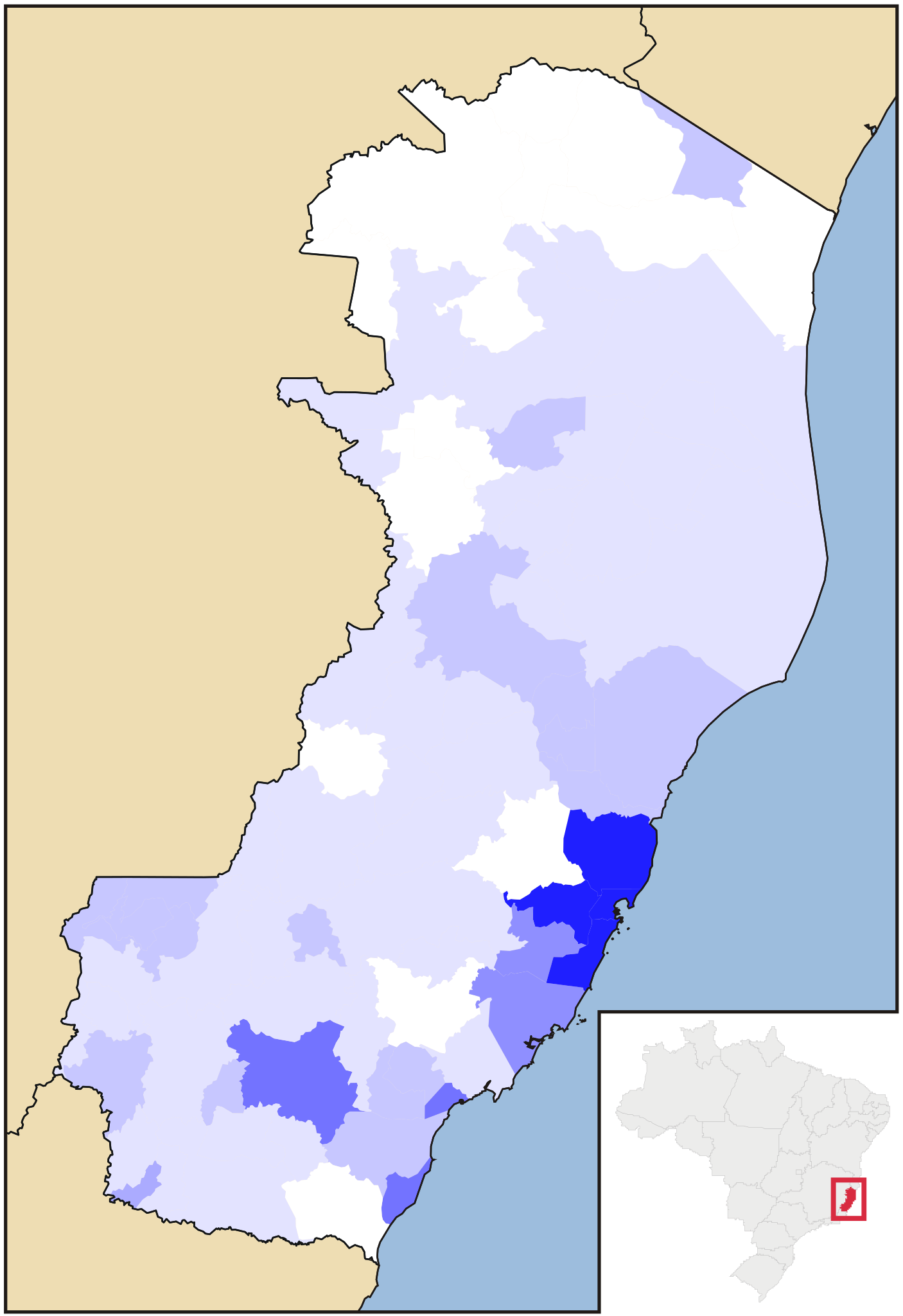
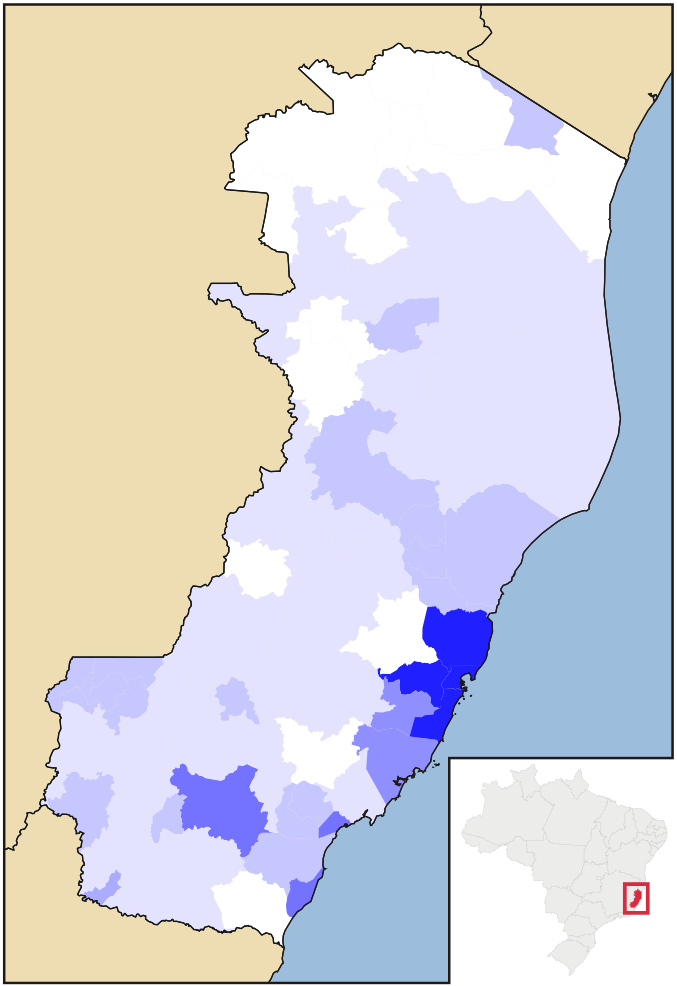
Português: Mapa da densidade populacional do estado do Espírito Santo (Brasil.
0-25 hab/km²
25-50 hab/km²
50-100 hab/km²
100-150 hab/km²
150-200 hab/km²
200-300 hab/km²
300-400 hab/km²
400-500 hab/km²
> 500 hab/km² |
| Date | |
| Source | File:EspiritoSanto MesoMicroMunicip.svg, Raphael Lorenzeto de Abreu. |
| Author |
by Marcos Elias de Oliveira Júnior talk! + (contact here) |
Licensing edit
This file is licensed under the Creative Commons Attribution-Share Alike 2.5 Generic license.
- You are free:
- to share – to copy, distribute and transmit the work
- to remix – to adapt the work
- Under the following conditions:
- attribution – You must give appropriate credit, provide a link to the license, and indicate if changes were made. You may do so in any reasonable manner, but not in any way that suggests the licensor endorses you or your use.
- share alike – If you remix, transform, or build upon the material, you must distribute your contributions under the same or compatible license as the original.
File history
Click on a date/time to view the file as it appeared at that time.
| Date/Time | Thumbnail | Dimensions | User | Comment | |
|---|---|---|---|---|---|
| current | 21:04, 19 August 2012 | | 677 × 986 (157 KB) | Marquinhos (talk | contribs) |
You cannot overwrite this file.
File usage on Commons
There are no pages that use this file.