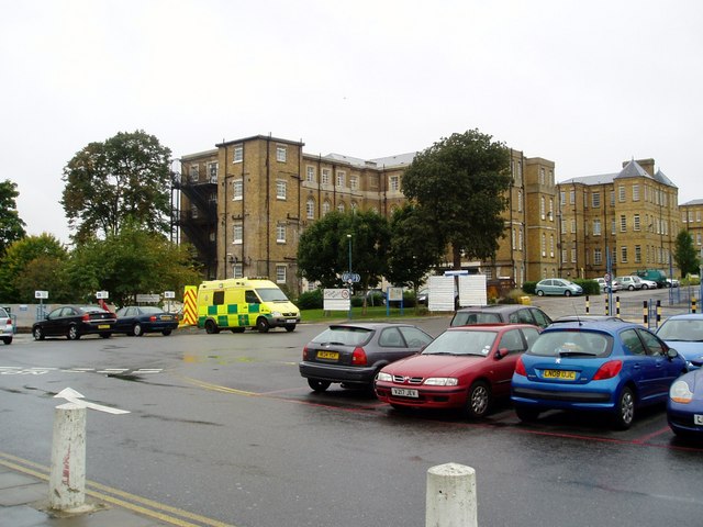
File:E Block, St. Bernard's Wing - Ealing hospital. - geograph.org.uk - 989635.jpg
E_Block,_St._Bernard's_Wing_-_Ealing_hospital._-_geograph.org.uk_-_989635.jpg (640 × 480 pixels, file size: 70 KB, MIME type: image/jpeg)
Captions
Captions
Summary edit
| DescriptionE Block, St. Bernard's Wing - Ealing hospital. - geograph.org.uk - 989635.jpg |
English: E Block, St. Bernard's Wing - Ealing hospital. St. Bernard's also known as Hanwell Insane Asylum, was built for the pauper insane and has evolved to become the West London Mental Health (NHS) Trust.
Work on the asylum at Hanwell started in 1829 on land most of which (44 acres) was purchased from the Earl of Jersey. The building contractor was William Cubitt. The architect was William Alderson, a Quaker. His neo-classical design consisted of central octagonal 'panopticon' tower of a basement and two floors. The windows have a tall aspect with semicircular bonded gauge brick arches at the top. In November of the same year building work started again on the first extension (there was more expansion again in 1837, 1857 and 1879). The newer extensions which were added in 1857-59 are readily identifiable, as they have flat bonded arches to the tops of the windows. Today the building also serves as the head offices of the West London Mental Health NHS Trust (WLMHT). Although the on-site facilities have been reduced and scaled down from what was once the world's largest asylum, it is still very much involved with the treatment and research into serious mental distress. The WLMHT currently act as guardians of the Corsellis Collection, containing some nine thousand specimens of brains dating back to the 1950s. |
| Date | |
| Source | From geograph.org.uk |
| Author | J Taylor |
| Attribution (required by the license) InfoField | J Taylor / E Block, St. Bernard's Wing - Ealing hospital. / |
InfoField | J Taylor / E Block, St. Bernard's Wing - Ealing hospital. |
| Camera location | 51° 30′ 26″ N, 0° 20′ 45″ W | View this and other nearby images on: OpenStreetMap |
|---|
| Object location | 51° 30′ 24″ N, 0° 20′ 53″ W | View this and other nearby images on: OpenStreetMap |
|---|
Licensing edit

|
This image was taken from the Geograph project collection. See this photograph's page on the Geograph website for the photographer's contact details. The copyright on this image is owned by J Taylor and is licensed for reuse under the Creative Commons Attribution-ShareAlike 2.0 license.
|
- You are free:
- to share – to copy, distribute and transmit the work
- to remix – to adapt the work
- Under the following conditions:
- attribution – You must give appropriate credit, provide a link to the license, and indicate if changes were made. You may do so in any reasonable manner, but not in any way that suggests the licensor endorses you or your use.
- share alike – If you remix, transform, or build upon the material, you must distribute your contributions under the same or compatible license as the original.
File history
Click on a date/time to view the file as it appeared at that time.
| Date/Time | Thumbnail | Dimensions | User | Comment | |
|---|---|---|---|---|---|
| current | 23:46, 22 February 2011 |  | 640 × 480 (70 KB) | GeographBot (talk | contribs) | == {{int:filedesc}} == {{Information |description={{en|1=E Block, St. Bernard's Wing - Ealing hospital. St. Bernard's also known as Hanwell Insane Asylum, was built for the pauper insane and has evolved to become the West London Mental Health (NHS) Trust. |
You cannot overwrite this file.
File usage on Commons
There are no pages that use this file.
File usage on other wikis
The following other wikis use this file:
- Usage on en.wikipedia.org
Metadata
This file contains additional information such as Exif metadata which may have been added by the digital camera, scanner, or software program used to create or digitize it. If the file has been modified from its original state, some details such as the timestamp may not fully reflect those of the original file. The timestamp is only as accurate as the clock in the camera, and it may be completely wrong.
| _error | 0 |
|---|
