File:Earth & Moon by Galileo.jpg
Size of this preview: 491 × 600 pixels. Other resolutions: 196 × 240 pixels | 393 × 480 pixels | 629 × 768 pixels | 838 × 1,024 pixels | 1,700 × 2,077 pixels.
Original file (1,700 × 2,077 pixels, file size: 743 KB, MIME type: image/jpeg)
Captions
Captions
Add a one-line explanation of what this file represents
Summary
edit
| Description |
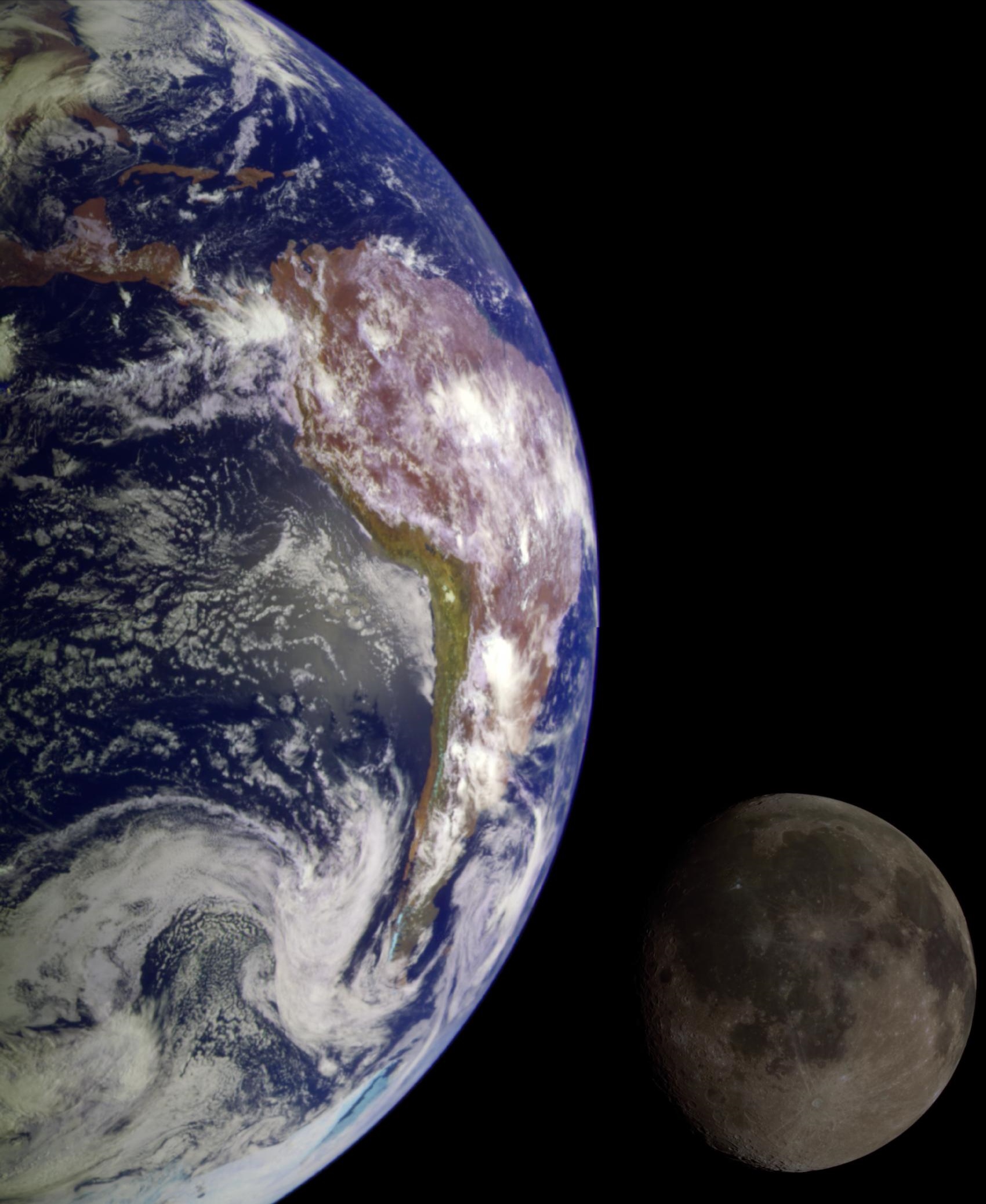
English: During its flight, the Galileo spacecraft returned images of the Earth and Moon. Separate images of the Earth and Moon were combined to generate this view. The Galileo spacecraft took the images in 1992 on its way to explore the Jupiter system in 1995-97. The image shows a partial view of the Earth centered on the Pacific Ocean about latitude 20 degrees south. The west coast of South America can be observed as well as the Caribbean; swirling white cloud patterns indicate storms in the southeast Pacific. The distinct bright ray crater at the bottom of the Moon is the Tycho impact basin. The lunar dark areas are lava rock filled impact basins. This picture contains same scale and relative color/albedo images of the Earth and Moon. False colors via use of the 1-micron filter as red, 727-nm filter as green, and violet filter as blue. The Galileo project is managed for NASA's Office of Space Science by the Jet Propulsion Laboratory. |
| Date | |
| Source | http://photojournal.jpl.nasa.gov/mission/Galileo |
| Author | NASA/JPL |
Licensing
edit
| This file is in the public domain in the United States because it was solely created by NASA. NASA copyright policy states that "NASA material is not protected by copyright unless noted". (See Template:PD-USGov, NASA copyright policy page or JPL Image Use Policy.) | ||
 |
Warnings:
|
File history
Click on a date/time to view the file as it appeared at that time.
| Date/Time | Thumbnail | Dimensions | User | Comment | |
|---|---|---|---|---|---|
| current | 07:49, 7 February 2015 | | 1,700 × 2,077 (743 KB) | Jcpag2012 (talk | contribs) | User created page with UploadWizard |
You cannot overwrite this file.
File usage on Commons
The following 5 pages use this file: