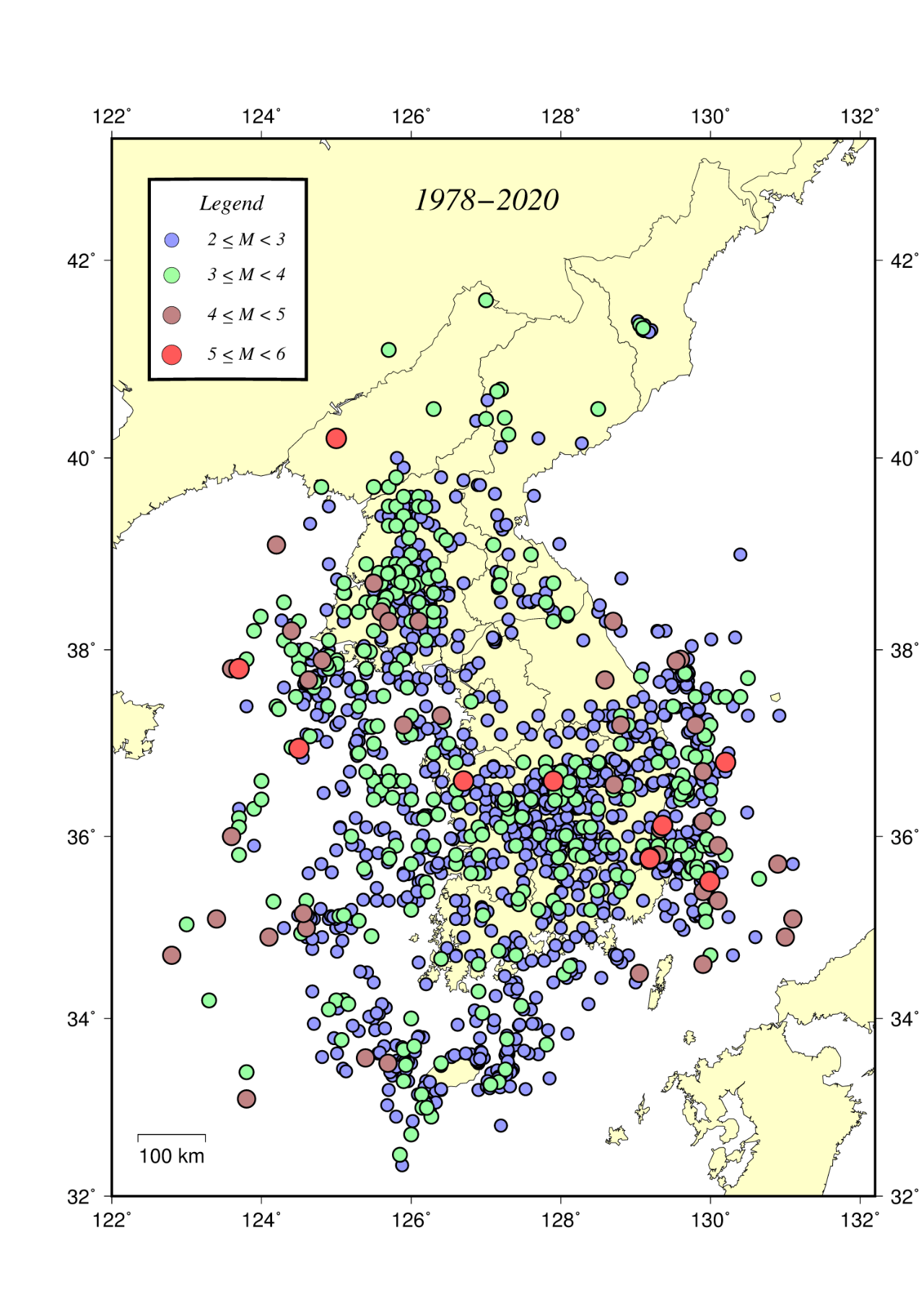
File:Earthquake map in Korea 1978-2020.png

Size of this preview: 424 × 600 pixels. Other resolutions: 169 × 240 pixels | 339 × 480 pixels | 543 × 768 pixels | 724 × 1,024 pixels | 1,280 × 1,811 pixels.
Original file (1,280 × 1,811 pixels, file size: 771 KB, MIME type: image/png)
Captions
Captions
Earthquake map in Korea 1978-2020
Summary edit
| Description |
English: Earthquake map in Korea 1978-2020 |
| Date | |
| Source |
Earthquake Status by Magnitude image |
| Author | Korea Meteorological Administration |
Licensing edit
This work is in the public domain because it is a work of Republic of Korea Government that is not eligible for copyright under Article 7 of the Copyright Act of South Korea. Works ineligible for copyright include the following:
|
 |
File history
Click on a date/time to view the file as it appeared at that time.
| Date/Time | Thumbnail | Dimensions | User | Comment | |
|---|---|---|---|---|---|
| current | 22:26, 4 November 2023 | | 1,280 × 1,811 (771 KB) | Phoenix7777 (talk | contribs) | Uploaded a work by Korea Meteorological Administration from [https://www.kma.go.kr/neng/earthquake/earthquake-trends.do Earthquake Status by Magnitude]<br>[https://www.kma.go.kr/neng/resources/image/eqkvol/img_tidalwave_map_21.png image] with UploadWizard |
You cannot overwrite this file.
File usage on Commons
The following page uses this file: