File:East of Hull - geograph.org.uk - 303535.jpg
Size of this preview: 435 × 600 pixels. Other resolutions: 174 × 240 pixels | 464 × 640 pixels.
Original file (464 × 640 pixels, file size: 118 KB, MIME type: image/jpeg)
Captions
Captions
Add a one-line explanation of what this file represents
Summary edit
| Description |
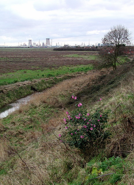
English: East of Hull, East Riding of Yorkshire, England. The Old Fleet on the parish boundary between East Hull and Preston, looking south-southeast towards the chemical works at Salt End from the embankment at Alderman Kneeshaw Park. Behind and to the right are the East Hull housing estates of Bilton Grange and Greatfield, while off to the left are the open fields of Neat Marsh, west of Preston village. |
| Date | |
| Source | From geograph.org.uk |
| Author | Paul Glazzard |
| Permission (Reusing this file) |
Creative Commons Attribution Share-alike license 2.0 |
| Attribution (required by the license) | Paul Glazzard / East of Hull / |
| Camera location | | View this and other nearby images on: OpenStreetMap |
|---|
_heading:180.00&language=en)
| Object location | | View this and other nearby images on: OpenStreetMap |
|---|
_heading:180.00&language=en)
Licensing edit

|
This image was taken from the Geograph project collection. See this photograph's page on the Geograph website for the photographer's contact details. The copyright on this image is owned by Paul Glazzard and is licensed for reuse under the Creative Commons Attribution-ShareAlike 2.0 license.
|
This file is licensed under the Creative Commons Attribution-Share Alike 2.0 Generic license.
Attribution: Paul Glazzard
- You are free:
- to share – to copy, distribute and transmit the work
- to remix – to adapt the work
- Under the following conditions:
- attribution – You must give appropriate credit, provide a link to the license, and indicate if changes were made. You may do so in any reasonable manner, but not in any way that suggests the licensor endorses you or your use.
- share alike – If you remix, transform, or build upon the material, you must distribute your contributions under the same or compatible license as the original.
File history
Click on a date/time to view the file as it appeared at that time.
| Date/Time | Thumbnail | Dimensions | User | Comment | |
|---|---|---|---|---|---|
| current | 21:43, 22 December 2010 | | 464 × 640 (118 KB) | GeographBot (talk | contribs) | == {{int:filedesc}} == {{Information |description={{en|1=East of Hull The Old Fleet on the parish boundary between East Hull and Preston, looking south-southeast towards the chemical works at Salt End from the embankment at Alderman Kneeshaw Park. Behind |
You cannot overwrite this file.
File usage on Commons
There are no pages that use this file.