File:Easton Point map.JPG
No higher resolution available.
Easton_Point_map.JPG (287 × 287 pixels, file size: 34 KB, MIME type: image/jpeg)
Captions
Captions
Add a one-line explanation of what this file represents
Summary edit
| Author |
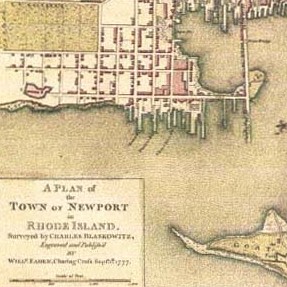
Charles Blaskowitz |
| Description |
English: Map by Charles Blaskowitz. A Plan of the Town of Newport in Rhode Island. London: Faden, 1777. Hand-colored engraving. [1] |
| Date | 1777 |
| Source/Photographer | https://www.loc.gov/rr/hispanic/portam/newport.html |
![[1]](http://images.google.com/imgres?imgurl=https://www.loc.gov/rr/hispanic/portam/img/touro1.jpg&imgrefurl=https://www.loc.gov/rr/hispanic/portam/newport.html&h=534&w=588&sz=80&hl=en&start=1&tbnid=9ufLrZyaldY1BM:&tbnh=123&tbnw=135&prev=/images%3Fq%3Dnewport%2Brhode%2Bisland%2Bmap%2Bcolonial%26hl%3Den%26lr%3D)
Licensing edit
|
This work is in the public domain in its country of origin and other countries and areas where the copyright term is the author's life plus 100 years or fewer. | |
| This file has been identified as being free of known restrictions under copyright law, including all related and neighboring rights. | |
Original upload log edit
The original description page was here. All following user names refer to en.wikipedia.
- 2008-04-25 05:16 Swampyank 287×287× (34504 bytes) map by Charles Blaskowitz. A Plan of the Town of Newport in Rhode Island. London: Faden, 1777. Hand-colored engraving. [http://images.google.com/imgres?imgurl=http://www.loc.gov/rr/hispanic/portam/img/touro1.jpg&imgrefurl=http://www.loc.gov/rr/hispanic/po
File history
Click on a date/time to view the file as it appeared at that time.
| Date/Time | Thumbnail | Dimensions | User | Comment | |
|---|---|---|---|---|---|
| current | 15:33, 5 February 2009 | | 287 × 287 (34 KB) | File Upload Bot (Magnus Manske) (talk | contribs) | {{BotMoveToCommons|en.wikipedia}} {{Information |Description={{en|map by Charles Blaskowitz. A Plan of the Town of Newport in Rhode Island. London: Faden, 1777. Hand-colored engraving. [http://images.google.com/imgres?imgurl=http://www.loc.gov/rr/hispani |
You cannot overwrite this file.
File usage on Commons
The following page uses this file:
File usage on other wikis
The following other wikis use this file:
- Usage on de.wikipedia.org
- Usage on en.wikipedia.org