File:Ebon Atoll Map.jpg

Size of this preview: 800 × 583 pixels. Other resolutions: 320 × 233 pixels | 640 × 467 pixels | 1,024 × 747 pixels | 1,240 × 904 pixels.
Original file (1,240 × 904 pixels, file size: 179 KB, MIME type: image/jpeg)
Captions
Captions
Add a one-line explanation of what this file represents

|
This map image could be re-created using vector graphics as an SVG file. This has several advantages; see Commons:Media for cleanup for more information. If an SVG form of this image is available, please upload it and afterwards replace this template with
{{vector version available|new image name}}.
It is recommended to name the SVG file “Ebon Atoll Map.svg”—then the template Vector version available (or Vva) does not need the new image name parameter. |

Summary
edit
| Description |
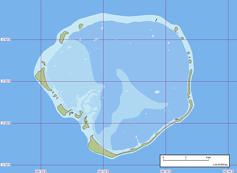
English: Map of Ebon Atoll, Marshall Islands |
| Date | |
| Source | Flickr |
| Author | EVS-Islands |
| Camera location | | View this and other nearby images on: OpenStreetMap |
|---|
Licensing
edit
This file is licensed under the Creative Commons Attribution 2.0 Generic license.
- You are free:
- to share – to copy, distribute and transmit the work
- to remix – to adapt the work
- Under the following conditions:
- attribution – You must give appropriate credit, provide a link to the license, and indicate if changes were made. You may do so in any reasonable manner, but not in any way that suggests the licensor endorses you or your use.
| This image was originally posted to Flickr by EVS-Islands at https://www.flickr.com/photos/60042877@N00/838804144. It was reviewed on 14 July 2009 by FlickreviewR and was confirmed to be licensed under the terms of the cc-by-2.0. |
File history
Click on a date/time to view the file as it appeared at that time.
| Date/Time | Thumbnail | Dimensions | User | Comment | |
|---|---|---|---|---|---|
| current | 10:48, 14 July 2009 | | 1,240 × 904 (179 KB) | Telim tor (talk | contribs) | == {{int:filedesc}} == {{Information |Description={{en|Map of Ebon Atoll, Marshall Islands}} |Source=[http://www.flickr.com/photos/evsmap/838804144/in/set-72157600867265751/ Flickr] |Date=2007-07-17 |Author=[http://www.flickr.com/photos/evsmap/ EVS-Island |
You cannot overwrite this file.
File usage on Commons
The following page uses this file:
File usage on other wikis
The following other wikis use this file:
- Usage on de.wikipedia.org
- Usage on hu.wikipedia.org
- Usage on lt.wikipedia.org
- Usage on pl.wikipedia.org
- Usage on uk.wikipedia.org
- Usage on www.wikidata.org