File:EdaMap11.jpg
Original file (4,692 × 2,620 pixels, file size: 549 KB, MIME type: image/jpeg)
Captions
Captions
Summary
edit
| Description |
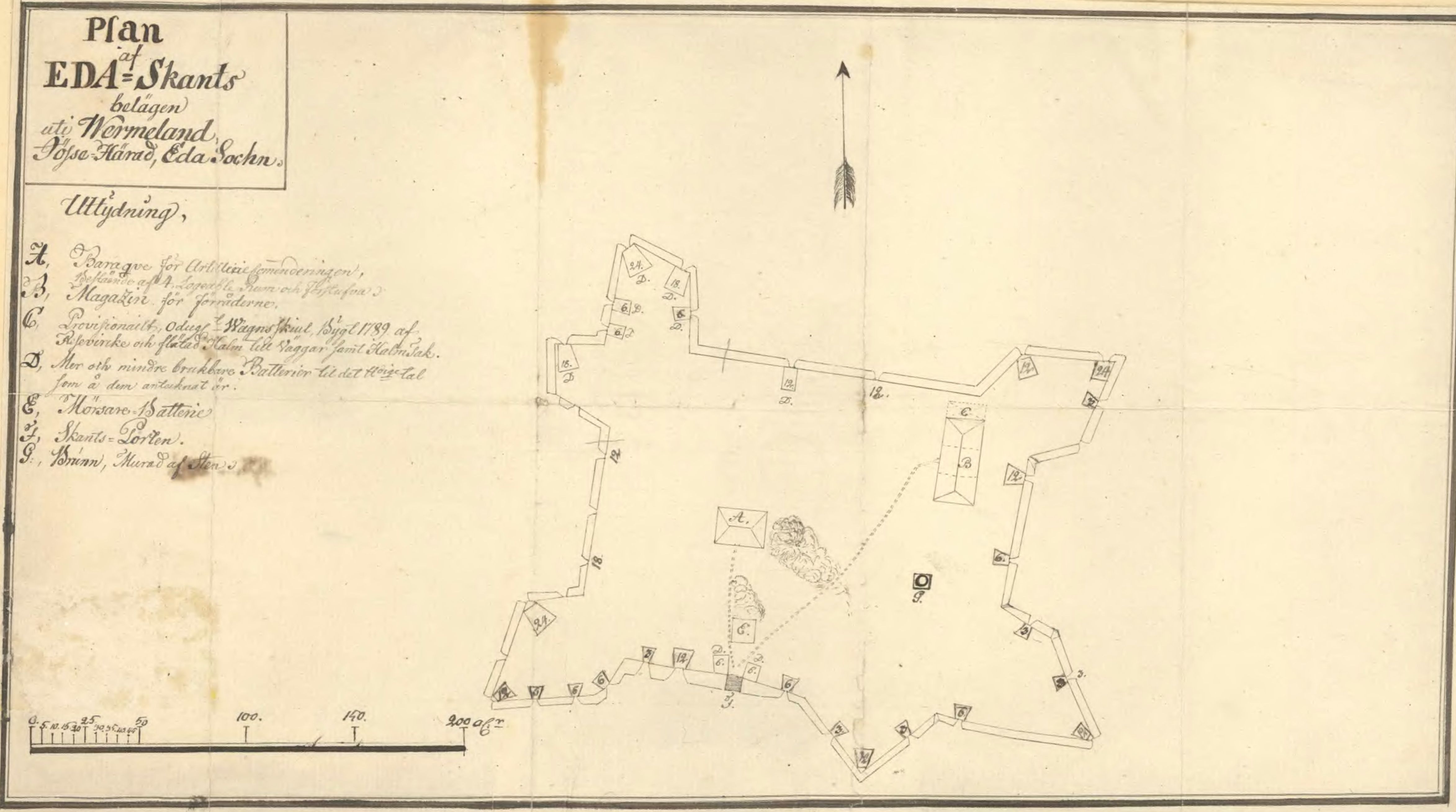
English: Map showing buildings, and placement of artillery at Eda sconce, Värmland in Sweden, in the early 19th century.
Svenska: Karta över byggnader och placering av artilleri, med pundigtal, på Eda skans under tidigt 1800-tal. |
| Date | early 19th century |
| Source | Krigsarkivet: Sverige, stads- och fästningsplaner, Eda skans, 0424:024:026 |
| Author | Unknown author |
Licensing
edit
|
This work is in the public domain in its country of origin and other countries and areas where the copyright term is the author's life plus 70 years or fewer.
| |
| This file has been identified as being free of known restrictions under copyright law, including all related and neighboring rights. | |
File history
Click on a date/time to view the file as it appeared at that time.
| Date/Time | Thumbnail | Dimensions | User | Comment | |
|---|---|---|---|---|---|
| current | 19:26, 27 May 2014 | | 4,692 × 2,620 (549 KB) | Dagjoh (talk | contribs) | {{Information |Description ={{en|1=Map showing buildings, and placement of artillery at Eda sconce, Värmland in Sweden, in the early 19th century.}} {{sv|1=Karta över byggnader och placering av artilleri, med pundigtal, på Eda skans under tidigt... |
You cannot overwrite this file.
File usage on Commons
There are no pages that use this file.
File usage on other wikis
The following other wikis use this file:
- Usage on sv.wikipedia.org