File:Edinburgh outline map.png
Edinburgh_outline_map.png (556 × 500 pixels, file size: 137 KB, MIME type: image/png)
Captions
Captions
Summary edit
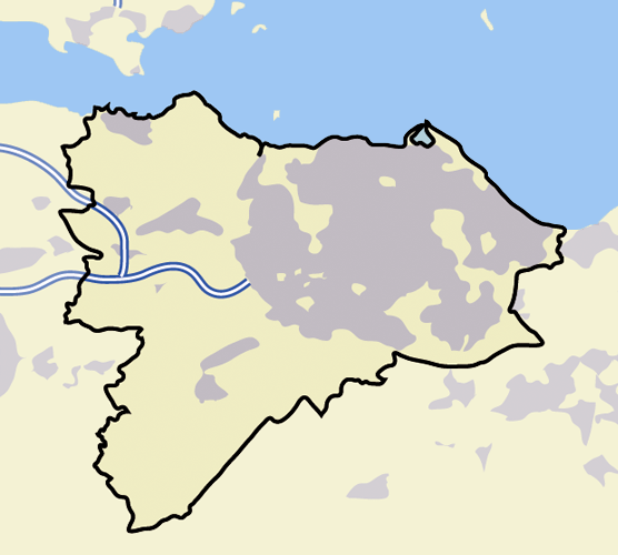
| Description | A blank map of Edinburgh, with roads, built-up areas and coastline; contact the author for help with modifications or add-ons |
| Date |
22 June 2006 (original upload date) |
| Source |
Transferred from en.wikipedia to Commons. |
| Author | (Original text: en:User:ChrisO) |
Licensing edit
|
NOTE: "subject to disclaimers" below may not actually apply, this was tagged with {{GFDL-user-en}}, and after May 2007, en:Template:GFDL-self did not require disclaimers. Please check the image description page on the English Wikipedia (or, if it has been deleted, ask an English Wikipedia administrator). See Wikipedia:GFDL standardization for details. | ||
ChrisO at the English-language Wikipedia, the copyright holder of this work, hereby publishes it under the following license:
| ||
|
Note: This tag should not be used. For images that were released on the English Wikipedia using either GFDL or GFDL-self with disclaimers, use {{GFDL-user-en-with-disclaimers}}. For images without disclaimers please use {{GFDL-user-en-no-disclaimers}} instead. If you are the copyright holder of files that were released on Wikipedia, please consider removing the disclaimers. |

| This file is licensed under the Creative Commons Attribution-Share Alike 3.0 Unported license. Subject to disclaimers. | ||
| Attribution: ChrisO at the English-language Wikipedia | ||
| ||
| This licensing tag was added to this file as part of the GFDL licensing update. |

|
Permission is granted to copy, distribute and/or modify this document under the terms of the GNU Free Documentation License, Version 1.2 or any later version published by the Free Software Foundation; with no Invariant Sections, no Front-Cover Texts, and no Back-Cover Texts. A copy of the license is included in the section entitled GNU Free Documentation License. Subject to disclaimers. |
Original upload log edit
- 2006-06-22 23:50 ChrisO 600×500×8 (7602 bytes) == Summary == {{Information| |Description=A blank map of Edinburgh, with roads, built-up areas and coastline; contact the author for help with modifications or add-ons |Source=Reference map provided by Demis Mapper 6 |Date=2006-23-06 |Author=[[User:ChrisO
- 2006-06-22 23:43 ChrisO 600×500×8 (8004 bytes) == Summary == {{Information| |Description=A blank map of Edinburgh, with roads, built-up areas and coastline; contact the author for help with modifications or add-ons |Source=Reference map provided by Demis Mapper 6 |Date=2006-23-06 |Author=[[User:ChrisO
File history
Click on a date/time to view the file as it appeared at that time.
| Date/Time | Thumbnail | Dimensions | User | Comment | |
|---|---|---|---|---|---|
| current | 13:24, 17 November 2007 | | 556 × 500 (137 KB) | Jza84 (talk | contribs) | standardising pantones to match those of the English language Wikipedia's other UK infobox maps. |
| 18:15, 7 August 2007 |  | 600 × 500 (7 KB) | Angusmclellan (talk | contribs) | {{Information |Description=''no original description'' |Source=Originally from [http://en.wikipedia.org en.wikipedia]; description page is/was [http://en.wikipedia.org/w/index.php?title=Image%3AEdinburgh_outline_map.png here].<br/> (Original text : ''Refe |
You cannot overwrite this file.
File usage on Commons
There are no pages that use this file.
File usage on other wikis
The following other wikis use this file:
- Usage on en.wikipedia.org
- Usage on ml.wikipedia.org