File:Edwards-Trinity aquifer system v1.svg

Size of this PNG preview of this SVG file: 745 × 600 pixels. Other resolutions: 298 × 240 pixels | 596 × 480 pixels | 954 × 768 pixels | 1,272 × 1,024 pixels | 2,544 × 2,048 pixels | 821 × 661 pixels.
Original file (SVG file, nominally 821 × 661 pixels, file size: 636 KB)
Captions
Captions
Add a one-line explanation of what this file represents
Summary
edit
| Description |
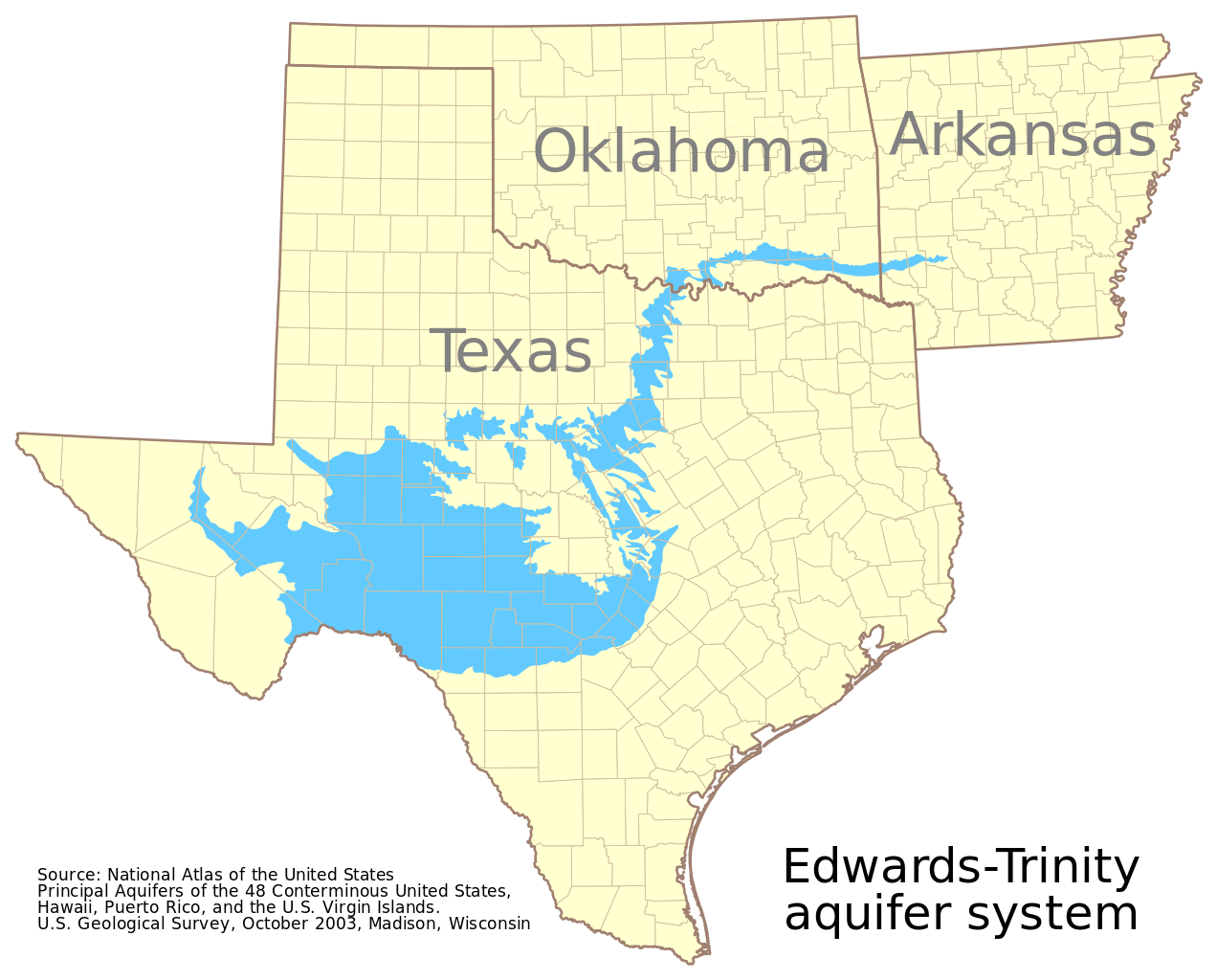
English: This map shows the extent of the Edwards-Trinity aquifer system. It is based on GIS data from the National Atlas of the United States at http://dds.cr.usgs.gov/pub/data/nationalatlas/aquifrp025.tar.gz. The metadata provides, in part:
 Citation:
   Citation_Information:
     Originator: U.S. Geological Survey
     Publication_Date: 200310
     Title:
       Principal Aquifers of the 48 Conterminous United States, Hawaii, Puerto
       Rico, and the U.S. Virgin Islands
     Edition: Version 1.0
     Publication_Information:
       Publication_Place: Madison, WI, USA
       Publisher: U.S. Geological Survey
     Online_Linkage: <http://nationalatlas.gov/atlasftp.html>
 Description:
   Abstract:
     This map layer contains the shallowest principal aquifers of the
     conterminous United States, Hawaii, Puerto Rico, and the U.S. Virgin
     Islands, portrayed as polygons.  The map layer was developed as part of
     the effort to produce the maps published at 1:2,500,000 in the printed
     series "Ground Water Atlas of the United States".  The published maps
     contain base and cultural features not included in these data.  This is a
     replacement for the July 1998 map layer called Principal Aquifers of the
     48 Conterminous United States.
   Purpose:
     These data are intended for use in publications, at a scale of 1:2,500,000
     or smaller.  Due to the small scale, the primary intended use is for
     regional and national data display and analysis, rather than specific
     local data analysis.
See the source data for the complete metadata. This map uses the polyconic projection centered on the west 100th meridian: "+proj=poly +lon_0=100W" |
| Date | |
| Source | Own work |
| Author | Kbh3rd |
Licensing
edit
I, the copyright holder of this work, hereby publish it under the following license:
This file is licensed under the Creative Commons Attribution-Share Alike 3.0 Unported license.
- You are free:
- to share – to copy, distribute and transmit the work
- to remix – to adapt the work
- Under the following conditions:
- attribution – You must give appropriate credit, provide a link to the license, and indicate if changes were made. You may do so in any reasonable manner, but not in any way that suggests the licensor endorses you or your use.
- share alike – If you remix, transform, or build upon the material, you must distribute your contributions under the same or compatible license as the original.
File history
Click on a date/time to view the file as it appeared at that time.
| Date/Time | Thumbnail | Dimensions | User | Comment | |
|---|---|---|---|---|---|
| current | 22:27, 19 October 2012 | | 821 × 661 (636 KB) | Ciaurlec (talk | contribs) | Changed colours |
| 07:03, 27 November 2009 |  | 821 × 661 (522 KB) | Kbh3rd (talk | contribs) | {{Information |Description={{en|1=This map shows the extent of the Edwards-Trinity aquifer system. It is based on GIS data from the National Atlas of the United States at http://dds.cr.usgs.gov/pub/data/nationalatlas/aquifrp025.ta |
You cannot overwrite this file.
File usage on Commons
There are no pages that use this file.
File usage on other wikis
The following other wikis use this file:
- Usage on ar.wikipedia.org
- Usage on en.wikipedia.org
- Usage on www.wikidata.org