File:Egypt Al Wadi al Jadid locator map.svg

Size of this PNG preview of this SVG file: 662 × 600 pixels. Other resolutions: 265 × 240 pixels | 530 × 480 pixels | 848 × 768 pixels | 1,130 × 1,024 pixels | 2,260 × 2,048 pixels | 1,055 × 956 pixels.
Original file (SVG file, nominally 1,055 × 956 pixels, file size: 351 KB)
Captions
Captions
Add a one-line explanation of what this file represents
Summary
edit
| Description |
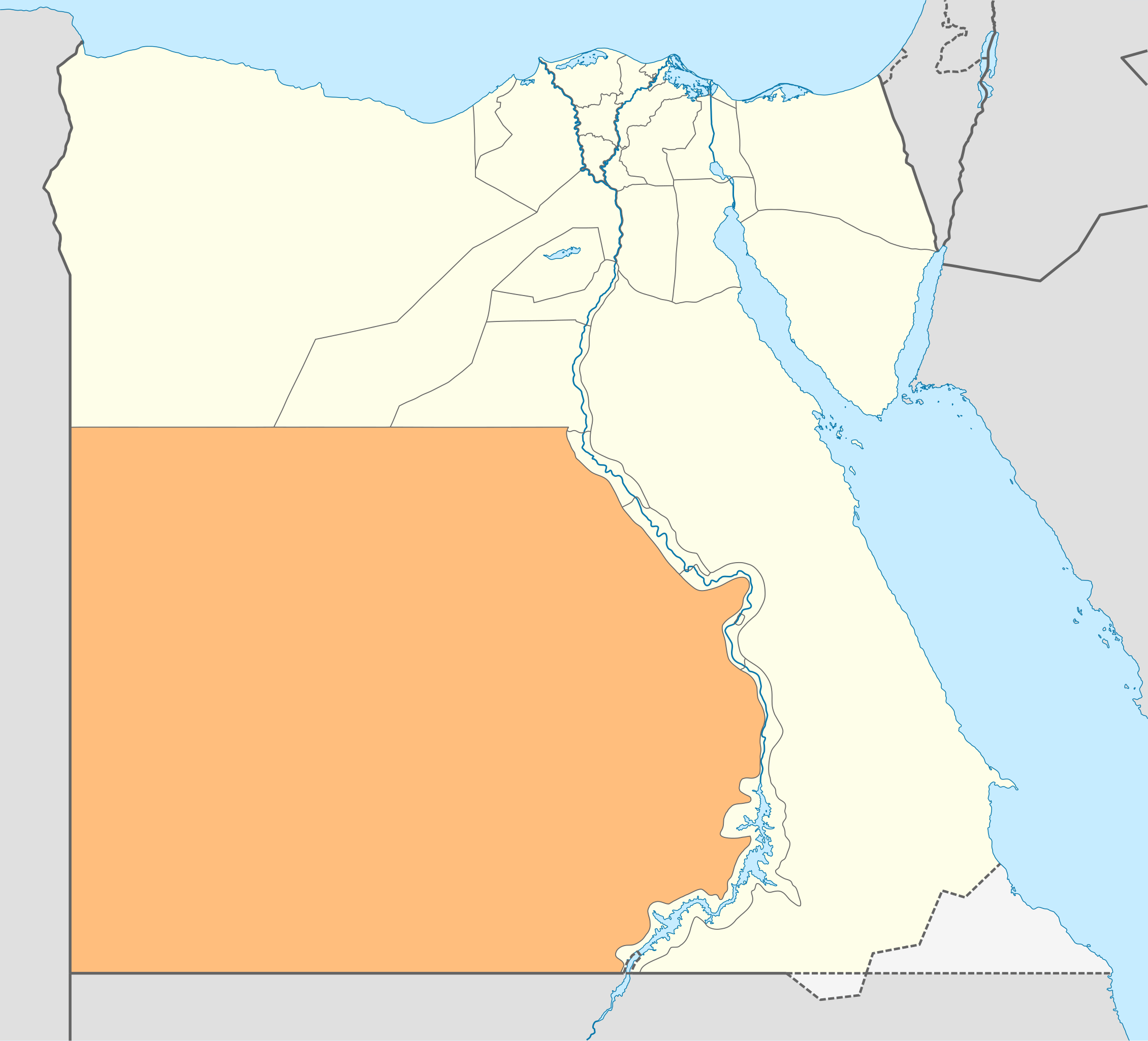
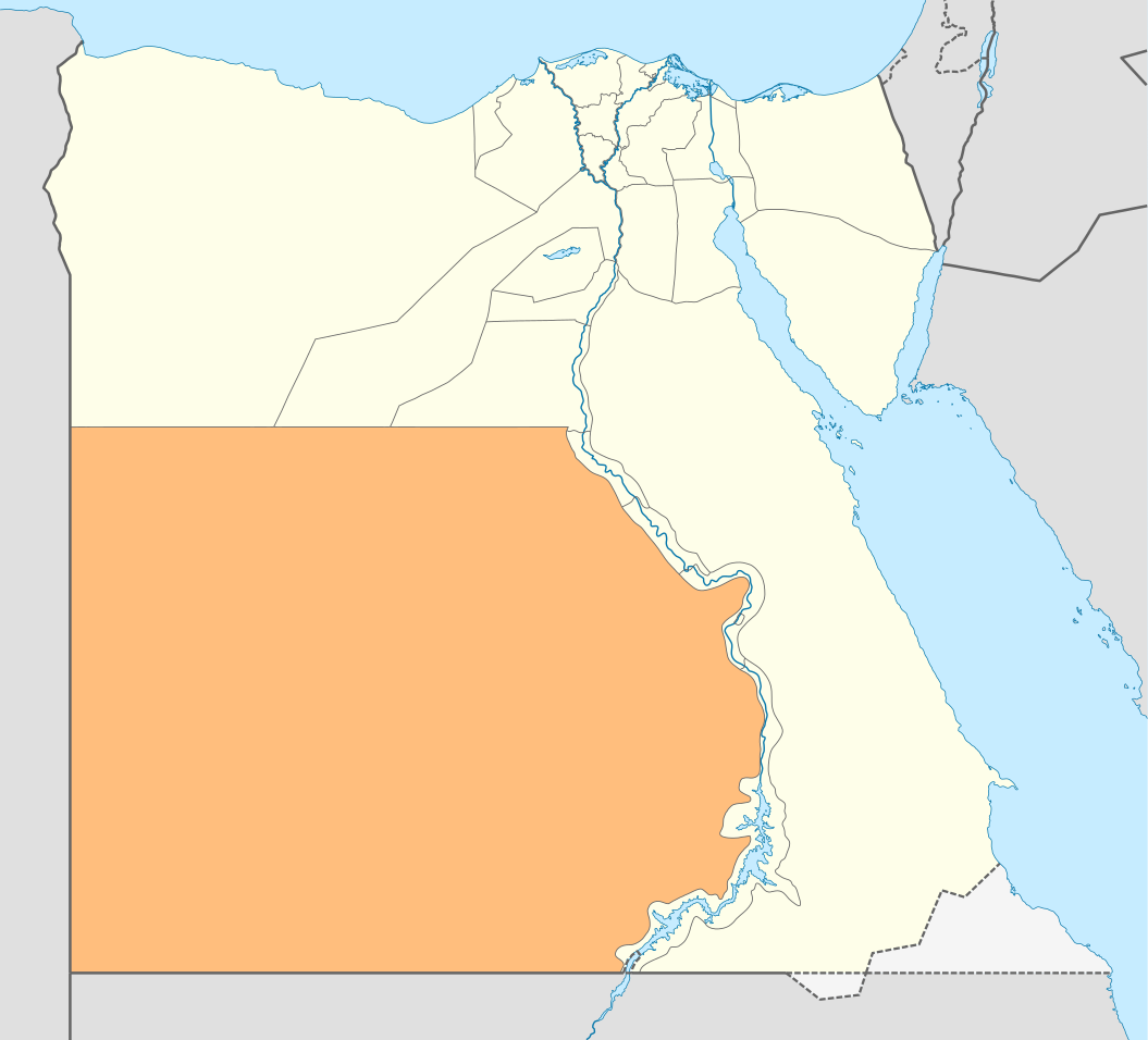
Deutsch: Lagekarte des Gouvernements New Valley—Al-Wadi al-dschadid in Ägypten
English: Locator Map of the New Valley Governorate of Egypt — the former Al Wadi al Jadid Governorate’’. |
| Date | |
| Source | Own work |
| Author | NordNordWest |
| Permission (Reusing this file) |
I, the copyright holder of this work, hereby publish it under the following license: This file is licensed under the Creative Commons Attribution-Share Alike 3.0 Unported license.
|

|
This map has been made or improved in the German Kartenwerkstatt (Map Lab). You can propose maps to improve as well.
|
File history
Click on a date/time to view the file as it appeared at that time.
| Date/Time | Thumbnail | Dimensions | User | Comment | |
|---|---|---|---|---|---|
| current | 16:21, 17 April 2011 | | 1,055 × 956 (351 KB) | NordNordWest (talk | contribs) | upd |
| 11:55, 3 September 2009 |  | 1,055 × 956 (560 KB) | NordNordWest (talk | contribs) | {{int:filedesc}} {{Information |Description= {{de|Lagekarte des Gouvernements Al-Wadi al-dschadid in Ägypten}} {{en|Locator map of the Al Wadi al Jadid Governorate in Egypt}} |Source={{Own}} |Date=2009-09-03 |Author={{U|NordNordWest}} |Permission={{self |
You cannot overwrite this file.
File usage on Commons
There are no pages that use this file.
File usage on other wikis
The following other wikis use this file:
- Usage on bg.wikipedia.org
- Usage on de.wikipedia.org
- Usage on de.wikivoyage.org
- Bārīs
- ʿAin Muṣṭafā Kāschif
- ʿAin Schams ed-Dīn
- ʿAin Umm ed-Dabādīb
- Chārga
- Chārga (Stadt)
- Farāfra
- Farāfra (Stadt)
- Gabbānat el-Bagawāt
- Gāra (Neues Tal)
- Gebel eṭ-Ṭeir (el-Chārga)
- Qaṣr el-Ghuweiṭa
- Hībis
- Ismant
- Kristallberg (Libysche Wüste)
- Deir el-Munīra
- Nāḍūra
- Qaṣr Dūsch
- Qaṣr el-Labacha
- Qaṣr ez-Zaiyān
- Hassan Fathy Village (el-Chārga)
- ʿAin Manāwir
- Maks el-Qiblī
- Qilāʿ eḍ-Ḍabba
- Nationalpark Weiße Wüste
- ʿAin el-Wādī
- ʿAin Scheich Marzūq
- Abū Minqār
- ʿAin Bisāi
- ʿAin Gallaw
- Biʾr Dikkār
- ʿAin ed-Dālla
- Wādī el-Ubeiyiḍ
- Deir Abū Mattā
- Baschandī
- Qārat el-Muzawwaqa
- Qaṣr ed-Dāchla
- Deir el-Ḥagar
- Budchulū
- Dāchla
- Ḥalfat el-Biʾr
- Ismant el-Charāb
- Tineida
- ʿAin Aṣīl
- Balāṭ
- ʿAin Birbīya
- Qaṣaba
- Qalamūn (ed-Dāchla)
View more global usage of this file.