File:Electrified main lines in CZ de.svg

Size of this PNG preview of this SVG file: 800 × 446 pixels. Other resolutions: 320 × 178 pixels | 640 × 357 pixels | 1,024 × 571 pixels | 1,280 × 713 pixels | 2,560 × 1,427 pixels | 1,141 × 636 pixels.
Original file (SVG file, nominally 1,141 × 636 pixels, file size: 796 KB)
Captions
Captions
Add a one-line explanation of what this file represents
Summary
edit
| Description |
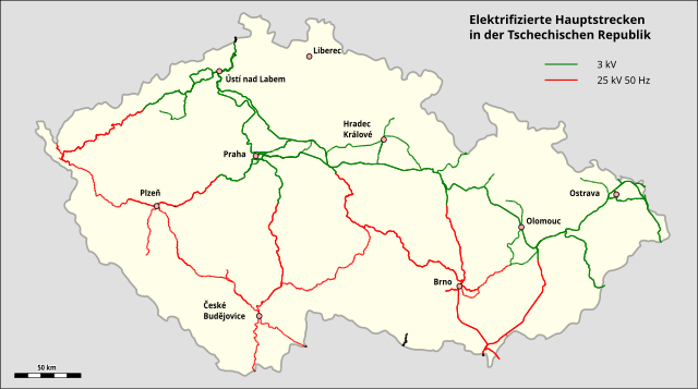
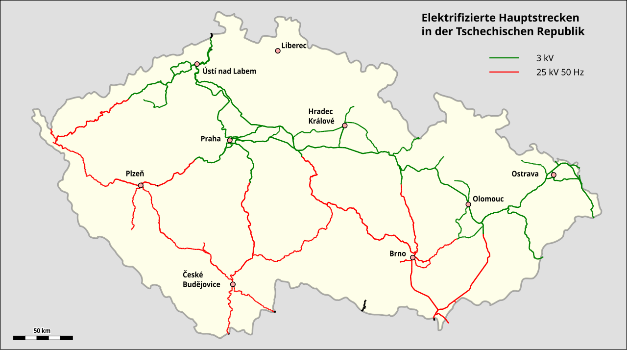
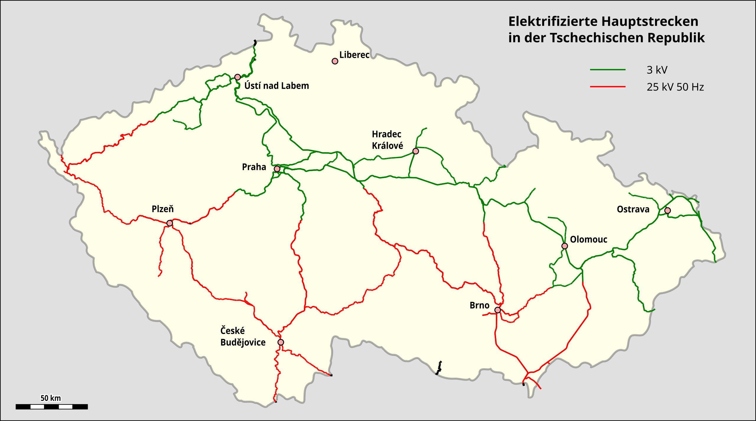
Deutsch: Karte der elektrifizierten Hauptstrecken in Tschechien |
| Date | |
| Source | Map created by using Open Street Map Data |
| Author |
|
| Other versions | English title |
Licensing
edit
| This work is licensed under the Open Database License (summary). |
File history
Click on a date/time to view the file as it appeared at that time.
| Date/Time | Thumbnail | Dimensions | User | Comment | |
|---|---|---|---|---|---|
| current | 19:30, 20 January 2023 | | 1,141 × 636 (796 KB) | Pechristener (talk | contribs) | farbige Punkte |
| 18:01, 19 January 2023 |  | 1,141 × 636 (796 KB) | Pechristener (talk | contribs) | {{Information |description={{de|1=Karte der elektrifizierten Hauptstrecken in Tschechien}} |date=2023-01-19 |source=Map created by using [http://www.openstreetmap.org/ Open Street Map Data] |permission= |other versions= }} =={{int:license-header}}== {{ODbL}} Category:Map of Czech railways.svg |
You cannot overwrite this file.
File usage on Commons
There are no pages that use this file.
File usage on other wikis
The following other wikis use this file:
- Usage on de.wikipedia.org