File:Elfstedentocht routekaart OSM.png

Size of this preview: 478 × 600 pixels. Other resolutions: 191 × 240 pixels | 383 × 480 pixels | 612 × 768 pixels | 816 × 1,024 pixels | 1,633 × 2,048 pixels | 3,814 × 4,784 pixels.
Original file (3,814 × 4,784 pixels, file size: 14.18 MB, MIME type: image/png)
Captions
Captions
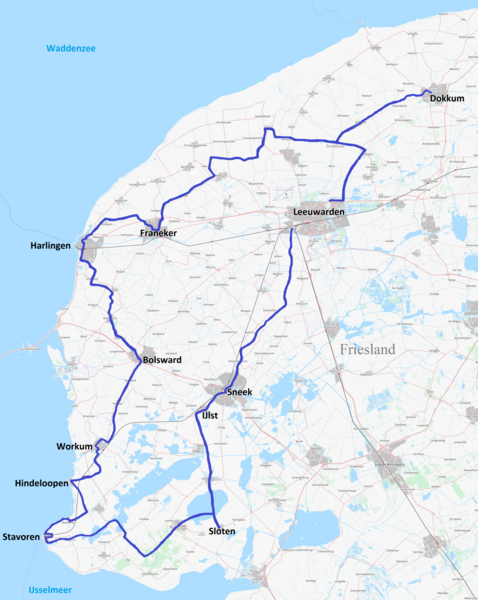
Map Elfstedentocht Friesland
Summary
edit
| Description |
Nederlands: Elfstedentocht, routekaart van de schaatstocht in Friesland. |
| Date | |
| Source | Own work |
| Author | Condor3d. Kaart op basis van OpenStreetMap. |
Licensing
edit
I, the copyright holder of this work, hereby publish it under the following license:
This file is licensed under the Creative Commons Attribution 4.0 International license.
- You are free:
- to share – to copy, distribute and transmit the work
- to remix – to adapt the work
- Under the following conditions:
- attribution – You must give appropriate credit, provide a link to the license, and indicate if changes were made. You may do so in any reasonable manner, but not in any way that suggests the licensor endorses you or your use.
File history
Click on a date/time to view the file as it appeared at that time.
| Date/Time | Thumbnail | Dimensions | User | Comment | |
|---|---|---|---|---|---|
| current | 17:29, 18 November 2021 | | 3,814 × 4,784 (14.18 MB) | Condor3d (talk | contribs) | Uploaded own work with UploadWizard |
You cannot overwrite this file.
File usage on Commons
The following 7 pages use this file:
File usage on other wikis
The following other wikis use this file:
- Usage on ca.wikipedia.org
- Usage on en.wikipedia.org
- Usage on fr.wikipedia.org
- Usage on he.wikipedia.org
- Usage on nl.wikipedia.org
- Elfstedentocht
- Veertiende Elfstedentocht
- Vijftiende Elfstedentocht
- Dertiende Elfstedentocht
- Twaalfde Elfstedentocht
- Elfde Elfstedentocht
- Tiende Elfstedentocht
- Negende Elfstedentocht
- Achtste Elfstedentocht
- Zevende Elfstedentocht
- Zesde Elfstedentocht
- Vijfde Elfstedentocht
- Vierde Elfstedentocht
- Derde Elfstedentocht
- Tweede Elfstedentocht
- Eerste Elfstedentocht
- Usage on www.wikidata.org