File:Ellergraben-2.jpg
Size of this preview: 800 × 363 pixels. Other resolutions: 320 × 145 pixels | 640 × 290 pixels | 1,024 × 464 pixels | 1,829 × 829 pixels.
Original file (1,829 × 829 pixels, file size: 366 KB, MIME type: image/jpeg)
Captions
Captions
Add a one-line explanation of what this file represents
Summary
edit
| Description |
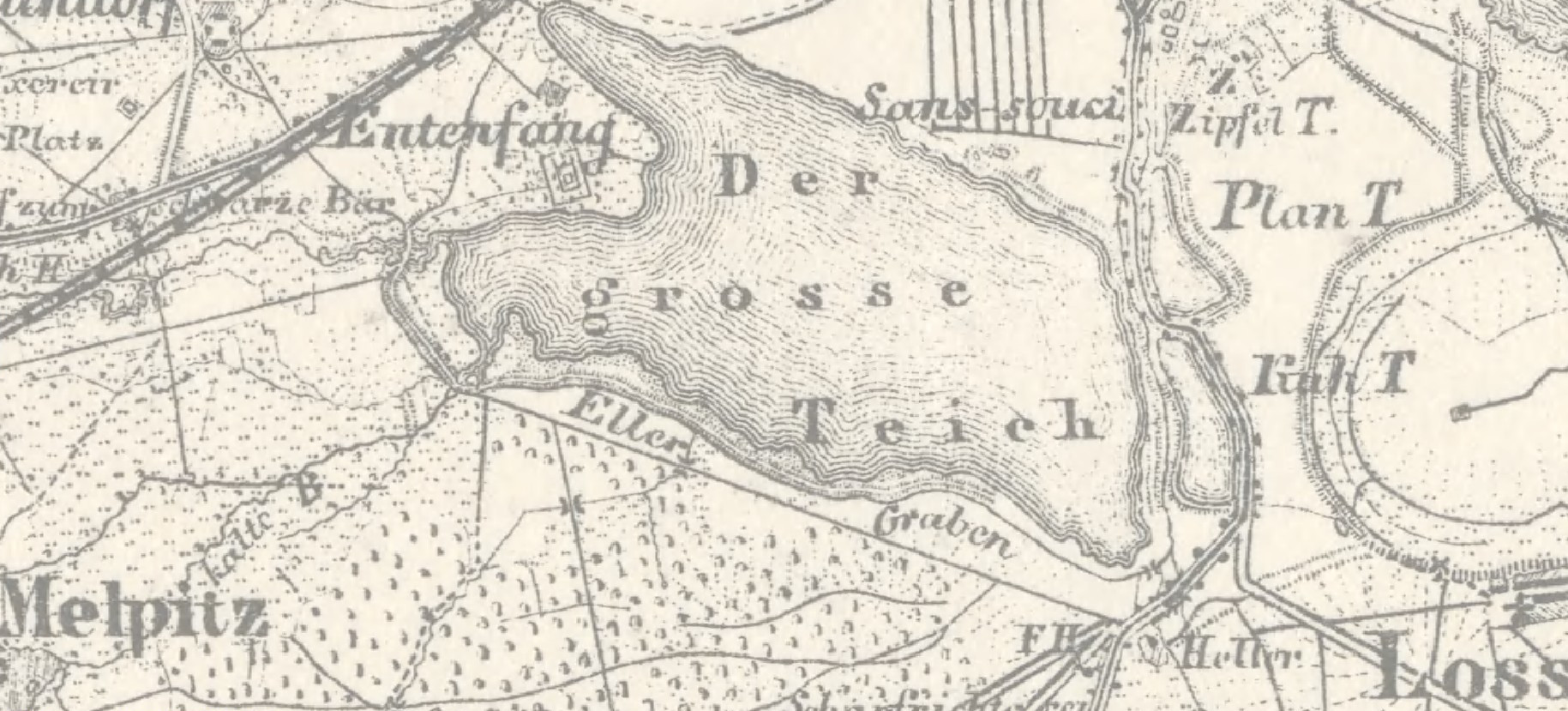
Deutsch: Ellergraben (Südumfluter des Schwarzen Grabens) im Ratsforst Torgau |
| Date | |
| Source | https://www.davidrumsey.com/blog/2011/4/10/karte-des-deutschen-reiches-1893 |
| Author | Reichsamt fur Landesaufnahme |
| Camera location | | View this and other nearby images on: OpenStreetMap |
|---|
Licensing
edit
The copyright situation of this work is theoretically uncertain, because in the country of origin copyright lasts 70 years after the death of the author, and the date of the author's death is unknown. However, the date of creation of the work was over 120 years ago, and it is thus a reasonable assumption that the copyright has expired (see here for the community discussion). Do not use this template if the date of death of the author is known.
This work is in the public domain in the United States because it was published (or registered with the U.S. Copyright Office) before January 1, 1929. | |
| This file has been identified as being free of known restrictions under copyright law, including all related and neighboring rights. | |
File history
Click on a date/time to view the file as it appeared at that time.
| Date/Time | Thumbnail | Dimensions | User | Comment | |
|---|---|---|---|---|---|
| current | 17:19, 28 December 2021 | | 1,829 × 829 (366 KB) | Lutzto (talk | contribs) | Uploaded a work by Reichsamt fur Landesaufnahme from https://www.davidrumsey.com/blog/2011/4/10/karte-des-deutschen-reiches-1893 with UploadWizard |
You cannot overwrite this file.
File usage on Commons
There are no pages that use this file.