File:Elsterwehr Bornitz.jpg
Size of this preview: 800 × 600 pixels. Other resolutions: 320 × 240 pixels | 640 × 480 pixels | 1,024 × 768 pixels | 1,280 × 960 pixels | 2,560 × 1,920 pixels | 4,128 × 3,096 pixels.
Original file (4,128 × 3,096 pixels, file size: 3.18 MB, MIME type: image/jpeg)
Captions
Captions
Add a one-line explanation of what this file represents
Summary
edit
| Description |
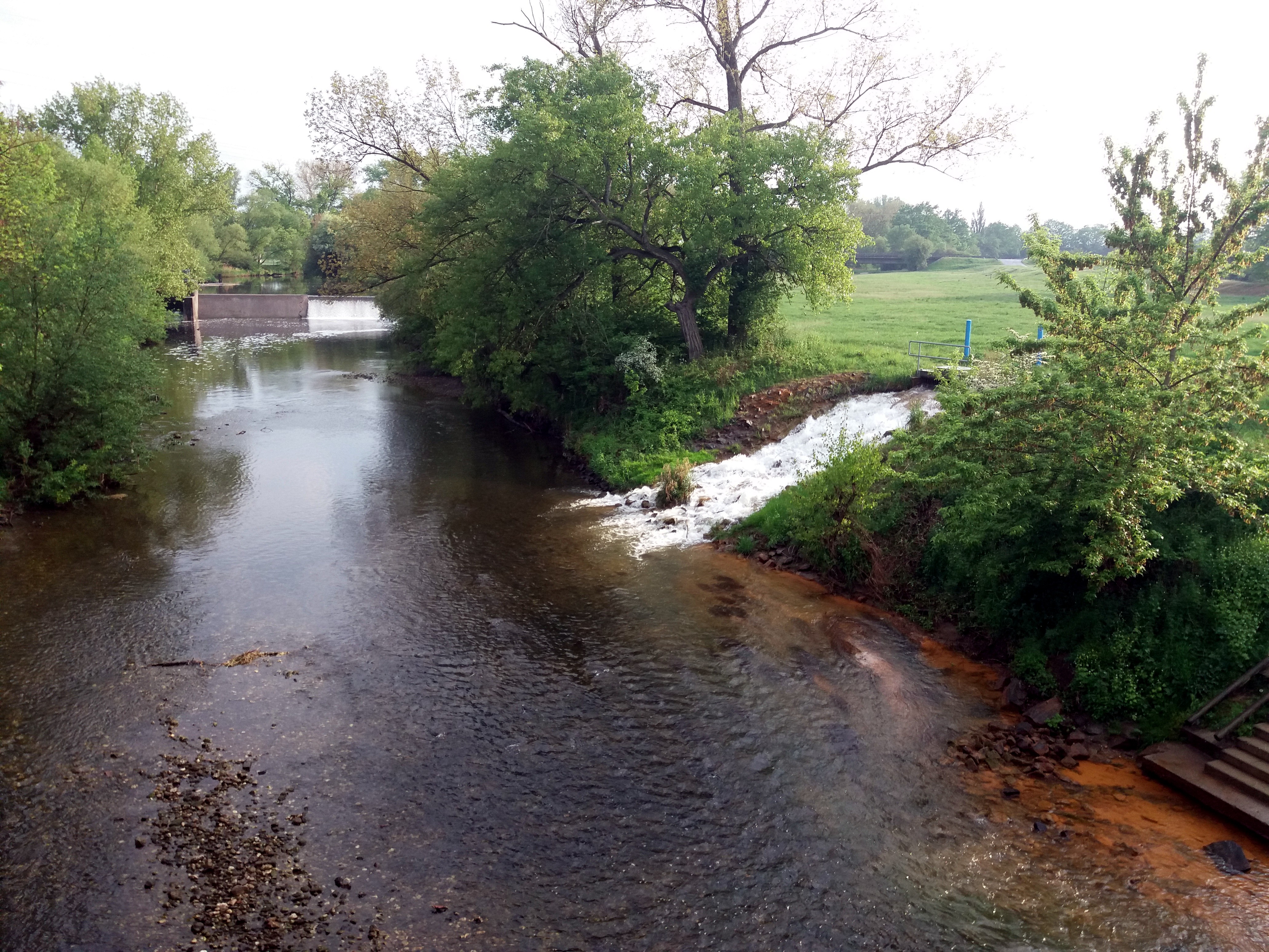
Deutsch: Blick nach Süden auf Bootsanleger und Elsterwehr von der Radfahrer- und Fußgängerbrücke bei Bornitz (Gemeinde Elsteraue), Burgenlandkreis, Sachsen-Anhalt. Die Holzbogenbrücke wurde 2004 errichtet und dient als Zugang zum Elsterradweg, sie ist 40m lang und ca. 25 Tonnen schwer. Der Höhenunterschied des Wehr beträgt bei normalen Wasserstand 1,70m und die Flussgeschwindigkeit ca. 5m/3s. Flussabwärts auf der rechten Seite befindet sich eine Fischaufstiegsanlage (Schlitzpass). Nördlich des Wehres befindet sich eine Einleitungsstelle von Sumpfungswasser aus den Tagebau sowie die Bootsschleppe, wo Kanu- Schlauchboote ins Wasser gelassen werden können. |
| Date | |
| Source | Own work |
| Author | Cookroach |
| Camera location | | View this and other nearby images on: OpenStreetMap |
|---|
Licensing
edit
I, the copyright holder of this work, hereby publish it under the following license:
This file is licensed under the Creative Commons Attribution-Share Alike 4.0 International license.
- You are free:
- to share – to copy, distribute and transmit the work
- to remix – to adapt the work
- Under the following conditions:
- attribution – You must give appropriate credit, provide a link to the license, and indicate if changes were made. You may do so in any reasonable manner, but not in any way that suggests the licensor endorses you or your use.
- share alike – If you remix, transform, or build upon the material, you must distribute your contributions under the same or compatible license as the original.
This image was uploaded as part of Wiki Loves Earth 2020.
|
 |
File history
Click on a date/time to view the file as it appeared at that time.
| Date/Time | Thumbnail | Dimensions | User | Comment | |
|---|---|---|---|---|---|
| current | 09:19, 23 July 2020 | | 4,128 × 3,096 (3.18 MB) | Cookroach (talk | contribs) | optimierte Version |
| 18:32, 3 June 2020 |  | 4,128 × 3,096 (4.79 MB) | Cookroach (talk | contribs) | Uploaded own work with UploadWizard |
You cannot overwrite this file.
File usage on Commons
The following page uses this file:
File usage on other wikis
The following other wikis use this file:
- Usage on www.wikidata.org